TopoQuest Logo
Do you find TopoQuest useful?
Help keep TopoQuest running and adding new maps/features by donating!
Bitcoin:  19c7KJd3qBynnjoSw5npx9KScwjBe4ifkT
Litecoin:  LXs6TkuXGGXo1vDsWCkWVdjQX94eUKd6ui
Home View Maps Find Maps Find Places Resources & Links


Exchange, Missouri Topographic Map

USGS Map Title: Exchange, MO
USGS Map MRC: 37091B1
DRG (GeoTIFF) Download: o37091b1.tif


Neighboring USGS Topographic Map Quads:


  Midridge, MO  
37091C2
 

  Corridon SE, MO  
37091C1
 

  Redford, MO  
37090C8
 

  Powder Mill Ferry, MO  
37091B2
 

  Exchange, MO  
37091B1
 

  Ellington, MO  
37090B8
 

  Stegall Mountain, MO  
37091A2
 

  Van Buren North, MO  
37091A1
 

  Garwood, MO  
37090A8


Map MRC Location:

N38°
W92°
N38°
W91°
H8 H7 H6 H5 H4 H3 H2 H1
G8 G7 G6 G5 G4 G3 G2 G1
F8 F7 F6 F5 F4 F3 F2 F1
E8 E7 E6 E5 E4 E3 E2 E1
D8 D7 D6 D5 D4 D3 D2 D1
C8 C7 C6 C5 C4 C3 C2 C1
B8 B7 B6 B5 B4 B3 B2 B1
A8 A7 A6 A5 A4 A3 A2 A1
N37°
W92°
N37°
W91°

Exchange, MO USGS 1:24K Topographic Map Preview:
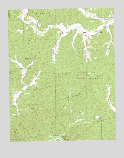
Exchange, MO USGS Topographic Map
Click on map above to begin viewing in our Map Viewer.

This topographic map contains these locations and features:
Feature Name Type Latitude Longitude GNIS ID View Map
Antioch ChurchChurchN37.2134°W91.0740°713326View Map
Banker CaveLocaleN37.1537°W91.1149°713616View Map
Banker HollowValleyN37.1545°W91.1149°713617View Map
Brawley HollowValleyN37.2295°W91.0421°714655View Map
Brown HollowValleyN37.2333°W91.0685°714779View Map
Burnham CemeteryCemeteryN37.1600°W91.0071°715082View Map
Cardareva MountainSummitN37.1326°W91.1246°715390View Map
Carr Creek ChurchChurchN37.1942°W91.1035°715426View Map
Cave Spring HollowValleyN37.2278°W91.0939°715551View Map
Christian HollowValleyN37.2266°W91.0320°715817View Map
Coleman HollowValleyN37.2331°W91.0064°716111View Map
Dark HollowValleyN37.1447°W91.0457°716670View Map
Deer Run State ForestForestN37.1795°W91.0237°716814View Map
DesletPopulated PlaceN37.1620°W91.1207°739901View Map
Dickens ValleyValleyN37.2366°W91.0082°716881View Map
Emmel HollowValleyN37.2335°W91.0957°717585View Map
ExchangeLocaleN37.2262°W91.0365°717712View Map
Exchange School (historical)SchoolN37.2253°W91.0312°730446View Map
Gravel SpringSpringN37.1263°W91.0617°718744View Map
Huckleberry HollowValleyN37.1286°W91.0755°719948View Map
John HollowValleyN37.2326°W91.0529°720341View Map
Little Paint Rock CreekStreamN37.1392°W91.0557°721289View Map
Lower Carr Creek School (historical)SchoolN37.1712°W91.1179°747815View Map
Neeley CemeteryCemeteryN37.1781°W91.1079°723147View Map
Paint Rock BluffCliffN37.1281°W91.0629°723963View Map
Paint Rock CreekStreamN37.1300°W91.0690°723964View Map
Paint Rock River AccessLocaleN37.1295°W91.0696°741405View Map
Paint Rock School (historical)SchoolN37.1375°W91.0548°747816View Map
Pete Shanty HollowValleyN37.1271°W91.0995°724249View Map
Pumpkin HollowValleyN37.2273°W91.0557°724998View Map
Pumpkin Hollow CemeteryCemeteryN37.2103°W91.0687°724999View Map
Rumburg CemeteryCemeteryN37.1942°W91.1110°755569View Map
Sloan HollowValleyN37.2260°W91.0885°726557View Map
Sloan SchoolSchoolN37.2334°W91.0829°747814View Map
Street HollowValleyN37.2387°W91.0904°727176View Map
Wolf Pen HollowValleyN37.1319°W91.0630°729072View Map

Note: Coordinates in the location and feature list above are referenced to NAD83 datum.


Copyright (C) 2008-2024 Ryan Niemi / Sunset Dynamics ... All Rights Reserved