TopoQuest Logo
Do you find TopoQuest useful?
Help keep TopoQuest running and adding new maps/features by donating!
Bitcoin:  19c7KJd3qBynnjoSw5npx9KScwjBe4ifkT
Litecoin:  LXs6TkuXGGXo1vDsWCkWVdjQX94eUKd6ui
Home View Maps Find Maps Find Places Resources & Links


Pittsfield, Maine Topographic Map

USGS Map Title: Pittsfield, ME
USGS Map MRC: 44069G4
DRG (GeoTIFF) Download: o44069g4.tif


Neighboring USGS Topographic Map Quads:


  Harmony, ME  
44069H5
 

  Hartland, ME  
44069H4
 

  Corinna, ME  
44069H3
 

  Canaan, ME  
44069G5
 

  Pittsfield, ME  
44069G4
 

  Newport, ME  
44069G3
 

  Clinton, ME  
44069F5
 

  Burnham, ME  
44069F4
 

  Unity Pond, ME  
44069F3


Map MRC Location:

N45°
W70°
N45°
W69°
H8 H7 H6 H5 H4 H3 H2 H1
G8 G7 G6 G5 G4 G3 G2 G1
F8 F7 F6 F5 F4 F3 F2 F1
E8 E7 E6 E5 E4 E3 E2 E1
D8 D7 D6 D5 D4 D3 D2 D1
C8 C7 C6 C5 C4 C3 C2 C1
B8 B7 B6 B5 B4 B3 B2 B1
A8 A7 A6 A5 A4 A3 A2 A1
N44°
W70°
N44°
W69°

Pittsfield, ME USGS 1:24K Topographic Map Preview:
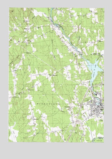
Pittsfield, ME USGS Topographic Map
Click on map above to begin viewing in our Map Viewer.

This topographic map contains these locations and features:
Feature Name Type Latitude Longitude GNIS ID View Map
Alternative Education SchoolSchoolN44.7879°W69.3913°2738131View Map
Bowley PondLakeN44.8448°W69.4989°562805View Map
Burton CornerPopulated PlaceN44.8334°W69.4759°579167View Map
Douglas PondReservoirN44.8172°W69.3881°565247View Map
Ell SchoolSchoolN44.8290°W69.4120°565844View Map
Emerson CornerPopulated PlaceN44.7987°W69.4742°579294View Map
Farnham BrookStreamN44.7537°W69.3892°566057View Map
First Baptist ChurchChurchN44.7798°W69.3845°1908546View Map
Fogg BrookStreamN44.8162°W69.3770°566345View Map
Ford HillSummitN44.8567°W69.4632°566377View Map
Fuller Corner CemeteryCemeteryN44.8442°W69.4759°566646View Map
Furbush HillSummitN44.8717°W69.3902°566654View Map
Gale SchoolSchoolN44.8667°W69.4192°566662View Map
Grignons Private Landing AreaAirportN44.8100°W69.4710°582247View Map
Hood BrookStreamN44.7634°W69.4992°568232View Map
Huff HillSummitN44.8722°W69.4970°568438View Map
Indian StreamStreamN44.8745°W69.4425°568615View Map
Interchange 38CrossingN44.7848°W69.4037°1908572View Map
Johnson W Parks Golf CourseLocaleN44.7945°W69.3925°1908576View Map
Johonnett BrookStreamN44.8390°W69.4120°568942View Map
Madawaska BrookStreamN44.8273°W69.3850°570641View Map
Maine Central InstituteSchoolN44.7794°W69.3866°1908599View Map
Manson CornerPopulated PlaceN44.8623°W69.4742°579495View Map
Manson Park SchoolSchoolN44.7802°W69.3815°1908616View Map
Marie Bradford SchoolSchoolN44.7917°W69.3875°1908613View Map
Mason ParkParkN44.7792°W69.3787°1908615View Map
Meadow BrookStreamN44.8601°W69.4389°571058View Map
Mill PondReservoirN44.7867°W69.3812°1773710View Map
Mosher CornerPopulated PlaceN44.7826°W69.4192°579544View Map
Negro HillSummitN44.8609°W69.4153°572083View Map
Palmyra Consolidated School (historical)SchoolN44.8442°W69.3834°572951View Map
Payne FieldAirportN44.8566°W69.4567°582161View Map
Phillips CornerPopulated PlaceN44.8126°W69.4423°579618View Map
Pine Grove CemeteryCemeteryN44.8678°W69.4464°573365View Map
Pioneer DamDamN44.7861°W69.3796°1773709View Map
PittsfieldPopulated PlaceN44.7826°W69.3834°573464View Map
Pittsfield Census Designated PlaceCensusN44.7717°W69.3800°2377949View Map
Pittsfield Fire DepartmentBuildingN44.7841°W69.3825°2552743View Map
Pittsfield Municipal AirportAirportN44.7735°W69.3780°582207View Map
Pittsfield Police DepartmentBuildingN44.7840°W69.3823°2735935View Map
Pittsfield Post OfficePost OfficeN44.7831°W69.3839°1908736View Map
Pittsfield Public LibraryBuildingN44.7820°W69.3833°1908651View Map
Pittsfield Universalist ChurchChurchN44.7845°W69.3812°1908652View Map
Pooler CemeteryCemeteryN44.8336°W69.4089°573622View Map
Saint Agnes Parochial SchoolSchoolN44.7845°W69.3756°1908665View Map
South Bog StreamStreamN44.7501°W69.4850°575762View Map
ThompsonPopulated PlaceN44.8567°W69.4373°579765View Map
Thompson BrookStreamN44.8603°W69.4450°576998View Map
Thompson CornerPopulated PlaceN44.8551°W69.4745°579766View Map
Tilton CornerPopulated PlaceN44.7923°W69.4917°579768View Map
Town of PittsfieldCivilN44.7714°W69.4387°582676View Map
Tuttle HillSummitN44.8426°W69.4884°577461View Map
Upper DamDamN44.7949°W69.3863°1773711View Map
Vickery SchoolSchoolN44.7878°W69.3933°1908723View Map
Warren Hill CemeteryCemeteryN44.8684°W69.4025°577848View Map
Warsaw Middle SchoolSchoolN44.7876°W69.3918°1908725View Map
WaverleyPopulated PlaceN44.7951°W69.3806°577910View Map
Weeks CornerPopulated PlaceN44.7717°W69.4673°579803View Map
West PalmyraPopulated PlaceN44.8323°W69.4084°579822View Map
West Pittsfield CemeteryCemeteryN44.7953°W69.4839°578193View Map

Note: Coordinates in the location and feature list above are referenced to NAD83 datum.


Copyright (C) 2008-2024 Ryan Niemi / Sunset Dynamics ... All Rights Reserved