TopoQuest Logo
Do you find TopoQuest useful?
Help keep TopoQuest running and adding new maps/features by donating!
Home View Maps Find Maps Find Places Resources & Links


Hazel, Minnesota Topographic Map

USGS Map Title: Hazel, MN
USGS Map MRC: 48096A1
DRG (GeoTIFF) Download: o48096a1.tif


Neighboring USGS Topographic Map Quads:


  Thief River Falls NW, MN  
48096B2
 

  Thief River Falls NE, MN  
48096B1


  Thief River Falls, MN  
48096A2
 

  Hazel, MN  
48096A1


  Plummer NW, MN  
47096H2
 

  Plummer, MN  
47096H1


Map MRC Location:

N49°
W97°
N49°
W96°
H8 H7 H6 H5 H4 H3 H2 H1
G8 G7 G6 G5 G4 G3 G2 G1
F8 F7 F6 F5 F4 F3 F2 F1
E8 E7 E6 E5 E4 E3 E2 E1
D8 D7 D6 D5 D4 D3 D2 D1
C8 C7 C6 C5 C4 C3 C2 C1
B8 B7 B6 B5 B4 B3 B2 B1
A8 A7 A6 A5 A4 A3 A2 A1
N48°
W97°
N48°
W96°

Hazel, MN USGS 1:24K Topographic Map Preview:
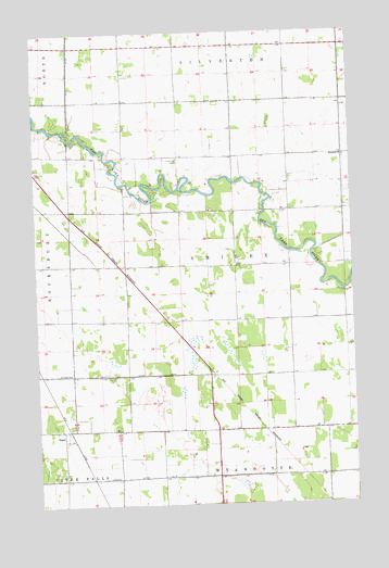
Hazel, MN USGS Topographic Map
Click on map above to begin viewing in our Map Viewer.

This topographic map contains these locations and features:
Feature Name Type Latitude Longitude GNIS ID View Map
Bethania CemeteryCemeteryN48.09158°W96.00294°2093559View Map
Bethania ChurchChurchN48.09191°W96.00253°639989View Map
County Ditch Number SixteenCanalN48.00691°W96.11226°641722View Map
County Ditch Number ThirtythreeCanalN48.11441°W96.11087°641975View Map
Emanuel CemeteryCemeteryN48.09105°W96.06869°643327View Map
HazelPopulated PlaceN48.01997°W96.11531°644799View Map
Hazel Post Office (historical)Post OfficeN48.02000°W96.11500°2093591View Map
Hazel Railroad StationLocaleN48.01889°W96.11278°2093615View Map
Pennington CountyCivilN48.06623°W96.03667°659502View Map
Saint Pauli ChurchChurchN48.03497°W96.11226°650975View Map
Township of SmileyCivilN48.06326°W96.04666°665635View Map

Note: Coordinates in the location and feature list above are referenced to NAD83 datum.


Copyright (C) 2008-2026 Ryan Niemi / Sunset Dynamics ... All Rights Reserved