TopoQuest Logo
Do you find TopoQuest useful?
Help keep TopoQuest running and adding new maps/features by donating!
Bitcoin:  19c7KJd3qBynnjoSw5npx9KScwjBe4ifkT
Litecoin:  LXs6TkuXGGXo1vDsWCkWVdjQX94eUKd6ui
Home View Maps Find Maps Find Places Resources & Links


Cooks Still, Georgia Topographic Map

USGS Map Title: Cooks Still, GA
USGS Map MRC: 31083H1
DRG (GeoTIFF) Download: o31083h1.tif


Neighboring USGS Topographic Map Quads:


  Lake Cypress, GA  
32083A2
 

  Milan, GA  
32083A1
 

  McRae, GA  
32082A8
 

  Rhine, GA  
31083H2
 

  Cooks Still, GA  
31083H1
 

  Workmore, GA  
31082H8
 

  Queensland, GA  
31083G2
 

  China Hill, GA  
31083G1
 

  Jacksonville, GA  
31082G8


Map MRC Location:

N32°
W84°
N32°
W83°
H8 H7 H6 H5 H4 H3 H2 H1
G8 G7 G6 G5 G4 G3 G2 G1
F8 F7 F6 F5 F4 F3 F2 F1
E8 E7 E6 E5 E4 E3 E2 E1
D8 D7 D6 D5 D4 D3 D2 D1
C8 C7 C6 C5 C4 C3 C2 C1
B8 B7 B6 B5 B4 B3 B2 B1
A8 A7 A6 A5 A4 A3 A2 A1
N31°
W84°
N31°
W83°

Cooks Still, GA USGS 1:24K Topographic Map Preview:
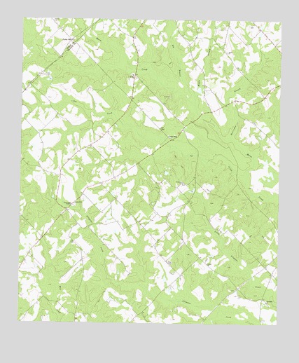
Cooks Still, GA USGS Topographic Map
Click on map above to begin viewing in our Map Viewer.

This topographic map contains these locations and features:
Feature Name Type Latitude Longitude GNIS ID View Map
Big Branch Horse CreekStreamN31.9649°W83.0410°311349View Map
Cat CreekStreamN31.9330°W83.0160°312414View Map
Cook ChapelChurchN31.9552°W83.0579°312917View Map
Cooks StillLocaleN31.9510°W83.0521°312927View Map
Davis PondReservoirN31.8935°W83.0544°341134View Map
Davis Pond DamDamN31.8918°W83.0549°341133View Map
Friendship ChurchChurchN31.8843°W83.0054°355926View Map
Garrison LakeReservoirN31.9715°W83.0390°341132View Map
Garrison Lake DamDamN31.9702°W83.0399°341131View Map
Hulett CemeteryCemeteryN31.8891°W83.0204°356930View Map
Hurricane BranchStreamN31.9510°W83.0229°315836View Map
Mathews LakeReservoirN31.9419°W83.0065°335986View Map
Mathews Lake DamDamN31.9418°W83.0065°335985View Map
Middle Branch Horse CreekStreamN31.9674°W83.0410°318065View Map
Milan DivisionCivilN31.9318°W83.0677°1936406View Map
Mount Zion CemeteryCemeteryN31.9771°W83.0715°356947View Map
Mount Zion ChurchChurchN31.9771°W83.0713°318964View Map
Poplar HillPopulated PlaceN31.9910°W83.1010°332729View Map
Rebecca ChurchChurchN31.9332°W83.0468°321352View Map
Rockwell CemeteryCemeteryN31.9232°W83.0149°356949View Map
Rockwell ChurchChurchN31.9241°W83.0985°321778View Map
Siloam ChurchChurchN31.9868°W83.0263°322980View Map
Studstill CemeteryCemeteryN31.9674°W83.1121°356956View Map
United ChurchChurchN31.8999°W83.0340°324592View Map
West Telfair AcademySchoolN31.9232°W83.0990°325074View Map
WMCG-FM (Milan)TowerN31.9363°W83.1065°352737View Map

Note: Coordinates in the location and feature list above are referenced to NAD83 datum.


Copyright (C) 2008-2024 Ryan Niemi / Sunset Dynamics ... All Rights Reserved