TopoQuest Logo
Do you find TopoQuest useful?
Help keep TopoQuest running and adding new maps/features by donating!
Bitcoin:  19c7KJd3qBynnjoSw5npx9KScwjBe4ifkT
Litecoin:  LXs6TkuXGGXo1vDsWCkWVdjQX94eUKd6ui
Home View Maps Find Maps Find Places Resources & Links


Como West, Wyoming Topographic Map

USGS Map Title: Como West, WY
USGS Map MRC: 41106H4
DRG (GeoTIFF) Download: o41106h4.tif


Neighboring USGS Topographic Map Quads:


  T E Ranch, WY  
42106A5
 

  Difficulty, WY  
42106A4
 

  Windy Hill, WY  
42106A3
 

  Elmo, WY  
41106H5
 

  Como West, WY  
41106H4
 

  Como East, WY  
41106H3
 

  Hanna, WY  
41106G5
 

  Carbon, WY  
41106G4
 

  Halfway Hill, WY  
41106G3


Map MRC Location:

N42°
W107°
N42°
W106°
H8 H7 H6 H5 H4 H3 H2 H1
G8 G7 G6 G5 G4 G3 G2 G1
F8 F7 F6 F5 F4 F3 F2 F1
E8 E7 E6 E5 E4 E3 E2 E1
D8 D7 D6 D5 D4 D3 D2 D1
C8 C7 C6 C5 C4 C3 C2 C1
B8 B7 B6 B5 B4 B3 B2 B1
A8 A7 A6 A5 A4 A3 A2 A1
N41°
W107°
N41°
W106°

Como West, WY USGS 1:24K Topographic Map Preview:
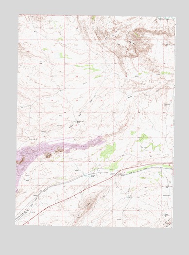
Como West, WY USGS Topographic Map
Click on map above to begin viewing in our Map Viewer.

This topographic map contains these locations and features:
Feature Name Type Latitude Longitude GNIS ID View Map
Big Rock ReservoirReservoirN41.8926°W106.4118°1585499View Map
Carbon Number Five MineMineN41.8769°W106.3756°1726044View Map
Carbon Number Four MineMineN41.8805°W106.3756°1726043View Map
Chace RanchLocaleN41.8997°W106.3784°1586536View Map
ComoLocaleN41.9094°W106.3750°1597265View Map
Dixie DrawValleyN41.9647°W106.4306°1587667View Map
Hanna Basin Strip MineMineN41.9166°W106.4747°1726045View Map
Hanna DivisionCivilN41.9661°W106.4615°1939713View Map
Hi Allen RidgeRidgeN41.8866°W106.4425°1589512View Map
Hi Allen SpringLakeN41.9046°W106.4417°1589513View Map
Missouri John SpringSpringN41.9367°W106.4531°1591655View Map
Missuori John DrawValleyN41.9652°W106.4189°1591658View Map
Number 5 ReservoirReservoirN41.8942°W106.3767°1605399View Map
Number 5 RidgeRidgeN41.8764°W106.3778°1605400View Map
RamseyLocaleN41.8927°W106.4825°1593154View Map
Rosebud DamDamN41.9133°W106.4789°1608446View Map
Rosebud Pit Number SevenMineN41.9058°W106.4911°1726046View Map
Rosebud ReservoirReservoirN41.9136°W106.4788°1608447View Map
Sampo (historical)Populated PlaceN41.9019°W106.4925°1597489View Map
Sampo MineMineN41.9022°W106.4967°1726047View Map
Sevenmile HillSummitN41.9477°W106.3834°1594123View Map
The BreaksRangeN41.9864°W106.4156°1595407View Map
The LakesLakeN41.9218°W106.3944°1595391View Map
Upper Number 5 ReservoirReservoirN41.8836°W106.3806°1605510View Map
Wildcat TopSummitN41.9833°W106.3828°1596392View Map

Note: Coordinates in the location and feature list above are referenced to NAD83 datum.


Copyright (C) 2008-2024 Ryan Niemi / Sunset Dynamics ... All Rights Reserved