TopoQuest Logo
Do you find TopoQuest useful?
Help keep TopoQuest running and adding new maps/features by donating!
Bitcoin:  19c7KJd3qBynnjoSw5npx9KScwjBe4ifkT
Litecoin:  LXs6TkuXGGXo1vDsWCkWVdjQX94eUKd6ui
Home View Maps Find Maps Find Places Resources & Links


Colstrip West, Montana Topographic Map

USGS Map Title: Colstrip West, MT
USGS Map MRC: 45106H6
DRG (GeoTIFF) Download: o45106h6.tif


Neighboring USGS Topographic Map Quads:


  Griffin Coulee, MT  
46106A7
 

  Sheep Creek Camp, MT  
46106A6
 

  McKerlich Creek, MT  
46106A5
 

  Trail Creek School, MT  
45106H7
 

  Colstrip West, MT  
45106H6
 

  Colstrip East, MT  
45106H5
 

  Rough Draw, MT  
45106G7
 

  Colstrip SW, MT  
45106G6
 

  Colstrip SE, MT  
45106G5


Map MRC Location:

N46°
W107°
N46°
W106°
H8 H7 H6 H5 H4 H3 H2 H1
G8 G7 G6 G5 G4 G3 G2 G1
F8 F7 F6 F5 F4 F3 F2 F1
E8 E7 E6 E5 E4 E3 E2 E1
D8 D7 D6 D5 D4 D3 D2 D1
C8 C7 C6 C5 C4 C3 C2 C1
B8 B7 B6 B5 B4 B3 B2 B1
A8 A7 A6 A5 A4 A3 A2 A1
N45°
W107°
N45°
W106°

Colstrip West, MT USGS 1:24K Topographic Map Preview:
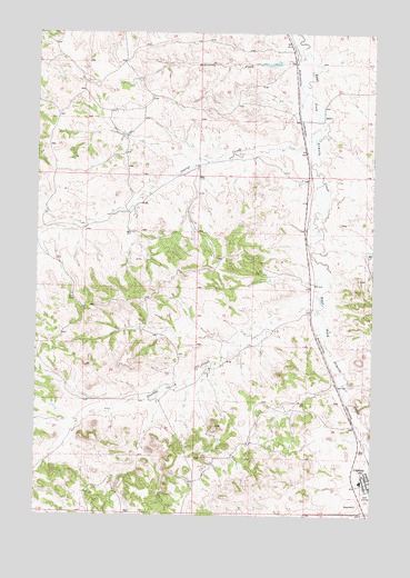
Colstrip West, MT USGS Topographic Map
Click on map above to begin viewing in our Map Viewer.

This topographic map contains these locations and features:
Feature Name Type Latitude Longitude GNIS ID View Map
02N40E01AAAA01 WellWellN45.9625°W106.6906°813593View Map
02N40E02DACB01 WellWellN45.9536°W106.7161°813545View Map
02N40E11AABA01 WellWellN45.9483°W106.7153°813512View Map
02N40E17ADAD01 SpringSpringN45.9283°W106.6497°813405View Map
02N40E35DDCD01 WellWellN45.8758°W106.7150°812987View Map
02N41E08CCD_01 WellWellN45.9417°W106.6575°813484View Map
02N41E10BCBC01 WellWellN45.9431°W106.6272°813491View Map
02N41E17ABCD01 WellWellN45.9303°W106.6578°813420View Map
02N41E17ADAA01 WellWellN45.8792°W106.6500°813018View Map
02N41E20DDDC01 WellWellN45.9047°W106.6525°813237View Map
02N41E21BADB01 WellWellN45.9161°W106.6409°813347View Map
02N41E21CADA01 WellWellN45.9092°W106.6400°813289View Map
02N41E21CDDD01 WellWellN45.9047°W106.6395°813236View Map
02N41E28AAAC01 WellWellN45.9031°W106.6300°813223View Map
02N41E28AACA01 WellWellN45.9017°W106.6320°813213View Map
02N41E30DDAA01 WellWellN45.8936°W106.6703°813159View Map
02N41E33DAAA01 WellWellN45.8819°W106.6322°813041View Map
02N41E33DAAA02 WellWellN45.8819°W106.6322°813042View Map
02N41E33DAAA03 WellWellN45.8819°W106.6322°813043View Map
02N41E34BBCC01 WellWellN45.8869°W106.6281°813091View Map
02N41E34BCDC01 WellWellN45.8836°W106.6253°813055View Map
03N41E28CCDD01 WellWellN45.9775°W106.6445°813660View Map
03N41E34CCCD01 SpringSpringN45.9633°W106.6261°813600View Map
Antelope ParkParkN45.9125°W106.6270°1716797View Map
B and R SubdivisionPopulated PlaceN45.9128°W106.6450°1716830View Map
Bicentennial Library of ColstripBuildingN45.8817°W106.6261°1716821View Map
Castle Rock LakeReservoirN45.8931°W106.6395°1716828View Map
Castle Rock Reservoir DamDamN45.8950°W106.6339°797085View Map
Castle Rock Saddle DamDamN45.8900°W106.6372°798218View Map
Christ Covenant ChurchChurchN45.8833°W106.6339°1716818View Map
Church of ChristChurchN45.9089°W106.6422°1716815View Map
City of ColstripCivilN45.8943°W106.6281°2410199View Map
Colstrip Christian and Missionary Alliance ChurchChurchN45.8833°W106.6339°1716817View Map
Colstrip Diversion DamDamN45.8983°W106.6673°798284View Map
Colstrip Evaporation Pond DamDamN45.9017°W106.6506°798283View Map
Colstrip Fire DistrictBuildingN45.8821°W106.6256°1716820View Map
Colstrip High SchoolSchoolN45.9144°W106.6343°1716826View Map
Colstrip Light Industrial ParkLocaleN45.9064°W106.6381°1716831View Map
Colstrip Medical CenterHospitalN45.8861°W106.6339°1716829View Map
Colstrip Police DepartmentBuildingN45.8820°W106.6256°2548945View Map
Colstrip Post OfficePost OfficeN45.8822°W106.6285°1716822View Map
Corral CreekStreamN45.9722°W106.6478°770111View Map
Cottonwood ParkParkN45.8778°W106.6275°1716804View Map
Firemans ParkParkN45.8806°W106.6267°1716806View Map
First Baptist ChurchChurchN45.8847°W106.6289°1716813View Map
Frank Brattin Middle SchoolSchoolN45.8837°W106.6296°1716823View Map
Grace Baptist ChurchChurchN45.9006°W106.6261°1716812View Map
Hollister ParkParkN45.8847°W106.6395°1716810View Map
Isabel Bills Elementary SchoolSchoolN45.8856°W106.6311°1716824View Map
Laramie ParkParkN45.9000°W106.6270°1716802View Map
Lee Number 9 DamDamN45.9917°W106.6623°796877View Map
Mount Calvary Lutheran ChurchChurchN45.8861°W106.6284°1716816View Map
North ParkParkN45.8900°W106.6284°1716808View Map
Pine Butte Elementary SchoolSchoolN45.9091°W106.6255°1716825View Map
Ponderosa Butte Public Golf CourseLocaleN45.8797°W106.6261°1716673View Map
Rosebud County Ambulance ServiceBuildingN45.8822°W106.6257°2637901View Map
Rosebud County Sheriff's Office ColstripBuildingN45.8822°W106.6257°2738251View Map
Saint Margaret Mary Catholic ChurchChurchN45.8844°W106.6261°1716811View Map
Stillwater Ballfield ComplexParkN45.9097°W106.6367°1716796View Map
Stocker CreekStreamN45.9283°W106.6459°777225View Map
The Church of Jesus Christ of Latter Day SaintsChurchN45.8833°W106.6339°1716819View Map
United Community ChurchChurchN45.8828°W106.6250°1716814View Map
Winchester ParkParkN45.8867°W106.6361°1716809View Map

Note: Coordinates in the location and feature list above are referenced to NAD83 datum.


Copyright (C) 2008-2024 Ryan Niemi / Sunset Dynamics ... All Rights Reserved