TopoQuest Logo
Do you find TopoQuest useful?
Help keep TopoQuest running and adding new maps/features by donating!
Bitcoin:  19c7KJd3qBynnjoSw5npx9KScwjBe4ifkT
Litecoin:  LXs6TkuXGGXo1vDsWCkWVdjQX94eUKd6ui
Home View Maps Find Maps Find Places Resources & Links


Collins Rim, Oregon Topographic Map

USGS Map Title: Collins Rim, OR
USGS Map MRC: 42120A1
DRG (GeoTIFF) Download: o42120a1.tif


Neighboring USGS Topographic Map Quads:


  Horse Prairie, OR  
42120B2
 

  Sage Hen Butte, OR  
42120B1
 

  Adel, OR  
42119B8
 

  Crane Mountain, OR  
42120A2
 

  Collins Rim, OR  
42120A1
 

  May Lake, OR  
42119A8
 

  Mount Bidwell, CA  
41120H2
 

  Lake Annie, CA  
41120H1
 

  Barrel Springs, NV  
41119H8


Map MRC Location:

N43°
W121°
N43°
W120°
H8 H7 H6 H5 H4 H3 H2 H1
G8 G7 G6 G5 G4 G3 G2 G1
F8 F7 F6 F5 F4 F3 F2 F1
E8 E7 E6 E5 E4 E3 E2 E1
D8 D7 D6 D5 D4 D3 D2 D1
C8 C7 C6 C5 C4 C3 C2 C1
B8 B7 B6 B5 B4 B3 B2 B1
A8 A7 A6 A5 A4 A3 A2 A1
N42°
W121°
N42°
W120°

Collins Rim, OR USGS 1:24K Topographic Map Preview:
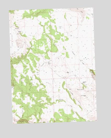
Collins Rim, OR USGS Topographic Map
Click on map above to begin viewing in our Map Viewer.

This topographic map contains these locations and features:
Feature Name Type Latitude Longitude GNIS ID View Map
Barley CampLocaleN42.0432°W120.0969°1137518View Map
Barley Camp CreekStreamN42.0502°W120.0941°1137519View Map
Collins CabinLocaleN42.1071°W120.0766°1140000View Map
Collins RimCliffN42.0885°W120.0652°1140007View Map
Dismal SpringSpringN42.0543°W120.0405°1141050View Map
Frakes CabinLocaleN42.0427°W120.0811°1142403View Map
Haw CabinLocaleN42.0668°W120.0233°1143368View Map
Juniper LakeLakeN42.1044°W120.0506°1144458View Map
Lane Reservoir Number FourReservoirN42.1044°W120.0892°1153723View Map
Lane Waterhole Number ElevenReservoirN42.0732°W120.0850°1153721View Map
Lane Waterhole Number TwelveReservoirN42.0832°W120.1080°1153722View Map
Long CanyonValleyN42.0018°W120.0172°1145388View Map
Mate CabinLocaleN42.0952°W120.0363°1145868View Map
Moss SpringsSpringN42.1034°W120.1169°1146510View Map
O'Keefe ReservoirReservoirN42.0921°W120.0273°1153720View Map
O'Keefe Reservoir Number FourReservoirN42.1083°W120.0232°1153718View Map
O'Keefe Reservoir Number SixReservoirN42.1016°W120.0447°1153719View Map
Pope SpringSpringN42.0646°W120.0677°1147890View Map
Rattlesnake SpringSpringN42.0421°W120.0202°1148243View Map
Rim Rock SpringSpringN42.1009°W120.1129°1148461View Map
Round MountainSummitN42.0354°W120.0299°1148779View Map
Round Mountain SpringSpringN42.0282°W120.0163°1148793View Map

Note: Coordinates in the location and feature list above are referenced to NAD83 datum.


Copyright (C) 2008-2024 Ryan Niemi / Sunset Dynamics ... All Rights Reserved