TopoQuest Logo
Do you find TopoQuest useful?
Help keep TopoQuest running and adding new maps/features by donating!
Bitcoin:  19c7KJd3qBynnjoSw5npx9KScwjBe4ifkT
Litecoin:  LXs6TkuXGGXo1vDsWCkWVdjQX94eUKd6ui
Home View Maps Find Maps Find Places Resources & Links


Coleman Point, Oregon Topographic Map

USGS Map Title: Coleman Point, OR
USGS Map MRC: 42120D6
DRG (GeoTIFF) Download: o42120d6.tif


Neighboring USGS Topographic Map Quads:


  Lee Thomas Crossing, OR  
42120E7
 

  Coffeepot Creek, OR  
42120E6
 

  Morgan Butte, OR  
42120E5
 

  Gearhart Mountain, OR  
42120D7
 

  Coleman Point, OR  
42120D6
 

  Shoestring Butte, OR  
42120D5
 

  Quartz Valley, OR  
42120C7
 

  Cougar Peak, OR  
42120C6
 

  Cox Flat, OR  
42120C5


Map MRC Location:

N43°
W121°
N43°
W120°
H8 H7 H6 H5 H4 H3 H2 H1
G8 G7 G6 G5 G4 G3 G2 G1
F8 F7 F6 F5 F4 F3 F2 F1
E8 E7 E6 E5 E4 E3 E2 E1
D8 D7 D6 D5 D4 D3 D2 D1
C8 C7 C6 C5 C4 C3 C2 C1
B8 B7 B6 B5 B4 B3 B2 B1
A8 A7 A6 A5 A4 A3 A2 A1
N42°
W121°
N42°
W120°

Coleman Point, OR USGS 1:24K Topographic Map Preview:
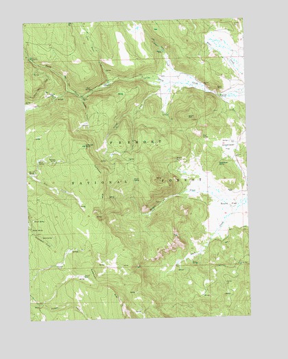
Coleman Point, OR USGS Topographic Map
Click on map above to begin viewing in our Map Viewer.

This topographic map contains these locations and features:
Feature Name Type Latitude Longitude GNIS ID View Map
Anderson RanchLocaleN42.4865°W120.6719°1116937View Map
Augur CreekStreamN42.4727°W120.6516°1117087View Map
Barrel SpringSpringN42.4363°W120.7495°1117256View Map
Bean SpringSpringN42.3979°W120.6585°1117341View Map
Blonde SpringSpringN42.4166°W120.7478°1117822View Map
Brush SpringSpringN42.4333°W120.6905°1118159View Map
Clear SpringSpringN42.4715°W120.7135°1119006View Map
Clear Spring Recreation SiteLocaleN42.4682°W120.7128°1952921View Map
Cliff SpringSpringN42.4504°W120.6509°1119022View Map
Coleman PointSummitN42.4477°W120.7172°1119140View Map
Coleman SpringSpringN42.4413°W120.7346°1119143View Map
Colt SpringSpringN42.4997°W120.7233°1119160View Map
Dairy Creek Campground (historical)LocaleN42.4843°W120.7475°1158192View Map
Dairy Creek Guard StationLocaleN42.4674°W120.6402°1119663View Map
Dairy PointSummitN42.4715°W120.6416°1119664View Map
Dairy Point Recreation SiteLocaleN42.4685°W120.6414°1167173View Map
Dead Horse CreekStreamN42.4993°W120.7191°1116728View Map
Dead Horse Recreation SiteLocaleN42.4740°W120.7039°1119750View Map
Deer CreekStreamN42.4710°W120.7258°1119818View Map
Drum HillSummitN42.4593°W120.6586°1120102View Map
Eagle SpringSpringN42.4415°W120.7443°1120269View Map
Grasshopper FlatFlatN42.4460°W120.6361°1121307View Map
Grasshopper SpringSpringN42.4398°W120.6419°1121310View Map
Happy Camp Recreation SiteLocaleN42.4760°W120.6844°1121574View Map
Lantern FlatFlatN42.3982°W120.7333°1122956View Map
Lantern Flat Guard StationBuildingN42.3995°W120.7324°2548252View Map
Morgan CreekStreamN42.4243°W120.6269°1124349View Map
Morgan SpringSpringN42.4416°W120.6662°1124360View Map
Murphy RanchLocaleN42.4279°W120.6344°1124553View Map
North Fork Augur CreekStreamN42.4968°W120.6858°1124749View Map
Picture FlatFlatN42.4696°W120.7355°1125361View Map
Road SpringSpringN42.4092°W120.7429°1126092View Map
Round SpringSpringN42.4128°W120.7487°1126333View Map
Shepard CampLocaleN42.3932°W120.7200°1126868View Map
Snag SpringSpringN42.3972°W120.6316°1127144View Map
South FlatFlatN42.4218°W120.6361°1149918View Map
Spring CreekStreamN42.4732°W120.6650°1150157View Map
Teepee CreekStreamN42.4685°W120.7186°1127919View Map

Note: Coordinates in the location and feature list above are referenced to NAD83 datum.


Copyright (C) 2008-2024 Ryan Niemi / Sunset Dynamics ... All Rights Reserved