TopoQuest Logo
Do you find TopoQuest useful?
Help keep TopoQuest running and adding new maps/features by donating!
Bitcoin:  19c7KJd3qBynnjoSw5npx9KScwjBe4ifkT
Litecoin:  LXs6TkuXGGXo1vDsWCkWVdjQX94eUKd6ui
Home View Maps Find Maps Find Places Resources & Links


Coleman Draw, Montana Topographic Map

USGS Map Title: Coleman Draw, MT
USGS Map MRC: 45106E1
DRG (GeoTIFF) Download: o45106e1.tif


Neighboring USGS Topographic Map Quads:


  Cook Creek Reservoir, MT  
45106F2
 

  Beaver Creek School, MT  
45106F1
 

  Stacey, MT  
45105F8
 

  Willow Crossing, MT  
45106E2
 

  Coleman Draw, MT  
45106E1
 

  Home Creek Butte, MT  
45105E8
 

  King Mountain, MT  
45106D2
 

  Yager Butte, MT  
45106D1
 

  Threemile Buttes, MT  
45105D8


Map MRC Location:

N46°
W107°
N46°
W106°
H8 H7 H6 H5 H4 H3 H2 H1
G8 G7 G6 G5 G4 G3 G2 G1
F8 F7 F6 F5 F4 F3 F2 F1
E8 E7 E6 E5 E4 E3 E2 E1
D8 D7 D6 D5 D4 D3 D2 D1
C8 C7 C6 C5 C4 C3 C2 C1
B8 B7 B6 B5 B4 B3 B2 B1
A8 A7 A6 A5 A4 A3 A2 A1
N45°
W107°
N45°
W106°

Coleman Draw, MT USGS 1:24K Topographic Map Preview:
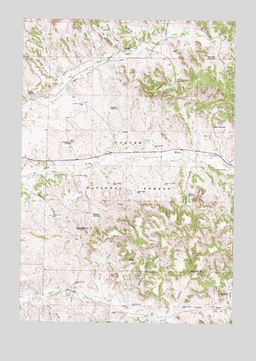
Coleman Draw, MT USGS Topographic Map
Click on map above to begin viewing in our Map Viewer.

This topographic map contains these locations and features:
Feature Name Type Latitude Longitude GNIS ID View Map
02S45E36AACB01 SpringSpringN45.6214°W106.1133°810607View Map
02S45E36AACD01 SpringSpringN45.6217°W106.1133°810609View Map
02S45E36ACBA01 SpringSpringN45.6192°W106.1192°810596View Map
02S46E27CCDB01 WellWellN45.6250°W106.0411°810632View Map
02S46E32ABCC01 SpringSpringN45.6206°W106.0747°810603View Map
02S46E32DACC01 SpringSpringN45.6144°W106.0694°810549View Map
02S46E32DDCD01 WellWellN45.6103°W106.0689°810500View Map
02S46E33CCAB01 WellWellN45.6122°W106.0614°810535View Map
02S46E33CCBA01 SpringSpringN45.6129°W106.0627°810539View Map
02S46E33DBAD01 WellWellN45.6156°W106.0506°810562View Map
02S46E34AAAB01 WellWellN45.6228°W106.0261°810619View Map
02S46E34BCAC01 WellWellN45.6186°W106.0414°810582View Map
02S46E34BCCB01 WellWellN45.6175°W106.0389°810578View Map
02S46E35BDDD01 WellWellN45.6169°W106.0142°810576View Map
02S46E35CAAB01 SpringSpringN45.6164°W106.0153°810574View Map
02S46E36BCCC01 WellWellN45.6158°W106.0022°810567View Map
02S46E36CBBB01 WellWellN45.6158°W106.0025°810568View Map
03S41E16ADCC01 WellWellN45.5731°W106.0475°810214View Map
03S45E01CDCC01 WellWellN45.5964°W106.1245°810375View Map
03S45E12BDCB01 WellWellN45.5894°W106.1247°810303View Map
03S45E12BDCB02 WellWellN45.5892°W106.1245°810297View Map
03S45E12BDCC01 WellWellN45.5892°W106.1242°810296View Map
03S45E12BDCD01 SpringSpringN45.5886°W106.1231°810293View Map
03S45E12BDDB01 WellWellN45.5894°W106.1225°810302View Map
03S45E13DCBC01 WellWellN45.5689°W106.1206°810182View Map
03S45E24ACDA01 WellWellN45.5611°W106.1172°810125View Map
03S45E36ACBC01 SpringSpringN45.5333°W106.1208°810007View Map
03S46E04BBBB01 WellWellN45.6086°W106.0611°810482View Map
03S46E04BDCD01 SpringSpringN45.6014°W106.0561°810423View Map
03S46E04CDBB01 SpringSpringN45.5967°W106.0586°810378View Map
03S46E05AABB01 WellWellN45.6092°W106.0683°810490View Map
03S46E05AABB02 WellWellN45.6092°W106.0681°810489View Map
03S46E05BBCB01 WellWellN45.6058°W106.0839°810460View Map
03S46E06AADB01 WellWellN45.6061°W106.0872°810462View Map
03S46E06AADD01 WellWellN45.6047°W106.0856°810455View Map
03S46E06CCBD01 WellWellN45.5961°W106.1036°810373View Map
03S46E07ADBB01 WellWellN45.5900°W106.0894°810315View Map
03S46E08BDDC01 WellWellN45.5872°W106.0756°810283View Map
03S46E14CBCD01 WellWellN45.5686°W106.0214°810178View Map
03S46E14CBCD02 WellWellN45.5686°W106.0214°810179View Map
03S46E14DBBD01 SpringSpringN45.5714°W106.0108°810202View Map
03S46E15CAAA01 WellWellN45.5714°W106.0333°810203View Map
03S46E16ADCC01 WellWellN45.5731°W106.0475°810215View Map
03S46E17ADBC01 WellWellN45.5739°W106.0683°810217View Map
03S46E17DBDC01 WellWellN45.5683°W106.0711°810177View Map
03S46E17DCAA01 WellWellN45.5683°W106.0692°810176View Map
03S46E18BDAC01 SpringSpringN45.5742°W106.0967°810219View Map
03S46E18CCCC01 WellWellN45.5650°W106.1061°810149View Map
03S46E18CCCC02 WellWellN45.5650°W106.1064°810150View Map
03S46E19ACBA01 WellWellN45.5603°W106.0928°810120View Map
03S46E19BBAB01 WellWellN45.5647°W106.1067°810146View Map
03S46E19BBBB01 WellWellN45.5644°W106.1061°810144View Map
03S46E20DBAB01 WellWellN45.5572°W106.0714°810107View Map
03S46E21CDBA01 WellWellN45.5542°W106.0575°810094View Map
03S46E22AACB01 WellWellN45.5622°W106.0275°810128View Map
03S46E22CACA01 WellWellN45.5550°W106.0361°810097View Map
03S46E22CBBA01 WellWellN45.5575°W106.0414°810110View Map
03S46E22DBDD01 SpringSpringN45.5544°W106.0281°810096View Map
03S46E23AABD01 WellWellN45.5633°W106.0050°810135View Map
03S46E30BCCC01 WellWellN45.5356°W106.1072°810018View Map
03S46E31AADD01 SpringSpringN45.5325°W106.0850°810002View Map
03S46E31CBCB01 WellWellN45.5261°W106.1042°809970View Map
03S46E32CDBD01 WellWellN45.5233°W106.0778°809952View Map
03S46E34DDCD01 SpringSpringN45.5217°W106.0256°809947View Map
03S46E35ACBA01 WellWellN45.5603°W106.0928°810121View Map
03S54E01ABDD01 SpringSpringN45.6078°W106.1156°810473View Map
03S54E25BCBD01 WellWellN45.5542°W106.0000°810093View Map
04S45E01DCD_01 WellWellN45.5103°W106.1183°809864View Map
04S45E12ABBC01 WellWellN45.5083°W106.1217°809857View Map
04S46E04DACA01 WellWellN45.5122°W106.0553°809873View Map
04S46E04DCDC01 WellWellN45.5072°W106.0597°809850View Map
04S46E05BCBC01 WellWellN45.5161°W106.0933°809906View Map
04S46E05CCAA01 WellWellN45.5103°W106.0895°809863View Map
04S46E09BBCA01 WellWellN45.5042°W106.0711°809837View Map
04S46E10BCBA01 WellWellN45.5031°W106.0500°809826View Map
04S46E11BBBA01 WellWellN45.5067°W106.0300°809847View Map
Anderson ReservoirReservoirN45.5147°W106.0028°779040View Map
Basin CreekStreamN45.6008°W106.0956°779402View Map
Bryan MineMineN45.5739°W106.0961°780498View Map
Cherry CreekStreamN45.5094°W106.0756°781186View Map
Coal Bank SpringSpringN45.5741°W106.0967°781430View Map
Coal CreekStreamN45.6086°W106.0811°781435View Map
Coal Mine Project WellWellN45.5900°W106.0897°781455View Map
Coleman DrawValleyN45.5622°W106.0936°781505View Map
Coleman ReservoirReservoirN45.5441°W106.0842°781506View Map
Corral CreekStreamN45.6122°W106.0686°781695View Map
Daily CreekStreamN45.5939°W106.1070°782042View Map
Daily ReservoirReservoirN45.6001°W106.0353°782044View Map
Darling DrawValleyN45.6186°W106.0408°782089View Map
Detborn DrawValleyN45.5661°W106.0247°782314View Map
Detborn ReservoirReservoirN45.5532°W106.0278°782315View Map
East Pasture WellWellN45.5569°W106.0714°782940View Map
Gaskill ReservoirReservoirN45.5885°W106.0737°783857View Map
Gaskill ReservoirReservoirN45.5944°W106.1228°783858View Map
Hanic ReservoirReservoirN45.5810°W106.0133°784518View Map
Home Creek School (historical)SchoolN45.5636°W106.0047°784963View Map
Home Creek WellWellN45.5572°W106.0417°784964View Map
Lewis DrawValleyN45.5069°W106.1200°1689984View Map
McLatchy CreekStreamN45.5067°W106.0639°787092View Map
McLatchy WellWellN45.5072°W106.0594°787095View Map
Middle Pasture WellWellN45.5039°W106.0708°787321View Map
Necessity ReservoirReservoirN45.6097°W106.0121°787919View Map
North Fork Threemile CreekStreamN45.5003°W106.0383°788264View Map
Prairie Dog CreekStreamN45.6150°W106.0572°789171View Map
Red Top HillSummitN45.5386°W106.0903°789495View Map
Sheep Wagon WellWellN45.5539°W106.0575°790372View Map
Shorty CreekStreamN45.5083°W106.1114°790450View Map
South Fork Threemile CreekStreamN45.5003°W106.0381°791071View Map
Stafford CreekStreamN45.5044°W106.0336°791406View Map
Stafford DrawValleyN45.5081°W106.0014°791407View Map
Stafford SpringSpringN45.5217°W106.0255°791408View Map
Stafford WellWellN45.5067°W106.0297°791409View Map
Thomas Draw WellWellN45.5439°W106.1070°792080View Map
Threemile WellWellN45.5161°W106.0928°792138View Map
Tucker SpringSpringN45.5208°W106.0514°792440View Map
U D SpringSpringN45.5328°W106.0854°792574View Map
West Branch Daily CreekStreamN45.6031°W106.1067°792956View Map
Wiechman WellWellN45.5728°W106.0481°793270View Map

Note: Coordinates in the location and feature list above are referenced to NAD83 datum.


Copyright (C) 2008-2024 Ryan Niemi / Sunset Dynamics ... All Rights Reserved