TopoQuest Logo
Do you find TopoQuest useful?
Help keep TopoQuest running and adding new maps/features by donating!
Bitcoin:  19c7KJd3qBynnjoSw5npx9KScwjBe4ifkT
Litecoin:  LXs6TkuXGGXo1vDsWCkWVdjQX94eUKd6ui
Home View Maps Find Maps Find Places Resources & Links


Coldwater, Ohio Topographic Map

USGS Map Title: Coldwater, OH
USGS Map MRC: 40084D6
DRG (GeoTIFF) Download: o40084d6.tif


Neighboring USGS Topographic Map Quads:


  New Corydon, IN  
40084E7
 

  Erastus, OH  
40084E6
 

  Celina, OH  
40084E5
 

  Fort Recovery, OH  
40084D7
 

  Coldwater, OH  
40084D6
 

  Montezuma, OH  
40084D5
 

  Cosmos, OH  
40084C7
 

  Rossburg, OH  
40084C6
 

  North Star, OH  
40084C5


Map MRC Location:

N41°
W85°
N41°
W84°
H8 H7 H6 H5 H4 H3 H2 H1
G8 G7 G6 G5 G4 G3 G2 G1
F8 F7 F6 F5 F4 F3 F2 F1
E8 E7 E6 E5 E4 E3 E2 E1
D8 D7 D6 D5 D4 D3 D2 D1
C8 C7 C6 C5 C4 C3 C2 C1
B8 B7 B6 B5 B4 B3 B2 B1
A8 A7 A6 A5 A4 A3 A2 A1
N40°
W85°
N40°
W84°

Coldwater, OH USGS 1:24K Topographic Map Preview:
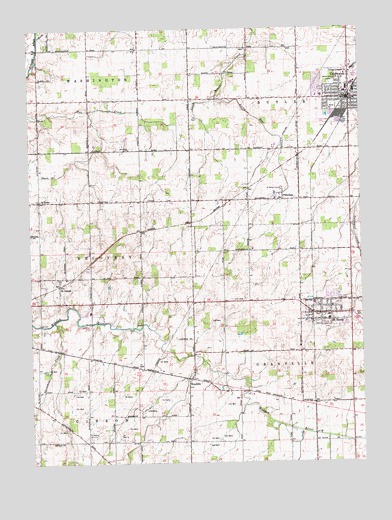
Coldwater, OH USGS Topographic Map
Click on map above to begin viewing in our Map Viewer.

This topographic map contains these locations and features:
Feature Name Type Latitude Longitude GNIS ID View Map
Albers FarmLocaleN40.4122°W84.6789°2708420View Map
Brunswick FarmsLocaleN40.4344°W84.7064°2711056View Map
ColdwaterPopulated PlaceN40.4798°W84.6283°1060984View Map
Coldwater EMS StationBuildingN40.4800°W84.6336°2780598View Map
Coldwater Fire DepartmentBuildingN40.4938°W84.6294°2549617View Map
Coldwater High SchoolSchoolN40.4822°W84.6299°1054891View Map
Coldwater Memorial ParkParkN40.4853°W84.6361°1961390View Map
Coldwater Police DepartmentBuildingN40.4796°W84.6312°2732736View Map
Coldwater Post OfficePost OfficeN40.4796°W84.6285°1961391View Map
Coldwater United Methodist ChurchChurchN40.4812°W84.6316°1961392View Map
Community Hospital HeliportAirportN40.4803°W84.6386°1082598View Map
East Elementary SchoolSchoolN40.4806°W84.6283°1054894View Map
Glazier Hill FarmLocaleN40.3803°W84.7092°2708263View Map
Hein Dairy FarmLocaleN40.4228°W84.7039°2708422View Map
Holy Trinity ChurchChurchN40.4800°W84.6286°1961396View Map
Honey Lane FarmsLocaleN40.4514°W84.7181°2711073View Map
Knapke FarmLocaleN40.4636°W84.7150°2711076View Map
Lefeld DairyLocaleN40.4394°W84.6686°2708421View Map
Lennartz FarmsLocaleN40.4411°W84.7450°2708264View Map
Links FarmLocaleN40.4492°W84.7150°2711060View Map
Little Bear CreekStreamN40.4806°W84.6777°1066074View Map
Mercer County Community HospitalHospitalN40.4804°W84.6392°1054920View Map
North Elementary SchoolSchoolN40.4814°W84.6302°1054922View Map
Northview Mobile VillagePopulated PlaceN40.4861°W84.6269°2651944View Map
Oakland Station (historical)LocaleN40.4417°W84.7080°1068233View Map
Osterholt Mobile Home ParkPopulated PlaceN40.4169°W84.6303°2651949View Map
PhilotheaPopulated PlaceN40.4506°W84.6536°1044423View Map
Philothea Post Office (historical)Post OfficeN40.4500°W84.6541°2037132View Map
Philothea Station (historical)LocaleN40.4506°W84.6436°1054926View Map
Saint HenryPopulated PlaceN40.4175°W84.6397°1057982View Map
Saint Henry Catholic CemeteryCemeteryN40.4134°W84.6383°1961386View Map
Saint Henry Catholic ChurchChurchN40.4173°W84.6375°1069698View Map
Saint Henry Elementary SchoolSchoolN40.4162°W84.6374°1054931View Map
Saint Henry Emergency Medical ServicesBuildingN40.4180°W84.6334°2550897View Map
Saint Henry High SchoolSchoolN40.4164°W84.6342°1054932View Map
Saint Henry Middle SchoolSchoolN40.4164°W84.6351°1054933View Map
Saint Henry Post OfficePost OfficeN40.4179°W84.6366°2036678View Map
Saint Henry Volunteer Fire DepartmentBuildingN40.4210°W84.6321°2550014View Map
Saint JosephPopulated PlaceN40.4264°W84.7394°1066935View Map
Saint Joseph Catholic CemeteryCemeteryN40.4275°W84.7386°1961401View Map
Saint Joseph Catholic ChurchChurchN40.4281°W84.7389°1069699View Map
Saint Marys CemeteryCemeteryN40.4536°W84.6544°1045644View Map
Saint PeterPopulated PlaceN40.4503°W84.7461°1065275View Map
Saint Peter ChurchChurchN40.4509°W84.7464°1075205View Map
Saint Peter Elementary SchoolSchoolN40.4509°W84.7458°1054934View Map
Saint Peters Catholic CemeteryCemeteryN40.4512°W84.7469°1961405View Map
Saint Peters Post Office (historical)Post OfficeN40.4500°W84.7458°2037135View Map
Saint Wendelin Catholic CemeteryCemeteryN40.3984°W84.6908°1961408View Map
Saint Wendelin ChurchChurchN40.3989°W84.6902°1075207View Map
Saint Wendelin School (historical)SchoolN40.3989°W84.6894°1069702View Map
Schlarman FarmsLocaleN40.4272°W84.7294°2711075View Map
Siefring Dairy FarmLocaleN40.4294°W84.6842°2708423View Map
Stammen FarmLocaleN40.3783°W84.7242°2711058View Map
Theo FarmsLocaleN40.4300°W84.6653°2708425View Map
Threemile CreekStreamN40.4159°W84.7408°1047050View Map
Township of ButlerCivilN40.4824°W84.6314°1086621View Map
Township of GibsonCivilN40.3800°W84.7492°1086625View Map
Township of GranvilleCivilN40.3975°W84.6309°1086626View Map
Township of RecoveryCivilN40.4359°W84.7445°1086631View Map
Twomile CreekStreamN40.4156°W84.7497°1047253View Map
Village of ColdwaterCivilN40.4833°W84.6317°2398595View Map
Village of Saint HenryCivilN40.4208°W84.6326°2399173View Map
Wendel FarmsLocaleN40.4133°W84.6869°2567628View Map
WendelinPopulated PlaceN40.3992°W84.6900°1061729View Map
Wendlin Post Office (historical)Post OfficeN40.3987°W84.6902°2037144View Map
West Elementary SchoolSchoolN40.4812°W84.6316°1054939View Map

Note: Coordinates in the location and feature list above are referenced to NAD83 datum.


Copyright (C) 2008-2024 Ryan Niemi / Sunset Dynamics ... All Rights Reserved