TopoQuest Logo
Do you find TopoQuest useful?
Help keep TopoQuest running and adding new maps/features by donating!
Bitcoin:  19c7KJd3qBynnjoSw5npx9KScwjBe4ifkT
Litecoin:  LXs6TkuXGGXo1vDsWCkWVdjQX94eUKd6ui
Home View Maps Find Maps Find Places Resources & Links


Cold Fork, California Topographic Map

USGS Map Title: Cold Fork, CA
USGS Map MRC: 40122B6
DRG (GeoTIFF) Download: o40122b6.tif


Neighboring USGS Topographic Map Quads:


  Beegum, CA  
40122C7


  North Yolla Bolly, CA  
40122B7
 

  Cold Fork, CA  
40122B6
 

  Oxbow Bridge, CA  
40122B5
 

  South Yolla Bolly, CA  
40122A7
 

  Raglin Ridge, CA  
40122A6
 

  Lowrey, CA  
40122A5


Map MRC Location:

N41°
W123°
N41°
W122°
H8 H7 H6 H5 H4 H3 H2 H1
G8 G7 G6 G5 G4 G3 G2 G1
F8 F7 F6 F5 F4 F3 F2 F1
E8 E7 E6 E5 E4 E3 E2 E1
D8 D7 D6 D5 D4 D3 D2 D1
C8 C7 C6 C5 C4 C3 C2 C1
B8 B7 B6 B5 B4 B3 B2 B1
A8 A7 A6 A5 A4 A3 A2 A1
N40°
W123°
N40°
W122°

Cold Fork, CA USGS 1:24K Topographic Map Preview:
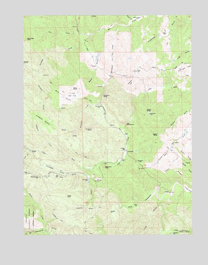
Cold Fork, CA USGS Topographic Map
Click on map above to begin viewing in our Map Viewer.

This topographic map contains these locations and features:
Feature Name Type Latitude Longitude GNIS ID View Map
Alford PlacePopulated PlaceN40.2182°W122.6667°256177View Map
Bayles PlacePopulated PlaceN40.1493°W122.6417°1666609View Map
Bone GulchValleyN40.2299°W122.6858°257337View Map
Burrill Homestead (historical)LocaleN40.1660°W122.6306°1666611View Map
Cobb FlatFlatN40.1735°W122.6425°221280View Map
Cold ForkPopulated PlaceN40.1718°W122.6733°1655910View Map
Cooks FlatFlatN40.1504°W122.6270°258670View Map
Cooks RidgesRidgeN40.1624°W122.6403°258671View Map
El Rancho Rio FrioLocaleN40.1729°W122.7447°259814View Map
Freshwater GulchValleyN40.1602°W122.7192°260414View Map
Goat CampLocaleN40.2154°W122.7358°260616View Map
Greasewood HillSummitN40.1577°W122.7397°260841View Map
Halley GradeTrailN40.2015°W122.7028°261027View Map
Halley SpringSpringN40.2078°W122.7145°261028View Map
Haven PlacePopulated PlaceN40.1824°W122.6758°1656063View Map
Heitman Place (historical)Populated PlaceN40.1579°W122.7047°1666616View Map
Hole in the GroundBasinN40.1877°W122.6745°261417View Map
Kingsley CreekStreamN40.1696°W122.7195°262190View Map
Kingsley GladesFlatN40.1904°W122.7364°262192View Map
Lanyan TrailTrailN40.1268°W122.6358°262318View Map
Long GulchValleyN40.1440°W122.6486°262840View Map
Maple CreekStreamN40.1274°W122.7347°263172View Map
McMoran FlatFlatN40.2115°W122.6714°263406View Map
Oak FlatFlatN40.2038°W122.7150°264278View Map
Panther GulchValleyN40.1557°W122.7025°264483View Map
Pettyjohn PlacePopulated PlaceN40.1735°W122.6758°264674View Map
Plumb GulchValleyN40.2471°W122.6700°264867View Map
Poker FlatFlatN40.1604°W122.7478°264902View Map
Rocky PeakSummitN40.1471°W122.7186°265539View Map
Rocky RidgeRidgeN40.1665°W122.6250°267192View Map
Salt Creek PeakSummitN40.2363°W122.7481°265771View Map
Salt GulchValleyN40.1602°W122.7053°253814View Map
Salt LickSpringN40.1588°W122.7250°265781View Map
Schoolhouse FlatFlatN40.1968°W122.6950°265921View Map
Sevenglass SpringSpringN40.1849°W122.7007°266013View Map
Shackleford PlacePopulated PlaceN40.1268°W122.7345°1666631View Map
Shackleford PlaceLocaleN40.1263°W122.7339°276972View Map
Shakecabin FlatFlatN40.1929°W122.6558°266035View Map
Skinner Mill PlacePopulated PlaceN40.1565°W122.7031°1656294View Map
Stevenson PeakSummitN40.1635°W122.6906°267740View Map
Stinking CreekStreamN40.2382°W122.7020°267754View Map
Story FlatFlatN40.1410°W122.6675°267795View Map
Sulphur SpringSpringN40.1827°W122.6514°267904View Map
Sulphur SpringSpringN40.1957°W122.6598°267905View Map
Van Horn FlatFlatN40.1871°W122.6275°1666634View Map
Vestal FlatFlatN40.2385°W122.6447°268689View Map
Weemasoul CreekStreamN40.2435°W122.6775°268841View Map
Weemasoul SpringSpringN40.2044°W122.6920°268842View Map
Widow Wilson FieldAreaN40.2488°W122.6658°269063View Map
Wilcox FlatFlatN40.1665°W122.6775°269068View Map
Wildcat GulchValleyN40.2168°W122.7403°269094View Map
Woodyard FlatFlatN40.1660°W122.6642°269310View Map

Note: Coordinates in the location and feature list above are referenced to NAD83 datum.


Copyright (C) 2008-2024 Ryan Niemi / Sunset Dynamics ... All Rights Reserved