TopoQuest Logo
Do you find TopoQuest useful?
Help keep TopoQuest running and adding new maps/features by donating!
Bitcoin:  19c7KJd3qBynnjoSw5npx9KScwjBe4ifkT
Litecoin:  LXs6TkuXGGXo1vDsWCkWVdjQX94eUKd6ui
Home View Maps Find Maps Find Places Resources & Links


Coffeeville, Mississippi Topographic Map

USGS Map Title: Coffeeville, MS
USGS Map MRC: 33089H6
DRG (GeoTIFF) Download: o33089h6.tif


Neighboring USGS Topographic Map Quads:


  Coker Lake, MS  
34089A7
 

  Velma, MS  
34089A6
 

  Pine Valley, MS  
34089A5
 

  Scobey, MS  
33089H7
 

  Coffeeville, MS  
33089H6
 

  Benwood, MS  
33089H5
 

  Grenada, MS  
33089G7
 

  Kincaid, MS  
33089G6
 

  Gore Springs, MS  
33089G5


Map MRC Location:

N34°
W90°
N34°
W89°
H8 H7 H6 H5 H4 H3 H2 H1
G8 G7 G6 G5 G4 G3 G2 G1
F8 F7 F6 F5 F4 F3 F2 F1
E8 E7 E6 E5 E4 E3 E2 E1
D8 D7 D6 D5 D4 D3 D2 D1
C8 C7 C6 C5 C4 C3 C2 C1
B8 B7 B6 B5 B4 B3 B2 B1
A8 A7 A6 A5 A4 A3 A2 A1
N33°
W90°
N33°
W89°

Coffeeville, MS USGS 1:24K Topographic Map Preview:
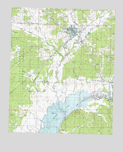
Coffeeville, MS USGS Topographic Map
Click on map above to begin viewing in our Map Viewer.

This topographic map contains these locations and features:
Feature Name Type Latitude Longitude GNIS ID View Map
Athens School (historical)SchoolN33.9609°W89.7226°705914View Map
Bailey CemeteryCemeteryN33.9815°W89.7045°692438View Map
Brooms CemeteryCemeteryN33.9882°W89.6609°692717View Map
Bruce JunctionPopulated PlaceN33.9646°W89.6848°692731View Map
BryantPopulated PlaceN33.9257°W89.7034°692736View Map
Buntin CemeteryCemeteryN33.9923°W89.6848°692766View Map
Caney CreekStreamN33.9143°W89.6334°692835View Map
Clear Springs CreekStreamN33.9096°W89.6456°692933View Map
Clear Springs School (historical)SchoolN33.8879°W89.6256°705917View Map
CoffeevillePopulated PlaceN33.9768°W89.6756°692939View Map
Coffeeville Elementary SchoolSchoolN33.9796°W89.6765°705918View Map
Coffeeville First Baptist ChurchChurchN33.9762°W89.6737°705919View Map
Coffeeville High SchoolSchoolN33.9771°W89.6745°705920View Map
Coffeeville Police DepartmentBuildingN33.9747°W89.6727°2754135View Map
Coffeeville Post OfficePost OfficeN33.9736°W89.6743°2768852View Map
Coffeeville Volunteer Fire DepartmentBuildingN33.9735°W89.6728°2665677View Map
Cool BranchStreamN33.9673°W89.7081°692962View Map
Cypress CreekStreamN33.9496°W89.6862°693037View Map
Cypress Creek Watershed Y-19a-13 DamDamN33.9651°W89.7118°695513View Map
Durden CreekStreamN33.9651°W89.6731°693141View Map
Elam CemeteryCemeteryN33.9537°W89.6320°693164View Map
Elam ChurchChurchN33.9534°W89.6320°693165View Map
GumsPopulated PlaceN33.9276°W89.6290°693388View Map
Gums CrossingPopulated PlaceN33.9107°W89.6292°693389View Map
Hairston CemeteryCemeteryN33.9459°W89.6740°693396View Map
Hardeman CemeteryCemeteryN33.8946°W89.7331°693414View Map
Hendersonville (historical)LocaleN33.9376°W89.7287°705923View Map
Hopewell Baptist ChurchChurchN33.9612°W89.7231°693527View Map
Hopewell CemeteryCemeteryN33.9679°W89.7248°693522View Map
Jones SchoolSchoolN33.8971°W89.6317°693641View Map
Mount Myra CemeteryCemeteryN33.8921°W89.7479°694068View Map
Oakachickan (historical)LocaleN33.9173°W89.7084°705928View Map
Okachickima CreekStreamN33.9179°W89.6981°694250View Map
Perkins LakeReservoirN33.9748°W89.7487°704582View Map
Pleasant Grove CemeteryCemeteryN33.9265°W89.7073°694421View Map
Pleasant Grove ChurchChurchN33.9265°W89.7073°694426View Map
Silver Knoll ChurchChurchN33.9865°W89.7265°694789View Map
Skuna Turkey Creek Public Use AreaParkN33.8779°W89.6890°704585View Map
Spearman CreekStreamN33.9120°W89.6256°694851View Map
Supervisor District 5CivilN33.9289°W89.7097°712152View Map
Town of CoffeevilleCivilN33.9765°W89.6845°2406290View Map
Turkey CreekPopulated PlaceN33.8876°W89.6820°695015View Map
Turkey CreekStreamN33.8932°W89.6812°695022View Map
Walton CemeteryCemeteryN33.8923°W89.7323°695095View Map
Wilbourn CemeteryCemeteryN33.8907°W89.7398°695172View Map
Williams CemeteryCemeteryN33.9162°W89.7237°695186View Map
Y-19a-3 DamDamN33.9751°W89.7168°695514View Map
Y-19a-3 LakeReservoirN33.9751°W89.7168°695515View Map
Yalobusha Lookout TowerTowerN33.9454°W89.6484°704590View Map

Note: Coordinates in the location and feature list above are referenced to NAD83 datum.


Copyright (C) 2008-2024 Ryan Niemi / Sunset Dynamics ... All Rights Reserved