TopoQuest Logo
Do you find TopoQuest useful?
Help keep TopoQuest running and adding new maps/features by donating!
Bitcoin:  19c7KJd3qBynnjoSw5npx9KScwjBe4ifkT
Litecoin:  LXs6TkuXGGXo1vDsWCkWVdjQX94eUKd6ui
Home View Maps Find Maps Find Places Resources & Links


Cliff Ridge, Washington Topographic Map

USGS Map Title: Cliff Ridge, WA
USGS Map MRC: 48117D6
DRG (GeoTIFF) Download: o48117d6.tif


Neighboring USGS Topographic Map Quads:


  White Mud Lake, WA  
48117E7
 

  Park Rapids, WA  
48117E6
 

  Lake Gillette, WA  
48117E5
 

  Addy Mountain, WA  
48117D7
 

  Cliff Ridge, WA  
48117D6
 

  Calispell Peak, WA  
48117D5
 

  Addy, WA  
48117C7
 

  Chewelah, WA  
48117C6
 

  Goddards Peak, WA  
48117C5


Map MRC Location:

N49°
W118°
N49°
W117°
H8 H7 H6 H5 H4 H3 H2 H1
G8 G7 G6 G5 G4 G3 G2 G1
F8 F7 F6 F5 F4 F3 F2 F1
E8 E7 E6 E5 E4 E3 E2 E1
D8 D7 D6 D5 D4 D3 D2 D1
C8 C7 C6 C5 C4 C3 C2 C1
B8 B7 B6 B5 B4 B3 B2 B1
A8 A7 A6 A5 A4 A3 A2 A1
N48°
W118°
N48°
W117°

Cliff Ridge, WA USGS 1:24K Topographic Map Preview:
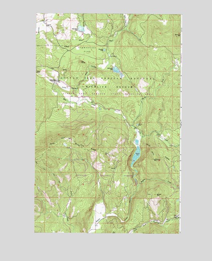
Cliff Ridge, WA USGS Topographic Map
Click on map above to begin viewing in our Map Viewer.

This topographic map contains these locations and features:
Feature Name Type Latitude Longitude GNIS ID View Map
Aspen CreekStreamN48.4924°W117.6727°1526451View Map
Bayley LakeLakeN48.4193°W117.6634°1516202View Map
Bear CanyonValleyN48.3841°W117.6894°1516218View Map
Bear CreekStreamN48.4607°W117.7339°1516244View Map
BingvillePopulated PlaceN48.3849°W117.6300°1516570View Map
Brewer MountainSummitN48.3971°W117.6455°1516937View Map
Camp Number OneLocaleN48.4760°W117.6858°1529547View Map
Camp Number TwoLocaleN48.4574°W117.7186°1529546View Map
Cliff RidgeRidgeN48.4213°W117.7002°1517859View Map
Little Pend Oreille National Wildlife RefugeParkN48.4622°W117.6554°1529428View Map
Little Pend Orielle State Wildlife AreaParkN48.4896°W117.6339°1528708View Map
McDonald MountainSummitN48.4171°W117.6486°1522888View Map
McDowell LakeReservoirN48.4675°W117.6803°1531989View Map
McDowell Lake DamDamN48.4699°W117.6827°1531988View Map
Mill ButteSummitN48.4724°W117.7114°1523148View Map
Narcisse GrangeBuildingN48.4943°W117.7422°1534481View Map
Narcisse SchoolSchoolN48.4930°W117.7408°1523576View Map
North Fork Bear CreekStreamN48.4363°W117.6672°1523735View Map
Perry MineMineN48.3752°W117.6827°1524343View Map
Pierce LakeLakeN48.4368°W117.6624°1524411View Map
Starvation FlatFlatN48.4793°W117.7069°1526621View Map
Starvation LakeLakeN48.4914°W117.7113°1526503View Map
Winslow LakeLakeN48.4793°W117.6914°1528250View Map

Note: Coordinates in the location and feature list above are referenced to NAD83 datum.


Copyright (C) 2008-2024 Ryan Niemi / Sunset Dynamics ... All Rights Reserved