TopoQuest Logo
Do you find TopoQuest useful?
Help keep TopoQuest running and adding new maps/features by donating!
Bitcoin:  19c7KJd3qBynnjoSw5npx9KScwjBe4ifkT
Litecoin:  LXs6TkuXGGXo1vDsWCkWVdjQX94eUKd6ui
Home View Maps Find Maps Find Places Resources & Links


Clarksville, New York Topographic Map

USGS Map Title: Clarksville, NY
USGS Map MRC: 42073E8
DRG (GeoTIFF) Download: o42073e8.tif


Neighboring USGS Topographic Map Quads:


  Altamont, NY  
42074F1
 

  Voorheesville, NY  
42073F8
 

  Albany, NY  
42073F7
 

  Westerlo, NY  
42074E1
 

  Clarksville, NY  
42073E8
 

  Delmar, NY  
42073E7
 

  Greenville, NY  
42074D1
 

  Alcove, NY  
42073D8
 

  Ravena, NY  
42073D7


Map MRC Location:

N43°
W74°
N43°
W73°
H8 H7 H6 H5 H4 H3 H2 H1
G8 G7 G6 G5 G4 G3 G2 G1
F8 F7 F6 F5 F4 F3 F2 F1
E8 E7 E6 E5 E4 E3 E2 E1
D8 D7 D6 D5 D4 D3 D2 D1
C8 C7 C6 C5 C4 C3 C2 C1
B8 B7 B6 B5 B4 B3 B2 B1
A8 A7 A6 A5 A4 A3 A2 A1
N42°
W74°
N42°
W73°

Clarksville, NY USGS 1:24K Topographic Map Preview:
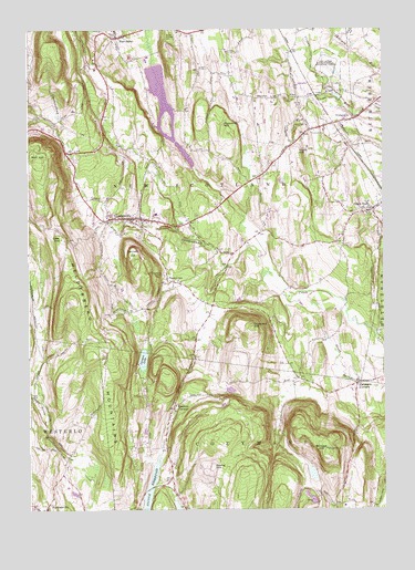
Clarksville, NY USGS Topographic Map
Click on map above to begin viewing in our Map Viewer.

This topographic map contains these locations and features:
Feature Name Type Latitude Longitude GNIS ID View Map
Albany CountyCivilN42.6002°W73.9736°974099View Map
Bennett HillSummitN42.5651°W73.9629°943669View Map
Blodget HillSummitN42.5151°W73.8954°944269View Map
Callanans CornersPopulated PlaceN42.5326°W73.8846°945475View Map
Cass HillSummitN42.5704°W73.9879°945968View Map
Cedar Grove School (historical)SchoolN42.5358°W73.9067°2357950View Map
ClarksvillePopulated PlaceN42.5759°W73.9640°946794View Map
Clarksville Elementary SchoolSchoolN42.5769°W73.9548°2435035View Map
Copeland HillSummitN42.5479°W73.9215°947411View Map
Delmar State Game Farm (historical)LocaleN42.6140°W73.8940°948280View Map
Diamond HillSummitN42.6001°W73.9318°948408View Map
Dunbar HollowValleyN42.5135°W73.9853°948779View Map
Feura BushPopulated PlaceN42.5779°W73.8787°950015View Map
Five Rivers Environmental Education CenterSchoolN42.6153°W73.8942°2357068View Map
Keefers CornersPopulated PlaceN42.5267°W73.9493°954426View Map
Koong HillSummitN42.5112°W73.9360°954804View Map
Lawson LakeLakeN42.5388°W73.9597°955115View Map
Mount Pleasant CemeteryCemeteryN42.6248°W73.9500°957889View Map
New SalemPopulated PlaceN42.6229°W73.9685°958455View Map
Onesquethaw CemeteryCemeteryN42.5613°W73.9520°959381View Map
Onesquethaw Volunteer Fire Company Station 1BuildingN42.5749°W73.9622°2718662View Map
Onesquethaw Volunteer Fire Company Station 2 Feura BushBuildingN42.5776°W73.8843°2718252View Map
Onesquethaw Volunteer Fire Company Station 3 UnionvilleBuildingN42.5992°W73.9001°2735518View Map
Peck Airport (historical)AirportN42.6206°W73.9171°978346View Map
School Number 2 (historical)SchoolN42.5144°W73.9861°2358971View Map
School Number 5 (historical)SchoolN42.5014°W73.8928°2357091View Map
School Number 9 (historical)SchoolN42.5161°W73.9533°2357096View Map
Stony HillPopulated PlaceN42.5947°W73.9069°2357072View Map
Stony HillSummitN42.5934°W73.9048°966570View Map
TarrytownPopulated PlaceN42.5590°W73.9510°967066View Map
Town of New ScotlandCivilN42.6047°W73.9413°979272View Map
UnionvillePopulated PlaceN42.6012°W73.8879°968236View Map
Unionville Reformed ChurchChurchN42.6008°W73.8906°2435818View Map
Wolf HillSummitN42.5915°W73.9960°971551View Map

Note: Coordinates in the location and feature list above are referenced to NAD83 datum.


Copyright (C) 2008-2024 Ryan Niemi / Sunset Dynamics ... All Rights Reserved