TopoQuest Logo
Do you find TopoQuest useful?
Help keep TopoQuest running and adding new maps/features by donating!
Bitcoin:  19c7KJd3qBynnjoSw5npx9KScwjBe4ifkT
Litecoin:  LXs6TkuXGGXo1vDsWCkWVdjQX94eUKd6ui
Home View Maps Find Maps Find Places Resources & Links


Clarksdale, Missouri Topographic Map

USGS Map Title: Clarksdale, MO
USGS Map MRC: 39094G5
DRG (GeoTIFF) Download: o39094g5.tif


Neighboring USGS Topographic Map Quads:


  Helena, MO  
39094H6
 

  Union Star, MO  
39094H5
 

  Wood, MO  
39094H4
 

  Cosby, MO  
39094G6
 

  Clarksdale, MO  
39094G5
 

  Amity, MO  
39094G4
 

  Agency, MO  
39094F6
 

  Hemple, MO  
39094F5
 

  Perrin, MO  
39094F4


Map MRC Location:

N40°
W95°
N40°
W94°
H8 H7 H6 H5 H4 H3 H2 H1
G8 G7 G6 G5 G4 G3 G2 G1
F8 F7 F6 F5 F4 F3 F2 F1
E8 E7 E6 E5 E4 E3 E2 E1
D8 D7 D6 D5 D4 D3 D2 D1
C8 C7 C6 C5 C4 C3 C2 C1
B8 B7 B6 B5 B4 B3 B2 B1
A8 A7 A6 A5 A4 A3 A2 A1
N39°
W95°
N39°
W94°

Clarksdale, MO USGS 1:24K Topographic Map Preview:
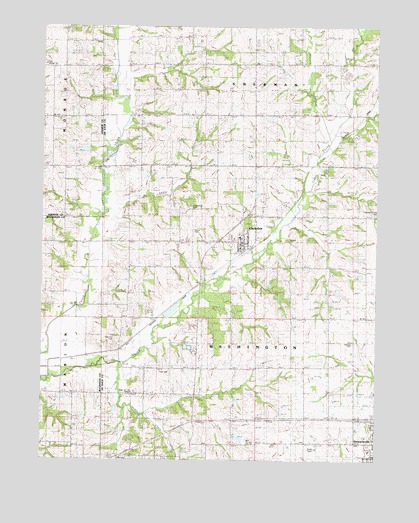
Clarksdale, MO USGS Topographic Map
Click on map above to begin viewing in our Map Viewer.

This topographic map contains these locations and features:
Feature Name Type Latitude Longitude GNIS ID View Map
Baker DamDamN39.7750°W94.6036°760531View Map
Baker LakeReservoirN39.7750°W94.6036°760532View Map
Bayfield (historical)Populated PlaceN39.7819°W94.5961°729425View Map
Bays BranchStreamN39.8203°W94.6027°738102View Map
Beauchamp School (historical)SchoolN39.8342°W94.6238°713835View Map
Bethel CemeteryCemeteryN39.8642°W94.6250°741960View Map
Bethel ChurchChurchN39.8640°W94.6244°748806View Map
Boxford (historical)Populated PlaceN39.8483°W94.5886°740172View Map
Carrol School (historical)SchoolN39.8575°W94.5691°729456View Map
City of ClarksdaleCivilN39.8138°W94.5508°2393541View Map
ClarksdalePopulated PlaceN39.8136°W94.5505°729458View Map
Clarksdale CemeteryCemeteryN39.8228°W94.5699°741976View Map
Clarksdale Fire Protection DistrictBuildingN39.8114°W94.5633°2621375View Map
Clarksdale Post OfficePost OfficeN39.8120°W94.5503°2782662View Map
Crab Orchard School (historical)SchoolN39.8025°W94.5194°729463View Map
De Kalb CemeteryCemeteryN39.7839°W94.5091°741975View Map
Dean School (historical)SchoolN39.8239°W94.5588°729470View Map
Fisher School (historical)SchoolN39.7697°W94.5858°729486View Map
Jordan CreekStreamN39.7778°W94.5961°736169View Map
Ketchem School (historical)SchoolN39.8569°W94.5216°729528View Map
Maple Grove Church (historical)ChurchN39.7847°W94.5091°729547View Map
Morgan BranchStreamN39.8453°W94.5177°729557View Map
Peterson LakeReservoirN39.8383°W94.6069°762515View Map
Peterson Lake DamDamN39.8383°W94.6069°762514View Map
Pleasant Grove CemeteryCemeteryN39.8208°W94.5008°741979View Map
Pleasant Grove School (historical)SchoolN39.8211°W94.5013°729610View Map
Ritchie SchoolSchoolN39.7728°W94.5688°730193View Map
Roger School (historical)SchoolN39.7778°W94.5269°729629View Map
Silvers CemeteryCemeteryN39.8133°W94.5338°741978View Map
Stewartsville Elementary SchoolSchoolN39.7529°W94.5022°2545177View Map
Stewartsville Fire Protection DistrictBuildingN39.7613°W94.5045°2621680View Map
Stewartsville High SchoolSchoolN39.7526°W94.5027°2545327View Map
Stone CemeteryCemeteryN39.8164°W94.5688°741977View Map
Thornton CemeteryCemeteryN39.7847°W94.5980°741974View Map
Thornton School (historical)SchoolN39.8119°W94.5922°729674View Map
Todd CemeteryCemeteryN39.7753°W94.5777°741972View Map
Township of WashingtonCivilN39.7912°W94.5273°766599View Map
Way of Life ChapelChurchN39.7686°W94.5930°741973View Map

Note: Coordinates in the location and feature list above are referenced to NAD83 datum.


Copyright (C) 2008-2024 Ryan Niemi / Sunset Dynamics ... All Rights Reserved