TopoQuest Logo
Do you find TopoQuest useful?
Help keep TopoQuest running and adding new maps/features by donating!
Bitcoin:  19c7KJd3qBynnjoSw5npx9KScwjBe4ifkT
Litecoin:  LXs6TkuXGGXo1vDsWCkWVdjQX94eUKd6ui
Home View Maps Find Maps Find Places Resources & Links


Clarence, Iowa Topographic Map

USGS Map Title: Clarence, IA
USGS Map MRC: 41091H1
DRG (GeoTIFF) Download: o41091h1.tif


Neighboring USGS Topographic Map Quads:


  Morley, IA  
42091A2
 

  Wyoming West, IA  
42091A1
 

  Wyoming East, IA  
42090A8
 

  Stanwood, IA  
41091H2
 

  Clarence, IA  
41091H1
 

  Oxford Junction, IA  
41090H8
 

  Tipton West, IA  
41091G2
 

  Tipton East, IA  
41091G1
 

  Lowden, IA  
41090G8


Map MRC Location:

N42°
W92°
N42°
W91°
H8 H7 H6 H5 H4 H3 H2 H1
G8 G7 G6 G5 G4 G3 G2 G1
F8 F7 F6 F5 F4 F3 F2 F1
E8 E7 E6 E5 E4 E3 E2 E1
D8 D7 D6 D5 D4 D3 D2 D1
C8 C7 C6 C5 C4 C3 C2 C1
B8 B7 B6 B5 B4 B3 B2 B1
A8 A7 A6 A5 A4 A3 A2 A1
N41°
W92°
N41°
W91°

Clarence, IA USGS 1:24K Topographic Map Preview:
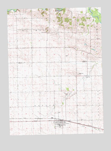
Clarence, IA USGS Topographic Map
Click on map above to begin viewing in our Map Viewer.

This topographic map contains these locations and features:
Feature Name Type Latitude Longitude GNIS ID View Map
CedarLocaleN41.9350°W91.0018°466084View Map
Cedar Post Office (historical)Post OfficeN41.9350°W91.0018°2001550View Map
City of ClarenceCivilN41.8859°W91.0570°2393532View Map
ClarencePopulated PlaceN41.8889°W91.0565°455423View Map
ClarenceLocaleN41.8895°W91.0571°2001643View Map
Clarence Ambulance ServiceBuildingN41.8890°W91.0584°2599880View Map
Clarence CemeteryCemeteryN41.8972°W91.0607°455424View Map
Clarence City HallBuildingN41.8889°W91.0590°2001654View Map
Clarence Community ParkParkN41.8875°W91.0657°2001655View Map
Clarence Family Practice CenterHospitalN41.8861°W91.0643°2001646View Map
Clarence Fire DepartmentBuildingN41.8890°W91.0584°2001653View Map
Clarence Nursing HomeHospitalN41.8864°W91.0632°2001648View Map
Clarence Police DepartmentBuildingN41.8890°W91.0583°2001652View Map
Clarence Post OfficePost OfficeN41.8872°W91.0565°2001645View Map
Clarence Water Treatment PlantLocaleN41.8842°W91.0575°2728270View Map
Dayton Valley CemeteryCemeteryN41.9320°W91.0208°455821View Map
Diamond CemeteryCemeteryN41.9527°W91.0486°455905View Map
Jungletown Public AccessLocaleN41.9972°W91.0560°1825067View Map
Mill Creek BridgeBridgeN41.9045°W91.0646°2001716View Map
North Cedar Middle SchoolSchoolN41.8845°W91.0593°2001651View Map
Onion Grove Cemetery (historical)CemeteryN41.9111°W91.0474°2001697View Map
Pleasant Hill CemeteryCemeteryN41.9762°W91.0739°460247View Map
Saint Johns CemeteryCemeteryN41.8886°W91.0318°461018View Map
Saint Johns United Church of ChristChurchN41.8875°W91.0515°2001649View Map
Saint Lukes Physicians ClinicHospitalN41.8861°W91.0643°2001647View Map
Township of DaytonCivilN41.9029°W91.0736°467684View Map
Township of HaleCivilN41.9903°W91.0734°467989View Map
United Methodist ChurchChurchN41.8872°W91.0552°2001650View Map
Zybell Memorial LibraryBuildingN41.8872°W91.0563°2001644View Map

Note: Coordinates in the location and feature list above are referenced to NAD83 datum.


Copyright (C) 2008-2024 Ryan Niemi / Sunset Dynamics ... All Rights Reserved