TopoQuest Logo
Do you find TopoQuest useful?
Help keep TopoQuest running and adding new maps/features by donating!
Bitcoin:  19c7KJd3qBynnjoSw5npx9KScwjBe4ifkT
Litecoin:  LXs6TkuXGGXo1vDsWCkWVdjQX94eUKd6ui
Home View Maps Find Maps Find Places Resources & Links


Circle, Montana Topographic Map

USGS Map Title: Circle, MT
USGS Map MRC: 47105D5
DRG (GeoTIFF) Download: o47105d5.tif


Neighboring USGS Topographic Map Quads:


  Haynie Reservoir, MT  
47105E6
 

  Hudiburgh Reservoir SE, MT  
47105E5
 

  Buffalo Creek, MT  
47105E4
 

  Youngquist Mine, MT  
47105D6
 

  Circle, MT  
47105D5
 

  Woodworth Hill, MT  
47105D4
 

  Circle SW, MT  
47105C6
 

  Quick Reservoir, MT  
47105C5
 

  Mount Antelope, MT  
47105C4


Map MRC Location:

N48°
W106°
N48°
W105°
H8 H7 H6 H5 H4 H3 H2 H1
G8 G7 G6 G5 G4 G3 G2 G1
F8 F7 F6 F5 F4 F3 F2 F1
E8 E7 E6 E5 E4 E3 E2 E1
D8 D7 D6 D5 D4 D3 D2 D1
C8 C7 C6 C5 C4 C3 C2 C1
B8 B7 B6 B5 B4 B3 B2 B1
A8 A7 A6 A5 A4 A3 A2 A1
N47°
W106°
N47°
W105°

Circle, MT USGS 1:24K Topographic Map Preview:
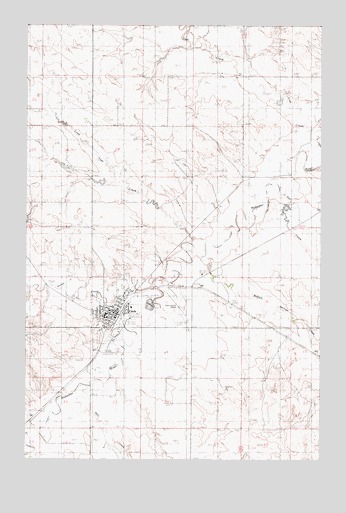
Circle, MT USGS Topographic Map
Click on map above to begin viewing in our Map Viewer.

This topographic map contains these locations and features:
Feature Name Type Latitude Longitude GNIS ID View Map
19N48E02CBAA01 WellWellN47.4342°W105.5719°822896View Map
19N48E02CBDA01 WellWellN47.4320°W105.5719°822871View Map
19N48E10BBCC01 WellWellN47.4247°W105.5967°822826View Map
19N48E10CADC01 WellWellN47.4172°W105.5886°822778View Map
19N48E10CCCD01 WellWellN47.4139°W105.5964°822762View Map
19N48E10CDAD01 WellWellN47.4161°W105.5903°822775View Map
19N48E10DACA01 WellWellN47.4147°W105.5847°822767View Map
19N48E11BC__01 WellWellN47.4208°W105.5728°822799View Map
19N48E11CBDC01 WellWellN47.4172°W105.5728°822777View Map
19N48E12BAAA01 WellWellN47.4270°W105.5453°822839View Map
19N48E12BAAB01 WellWellN47.4270°W105.5458°822840View Map
19N48E12CCDC01 WellWellN47.4136°W105.5514°822760View Map
19N48E12DABC01 WellWellN47.4186°W105.5378°822786View Map
19N48E12DCCA01 WellWellN47.4136°W105.5425°822759View Map
19N48E15BDDC01 WellWellN47.4064°W105.5886°822711View Map
19N48E15DBBB01 WellWellN47.4050°W105.5861°822695View Map
19N48E16DDDB01 WellWellN47.3992°W105.5994°822668View Map
19N48E20DDCD01 WellWellN47.3847°W105.6228°822590View Map
19N48E20DDDC01 WellWellN47.3847°W105.6208°822588View Map
19N48E20DDDC02 WellWellN47.3847°W105.6208°822589View Map
19N48E28BCBB01 WellWellN47.3797°W105.6181°822555View Map
19N48E28BCBC01 WellWellN47.3789°W105.6181°822545View Map
20N48E15BAAC01 WellWellN47.4989°W105.5883°823414View Map
20N48E22CCCD01 WellWellN47.4695°W105.5958°823209View Map
20N48E28DCBD01 WellWellN47.4586°W105.6064°823105View Map
20N48E28DCBD02 WellWellN47.4586°W105.6064°823106View Map
20N48E28DDCA01 WellWellN47.4572°W105.6011°823083View Map
20N48E36BAAB01 WellWellN47.4558°W105.5456°823070View Map
20N48E36BCDD01 WellWellN47.4500°W105.5500°823004View Map
20N49E18CCCD01 WellWellN47.4847°W105.5325°823329View Map
20N49E18CCDC01 WellWellN47.4847°W105.5311°823328View Map
20N49E30DAA_01 WellWellN47.4628°W105.5144°823147View Map
20N49E30DADB01 WellWellN47.4614°W105.5147°823129View Map
20N49E32BCBC01 WellWellN47.4511°W105.5122°823018View Map
20N49E32CBAC01 WellWellN47.4481°W105.5103°822986View Map
22N48E22CCCD01 WellWellN47.4695°W105.5958°823210View Map
Ben Larson ParkParkN47.4120°W105.5922°1716202View Map
Bo Peep Elementary SchoolSchoolN47.4170°W105.5914°1716061View Map
Buffalo Springs CreekStreamN47.4333°W105.5503°769360View Map
CirclePopulated PlaceN47.4167°W105.5922°806926View Map
CircleLocaleN47.4167°W105.5861°1716193View Map
Circle High SchoolSchoolN47.4161°W105.5919°1716066View Map
Circle Historical MarkerParkN47.4122°W105.5908°1716267View Map
Circle ParkParkN47.4106°W105.5856°1716201View Map
Circle Police DepartmentBuildingN47.4168°W105.5868°1716207View Map
Circle Post OfficePost OfficeN47.4186°W105.5887°1716194View Map
Circle Town County AirportAirportN47.4214°W105.5615°806385View Map
Circle Trailer CourtPopulated PlaceN47.4222°W105.5794°1716236View Map
Clara DamDamN47.4900°W105.5706°797570View Map
Evangelical Church of North AmericaChurchN47.4231°W105.5819°1716234View Map
Faith Assembly of God ChurchChurchN47.4200°W105.5814°1716232View Map
Farmers ElevatorLocaleN47.4167°W105.5861°1716247View Map
Farmers Union Elevator (historical)LocaleN47.4167°W105.5858°1716246View Map
First Baptist ChurchChurchN47.4183°W105.5989°1716233View Map
First Lutheran ChurchChurchN47.4153°W105.5914°1716228View Map
George McCone Memorial County LibraryBuildingN47.4156°W105.5908°1716250View Map
Gyp CreekStreamN47.4522°W105.5189°770374View Map
Hell CreekStreamN47.3947°W105.5975°772325View Map
Horse CreekStreamN47.4253°W105.5703°772553View Map
Lone Tree CreekStreamN47.4356°W105.5561°773597View Map
McCone County CourthouseBuildingN47.4167°W105.5914°1716204View Map
McCone County FairgroundsLocaleN47.4064°W105.5894°1716203View Map
McCone County Medical CenterHospitalN47.4189°W105.5808°1716248View Map
McCone County MuseumBuildingN47.4122°W105.5908°1716268View Map
McCone County Nursing HomeHospitalN47.4189°W105.5808°1716249View Map
McCone County Sheriff's OfficeBuildingN47.4166°W105.5879°1716206View Map
McCone County Volunteer Fire DepartmentBuildingN47.4202°W105.5841°1716205View Map
Peavey Elevator (historical)LocaleN47.4170°W105.5861°1716245View Map
Redwater SchoolSchoolN47.4167°W105.5914°1716125View Map
Redwater Valley Ambulance ServiceBuildingN47.4197°W105.5802°2637894View Map
Riverview CemeteryCemeteryN47.4056°W105.5769°1716235View Map
Saint Francis Xaviers Catholic ChurchChurchN47.4161°W105.5911°1716227View Map
Salem Lutheran Wisconsin SynodChurchN47.4125°W105.5919°1716229View Map
Scheers Trailer CourtLocaleN47.4245°W105.5817°1716251View Map
Stephensons Trailer CourtPopulated PlaceN47.4192°W105.5928°1716237View Map
Town of CircleCivilN47.4176°W105.5871°2413204View Map
United Christian ChurchChurchN47.4183°W105.5836°1716231View Map

Note: Coordinates in the location and feature list above are referenced to NAD83 datum.


Copyright (C) 2008-2024 Ryan Niemi / Sunset Dynamics ... All Rights Reserved