TopoQuest Logo
Do you find TopoQuest useful?
Help keep TopoQuest running and adding new maps/features by donating!
Bitcoin:  19c7KJd3qBynnjoSw5npx9KScwjBe4ifkT
Litecoin:  LXs6TkuXGGXo1vDsWCkWVdjQX94eUKd6ui
Home View Maps Find Maps Find Places Resources & Links


Chula, Missouri Topographic Map

USGS Map Title: Chula, MO
USGS Map MRC: 39093H4
DRG (GeoTIFF) Download: o39093h4.tif


Neighboring USGS Topographic Map Quads:


  Trenton East, MO  
40093A5
 

  Laredo, MO  
40093A4
 

  Lindley, MO  
40093A3
 

  Farmersville, MO  
39093H5
 

  Chula, MO  
39093H4
 

  Eversonville, MO  
39093H3
 

  Chillicothe, MO  
39093G5
 

  Wheeling, MO  
39093G4
 

  Meadville, MO  
39093G3


Map MRC Location:

N40°
W94°
N40°
W93°
H8 H7 H6 H5 H4 H3 H2 H1
G8 G7 G6 G5 G4 G3 G2 G1
F8 F7 F6 F5 F4 F3 F2 F1
E8 E7 E6 E5 E4 E3 E2 E1
D8 D7 D6 D5 D4 D3 D2 D1
C8 C7 C6 C5 C4 C3 C2 C1
B8 B7 B6 B5 B4 B3 B2 B1
A8 A7 A6 A5 A4 A3 A2 A1
N39°
W94°
N39°
W93°

Chula, MO USGS 1:24K Topographic Map Preview:
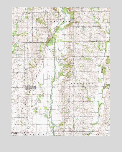
Chula, MO USGS Topographic Map
Click on map above to begin viewing in our Map Viewer.

This topographic map contains these locations and features:
Feature Name Type Latitude Longitude GNIS ID View Map
AlphaPopulated PlaceN39.9853°W93.4210°730048View Map
Alpha CemeteryCemeteryN39.9842°W93.4180°1782176View Map
ChulaPopulated PlaceN39.9217°W93.4744°715830View Map
Chula Post OfficePost OfficeN39.9223°W93.4762°2782660View Map
Chula Rural Fire DistrictBuildingN39.9223°W93.4766°2621544View Map
City of ChulaCivilN39.9219°W93.4776°2393522View Map
Gordonville SchoolSchoolN39.8950°W93.4119°718620View Map
Harmony (historical)Populated PlaceN39.9067°W93.3827°740170View Map
Little Muddy CreekStreamN39.9211°W93.3822°721280View Map
Livingston County Elementary SchoolSchoolN39.9196°W93.4810°2545202View Map
Manning SchoolSchoolN39.9228°W93.4169°721804View Map
Maple Grove SchoolSchoolN39.8917°W93.4841°721828View Map
Mount Gilead School (historical)SchoolN39.9847°W93.4555°722756View Map
Mount Vernon SchoolSchoolN39.9814°W93.3988°722916View Map
NianticPopulated PlaceN39.9656°W93.4569°740169View Map
Phillip SchoolSchoolN39.9514°W93.4124°724287View Map
Plainview CemeteryCemeteryN39.9292°W93.4747°724456View Map
Ricket CemeteryCemeteryN39.8800°W93.4291°725286View Map
Smith School (historical)SchoolN39.9506°W93.4830°726628View Map
Stucker CemeteryCemeteryN39.9939°W93.4785°727197View Map
Township of MedicineCivilN39.9232°W93.4080°766933View Map
Township of WilsonCivilN39.9994°W93.4323°766712View Map
Wallace CemeteryCemeteryN39.9320°W93.4260°728278View Map

Note: Coordinates in the location and feature list above are referenced to NAD83 datum.


Copyright (C) 2008-2024 Ryan Niemi / Sunset Dynamics ... All Rights Reserved