TopoQuest Logo
Do you find TopoQuest useful?
Help keep TopoQuest running and adding new maps/features by donating!
Bitcoin:  19c7KJd3qBynnjoSw5npx9KScwjBe4ifkT
Litecoin:  LXs6TkuXGGXo1vDsWCkWVdjQX94eUKd6ui
Home View Maps Find Maps Find Places Resources & Links


Christmas, Arizona Topographic Map

USGS Map Title: Christmas, AZ
USGS Map MRC: 33110A6
DRG (GeoTIFF) Download: o33110a6.tif


Neighboring USGS Topographic Map Quads:


  El Capitan Mountain, AZ  
33110B7
 

  Mescal Warm Spring, AZ  
33110B6
 

  Coolidge Dam, AZ  
33110B5
 

  Hayden, AZ  
33110A7
 

  Christmas, AZ  
33110A6
 

  Jerusalem Mountain, AZ  
33110A5
 

  Winkelman, AZ  
32110H7
 

  Dudleyville, AZ  
32110H6
 

  Brandenburg Mountain, AZ  
32110H5


Map MRC Location:

N34°
W111°
N34°
W110°
H8 H7 H6 H5 H4 H3 H2 H1
G8 G7 G6 G5 G4 G3 G2 G1
F8 F7 F6 F5 F4 F3 F2 F1
E8 E7 E6 E5 E4 E3 E2 E1
D8 D7 D6 D5 D4 D3 D2 D1
C8 C7 C6 C5 C4 C3 C2 C1
B8 B7 B6 B5 B4 B3 B2 B1
A8 A7 A6 A5 A4 A3 A2 A1
N33°
W111°
N33°
W110°

Christmas, AZ USGS 1:24K Topographic Map Preview:
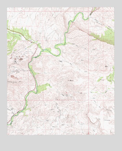
Christmas, AZ USGS Topographic Map
Click on map above to begin viewing in our Map Viewer.

This topographic map contains these locations and features:
Feature Name Type Latitude Longitude GNIS ID View Map
Apache SpringSpringN33.0253°W110.7468°741View Map
Ash CreekStreamN33.0251°W110.7320°834View Map
ChristmasPopulated PlaceN33.0623°W110.7426°2897View Map
Christmas Mill and MineMineN33.0584°W110.7465°22320View Map
Christmas Tailings Dam Number FiveDamN33.0551°W110.7407°22321View Map
Christmas Tailings Dam Number OneDamN33.0551°W110.7407°22322View Map
Christmas Tailings Dam Number SevenDamN33.0551°W110.7407°22323View Map
Christmas Tailings Dam Number SixDamN33.0551°W110.7407°22324View Map
Christmas Tailings Dam Number ThreeDamN33.0551°W110.7407°22325View Map
Christmas Tailings Dam Number TwoDamN33.0551°W110.7407°22326View Map
Copper CanyonValleyN33.0648°W110.7234°3217View Map
Corral MountainSummitN33.0673°W110.6376°3292View Map
Cottonwood SpringSpringN33.0723°W110.6865°3365View Map
Deer CreekStreamN33.0476°W110.7157°3801View Map
Dripping Spring WashStreamN33.0831°W110.7087°4117View Map
Dripping Springs ValleyValleyN33.0834°W110.7090°23856View Map
Granite BasinBasinN33.1062°W110.6370°5236View Map
Lee MountainSummitN33.0537°W110.6782°6954View Map
Lees MineMineN33.0384°W110.6804°6960View Map
Little Ash CreekStreamN33.0890°W110.6829°7064View Map
Little Gold GulchValleyN33.0190°W110.6893°7113View Map
Little Rock CreekStreamN33.0406°W110.6582°7170View Map
O'Carroll CanyonValleyN33.0192°W110.7432°8841View Map
Old Mill (historical)LocaleN33.0228°W110.6895°8955View Map
Pooles MineMineN33.0295°W110.7048°9639View Map
Porphyry GulchValleyN33.1159°W110.6543°9655View Map
Reese RanchLocaleN33.0862°W110.7123°10197View Map
Rock CreekStreamN33.0787°W110.6898°10389View Map
The TablelandsBenchN33.0127°W110.6303°12378View Map
Two Queens MineMineN33.0245°W110.7004°13002View Map
Young RanchLocaleN33.0906°W110.7209°14096View Map

Note: Coordinates in the location and feature list above are referenced to NAD83 datum.


Copyright (C) 2008-2024 Ryan Niemi / Sunset Dynamics ... All Rights Reserved