TopoQuest Logo
Do you find TopoQuest useful?
Help keep TopoQuest running and adding new maps/features by donating!
Bitcoin:  19c7KJd3qBynnjoSw5npx9KScwjBe4ifkT
Litecoin:  LXs6TkuXGGXo1vDsWCkWVdjQX94eUKd6ui
Home View Maps Find Maps Find Places Resources & Links


Christensen Ranch, Montana Topographic Map

USGS Map Title: Christensen Ranch, MT
USGS Map MRC: 45112B4
DRG (GeoTIFF) Download: o45112b4.tif


Neighboring USGS Topographic Map Quads:


  Glen SE, MT  
45112C5
 

  Beaverhead Rock SW, MT  
45112C4
 

  Beaverhead Rock SE, MT  
45112C3
 

  Dillon East, MT  
45112B5
 

  Christensen Ranch, MT  
45112B4
 

  Mine Gulch, MT  
45112B3
 

  Ashbough Canyon, MT  
45112A5
 

  Elk Gulch, MT  
45112A4
 

  Red Canyon, MT  
45112A3


Map MRC Location:

N46°
W113°
N46°
W112°
H8 H7 H6 H5 H4 H3 H2 H1
G8 G7 G6 G5 G4 G3 G2 G1
F8 F7 F6 F5 F4 F3 F2 F1
E8 E7 E6 E5 E4 E3 E2 E1
D8 D7 D6 D5 D4 D3 D2 D1
C8 C7 C6 C5 C4 C3 C2 C1
B8 B7 B6 B5 B4 B3 B2 B1
A8 A7 A6 A5 A4 A3 A2 A1
N45°
W113°
N45°
W112°

Christensen Ranch, MT USGS 1:24K Topographic Map Preview:
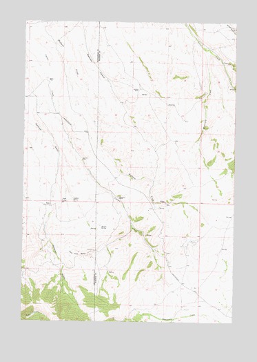
Christensen Ranch, MT USGS Topographic Map
Click on map above to begin viewing in our Map Viewer.

This topographic map contains these locations and features:
Feature Name Type Latitude Longitude GNIS ID View Map
07S06W07BBAD01 WellWellN45.2446°W112.3942°808562View Map
Abenson DamDamN45.1616°W112.4858°795008View Map
Aldrich SpringSpringN45.1757°W112.4709°768161View Map
Bachelor CanyonValleyN45.2496°W112.4695°768421View Map
Benson RanchLocaleN45.1730°W112.4845°768708View Map
Bishop PlacePopulated PlaceN45.2249°W112.4867°806901View Map
Christensen RanchLocaleN45.1763°W112.4445°769865View Map
Crittenden CreekStreamN45.2333°W112.3839°770302View Map
Eagle SpringSpringN45.1752°W112.4749°770977View Map
Guidici CowcampLocaleN45.1458°W112.4492°772023View Map
Guntner PlacePopulated PlaceN45.1927°W112.4661°806951View Map
Hanson SpringSpringN45.1642°W112.4542°772135View Map
Hoffman PlaceLocaleN45.1749°W112.4167°806953View Map
Hoffman Place MineMineN45.1685°W112.4175°804516View Map
Holden PlacePopulated PlaceN45.2152°W112.4158°806954View Map
NW NE Section 12 MineMineN45.1569°W112.4050°804514View Map
Regal MineMineN45.1716°W112.4261°804515View Map
SE NE Section 13 MineMineN45.1396°W112.3994°802486View Map
Sorensen RanchLocaleN45.2219°W112.4342°776744View Map
The Iron MineSummitN45.1519°W112.4695°777514View Map
Winnipeg CreekStreamN45.2385°W112.3928°778602View Map

Note: Coordinates in the location and feature list above are referenced to NAD83 datum.


Copyright (C) 2008-2024 Ryan Niemi / Sunset Dynamics ... All Rights Reserved