TopoQuest Logo
Do you find TopoQuest useful?
Help keep TopoQuest running and adding new maps/features by donating!
Bitcoin:  19c7KJd3qBynnjoSw5npx9KScwjBe4ifkT
Litecoin:  LXs6TkuXGGXo1vDsWCkWVdjQX94eUKd6ui
Home View Maps Find Maps Find Places Resources & Links


Chise, New Mexico Topographic Map

USGS Map Title: Chise, NM
USGS Map MRC: 33107C5
DRG (GeoTIFF) Download: o33107c5.tif


Neighboring USGS Topographic Map Quads:


  Iron Mountain, NM  
33107D6
 

  Jaralosa Mountain, NM  
33107D5
 

  Monticello, NM  
33107D4
 

  Winston, NM  
33107C6
 

  Chise, NM  
33107C5
 

  Priest Tank, NM  
33107C4
 

  Sugarloaf Peak, NM  
33107B6
 

  Thumb Tank Peak, NM  
33107B5
 

  Williamsburg NW, NM  
33107B4


Map MRC Location:

N34°
W108°
N34°
W107°
H8 H7 H6 H5 H4 H3 H2 H1
G8 G7 G6 G5 G4 G3 G2 G1
F8 F7 F6 F5 F4 F3 F2 F1
E8 E7 E6 E5 E4 E3 E2 E1
D8 D7 D6 D5 D4 D3 D2 D1
C8 C7 C6 C5 C4 C3 C2 C1
B8 B7 B6 B5 B4 B3 B2 B1
A8 A7 A6 A5 A4 A3 A2 A1
N33°
W108°
N33°
W107°

Chise, NM USGS 1:24K Topographic Map Preview:
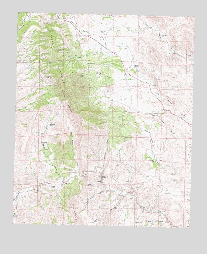
Chise, NM USGS Topographic Map
Click on map above to begin viewing in our Map Viewer.

This topographic map contains these locations and features:
Feature Name Type Latitude Longitude GNIS ID View Map
Alto WellWellN33.3417°W107.6167°885713View Map
Apache WellWellN33.2984°W107.6064°885846View Map
Becky MineMineN33.3456°W107.6006°886160View Map
Black KnifeMineN33.3531°W107.5914°917446View Map
Caņada Rancho de los ChivosStreamN33.2815°W107.5800°897734View Map
ChisePopulated PlaceN33.2723°W107.5975°898743View Map
Chise DepositsMineN33.2876°W107.5756°915563View Map
ConfidenceMineN33.3381°W107.6042°917448View Map
Confidence MinesMineN33.3373°W107.6042°887785View Map
Coyote CanyonValleyN33.2640°W107.6234°905467View Map
Cross MountainSummitN33.2737°W107.5736°888091View Map
Cuchillo MountainSummitN33.3265°W107.5889°888133View Map
Cuchillo Mountains HematiteMineN33.3542°W107.6042°917449View Map
Denver Lode and Little BonanzaMineN33.3251°W107.6011°917450View Map
Dictator and CovingtonMineN33.3387°W107.5784°917924View Map
Dictator MineMineN33.3384°W107.5786°888383View Map
Fita WindmillLocaleN33.3370°W107.5345°889056View Map
Goat Camp WellWellN33.2809°W107.5817°889441View Map
Hidden CaveMineN33.2820°W107.5492°917440View Map
Hidden Cave ClaimsMineN33.3084°W107.5464°916525View Map
Hok RanchLocaleN33.3167°W107.5306°890062View Map
Jakes TankReservoirN33.2700°W107.5190°890404View Map
L C RanchLocaleN33.3670°W107.5367°890760View Map
Little Willow DrawValleyN33.3362°W107.5350°891207View Map
Lower WellWellN33.3631°W107.5242°891460View Map
Madera CanyonValleyN33.2531°W107.5159°891532View Map
Margarita CanyonValleyN33.2759°W107.5884°891599View Map
Margarita TankReservoirN33.3091°W107.6012°891600View Map
Mill HillMineN33.2687°W107.5728°917914View Map
Mine Road CanyonValleyN33.2715°W107.5603°892093View Map
Minita MineMineN33.2528°W107.5389°892105View Map
Montoya CanyonValleyN33.2837°W107.5631°892184View Map
Monument CreekStreamN33.2690°W107.6214°908870View Map
Prospectors Delight MineMineN33.3534°W107.5975°893496View Map
RG 29057 Water WellWellN33.3492°W107.5773°921990View Map
Rifle ShotMineN33.3334°W107.6070°917439View Map
Rouse CampLocaleN33.3456°W107.5717°894201View Map
Sierra CuchilloMineN33.2706°W107.5559°917921View Map
Sierra CuchilloRangeN33.3484°W107.5986°911035View Map
Sophio CanyonValleyN33.2684°W107.5486°895001View Map
Sophio WellWellN33.2606°W107.5539°895003View Map
South WellWellN33.2892°W107.5267°895161View Map
South Well CanyonValleyN33.2801°W107.5042°895181View Map
Terrasas WellWellN33.3337°W107.5298°895591View Map
Twin PeaksSummitN33.2623°W107.5839°895953View Map
Victoria CanyonValleyN33.2684°W107.5409°896133View Map
Victoria TankReservoirN33.3026°W107.5478°896135View Map
VictorioMineN33.2706°W107.5720°917462View Map
Vindicator and West Contact MineMineN33.3642°W107.6025°940070View Map
Vindicator MineMineN33.3640°W107.6025°896156View Map
Warm SpringsSpringN33.2790°W107.5636°896260View Map
Willow SpringSpringN33.3445°W107.5423°896661View Map
Willow Spring CorralLocaleN33.3642°W107.5675°896664View Map
Win Industries MineMineN33.2673°W107.5656°917915View Map
Witch WellWellN33.3617°W107.5825°896727View Map

Note: Coordinates in the location and feature list above are referenced to NAD83 datum.


Copyright (C) 2008-2024 Ryan Niemi / Sunset Dynamics ... All Rights Reserved