TopoQuest Logo
Do you find TopoQuest useful?
Help keep TopoQuest running and adding new maps/features by donating!
Bitcoin:  19c7KJd3qBynnjoSw5npx9KScwjBe4ifkT
Litecoin:  LXs6TkuXGGXo1vDsWCkWVdjQX94eUKd6ui
Home View Maps Find Maps Find Places Resources & Links


Chicken Mountain, New Mexico Topographic Map

USGS Map Title: Chicken Mountain, NM
USGS Map MRC: 34107F3
DRG (GeoTIFF) Download: o34107f3.tif


Neighboring USGS Topographic Map Quads:


  Marmon Ranch, NM  
34107G4
 

  Cerro Verde, NM  
34107G3
 

  White Ridge, NM  
34107G2
 

  Cerro Del Oro, NM  
34107F4
 

  Chicken Mountain, NM  
34107F3
 

  Mesa Gallina, NM  
34107F2
 

  Field Ranch, NM  
34107E4
 

  Puerto De Los Cavadores, NM  
34107E3
 

  Mesa Sarca, NM  
34107E2


Map MRC Location:

N35°
W108°
N35°
W107°
H8 H7 H6 H5 H4 H3 H2 H1
G8 G7 G6 G5 G4 G3 G2 G1
F8 F7 F6 F5 F4 F3 F2 F1
E8 E7 E6 E5 E4 E3 E2 E1
D8 D7 D6 D5 D4 D3 D2 D1
C8 C7 C6 C5 C4 C3 C2 C1
B8 B7 B6 B5 B4 B3 B2 B1
A8 A7 A6 A5 A4 A3 A2 A1
N34°
W108°
N34°
W107°

Chicken Mountain, NM USGS 1:24K Topographic Map Preview:
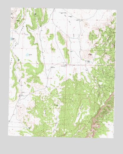
Chicken Mountain, NM USGS Topographic Map
Click on map above to begin viewing in our Map Viewer.

This topographic map contains these locations and features:
Feature Name Type Latitude Longitude GNIS ID View Map
Bonita TankReservoirN34.6990°W107.3657°886593View Map
Burkhardt TankReservoirN34.7422°W107.3023°886927View Map
Cerro AlesnaSummitN34.7059°W107.2803°897876View Map
Cerro Alesna TanksReservoirN34.6981°W107.2810°887392View Map
Chicken MountainSummitN34.6501°W107.2839°938810View Map
Chicken Mountain TankReservoirN34.6558°W107.3163°887504View Map
Davy Water WellWellN34.6542°W107.3653°918487View Map
Davy WindmillLocaleN34.6542°W107.3653°888226View Map
Dry LakeLakeN34.7043°W107.3542°888533View Map
East TankReservoirN34.6925°W107.3255°888716View Map
Horse MountainSummitN34.6517°W107.3320°933080View Map
Jayne TankReservoirN34.6334°W107.3513°890428View Map
Laguna BonitaLakeN34.7196°W107.3739°897966View Map
Mesa CimarronSummitN34.7162°W107.2534°898017View Map
Mule TankReservoirN34.7440°W107.3472°892331View Map
Pie RanchLocaleN34.6676°W107.3598°893251View Map
Pie Ranch Water WellWellN34.6681°W107.3598°918531View Map
Pronto Detention DamDamN34.6901°W107.3673°923841View Map
Rough and Muddy TankReservoirN34.7458°W107.3162°898422View Map
Sierra LuceroRidgeN34.6520°W107.2703°897478View Map
T X Detention Dike Number 1DamN34.7217°W107.3006°923842View Map
T X Diversion Dam Number ThreeDamN34.7084°W107.3006°923810View Map
Three Way TankReservoirN34.6941°W107.3084°895658View Map
Virgils WindmillLocaleN34.7395°W107.2945°896161View Map

Note: Coordinates in the location and feature list above are referenced to NAD83 datum.


Copyright (C) 2008-2024 Ryan Niemi / Sunset Dynamics ... All Rights Reserved