TopoQuest Logo
Do you find TopoQuest useful?
Help keep TopoQuest running and adding new maps/features by donating!
Bitcoin:  19c7KJd3qBynnjoSw5npx9KScwjBe4ifkT
Litecoin:  LXs6TkuXGGXo1vDsWCkWVdjQX94eUKd6ui
Home View Maps Find Maps Find Places Resources & Links


Chester, Georgia Topographic Map

USGS Map Title: Chester, GA
USGS Map MRC: 32083D2
DRG (GeoTIFF) Download: o32083d2.tif


Neighboring USGS Topographic Map Quads:


  Danville West, GA  
32083E3
 

  Danville East, GA  
32083E2
 

  Dudley, GA  
32083E1
 

  Cochran, GA  
32083D3
 

  Chester, GA  
32083D2
 

  Dexter, GA  
32083D1
 

  Empire, GA  
32083C3
 

  Yonkers, GA  
32083C2
 

  Cadwell, GA  
32083C1


Map MRC Location:

N33°
W84°
N33°
W83°
H8 H7 H6 H5 H4 H3 H2 H1
G8 G7 G6 G5 G4 G3 G2 G1
F8 F7 F6 F5 F4 F3 F2 F1
E8 E7 E6 E5 E4 E3 E2 E1
D8 D7 D6 D5 D4 D3 D2 D1
C8 C7 C6 C5 C4 C3 C2 C1
B8 B7 B6 B5 B4 B3 B2 B1
A8 A7 A6 A5 A4 A3 A2 A1
N32°
W84°
N32°
W83°

Chester, GA USGS 1:24K Topographic Map Preview:
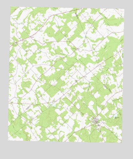
Chester, GA USGS Topographic Map
Click on map above to begin viewing in our Map Viewer.

This topographic map contains these locations and features:
Feature Name Type Latitude Longitude GNIS ID View Map
Booth School (historical)SchoolN32.4763°W83.1582°346496View Map
Buckhorn CemeteryCemeteryN32.4635°W83.1254°311981View Map
ChesterPopulated PlaceN32.3938°W83.1529°331384View Map
Chester Baptist ChurchChurchN32.3974°W83.1543°348110View Map
Chester Elementary SchoolSchoolN32.3913°W83.1510°348111View Map
Chester Volunteer Fire DepartmentBuildingN32.3957°W83.1543°2604396View Map
Christian Hope ChurchChurchN32.4641°W83.2471°312657View Map
Cochran - Bleckley Fire Department Salem StationBuildingN32.4685°W83.2447°2604253View Map
District Hollow BranchStreamN32.3810°W83.2379°313484View Map
Dodge State PrisonBuildingN32.3935°W83.1677°348115View Map
Dodge State Prison Fire DepartmentBuildingN32.3917°W83.1671°2604980View Map
Floyd DamDamN32.3999°W83.1329°336254View Map
Floyd LakeReservoirN32.3999°W83.1325°336255View Map
GoldsboroPopulated PlaceN32.4727°W83.2277°314679View Map
Hinson CemeteryCemeteryN32.4763°W83.2421°342379View Map
Little Bethel ChurchChurchN32.4618°W83.1771°316950View Map
Macedonia CemeteryCemeteryN32.3952°W83.2229°348132View Map
Macedonia ChurchChurchN32.3957°W83.2232°317544View Map
Mare BranchStreamN32.4691°W83.1290°317685View Map
Mullis-Cole CemeteryCemeteryN32.4124°W83.1988°319146View Map
North Broad River Watershed Structure Number 17 DamDamN32.4335°W83.1515°342341View Map
Northeast Bleckley DivisionCivilN32.4879°W83.2316°1936524View Map
PowellPopulated PlaceN32.4516°W83.2443°342385View Map
RebiePopulated PlaceN32.4621°W83.1760°321355View Map
RowlandPopulated PlaceN32.4366°W83.1685°326501View Map
Rowland CemeteryCemeteryN32.4188°W83.1851°321974View Map
Rowland ChapelChurchN32.4316°W83.1760°321975View Map
Saint Johns ChurchChurchN32.4935°W83.2002°322122View Map
Salem Baptist ChurchChurchN32.4663°W83.2429°322356View Map
Stitchihatchie PondLakeN32.3999°W83.1325°323633View Map
Town of ChesterCivilN32.3945°W83.1551°2406264View Map
Trail Branch ChurchChurchN32.4685°W83.2363°324265View Map
Walters CemeteryCemeteryN32.4899°W83.2077°342392View Map
Whitehall AirportAirportN32.4987°W83.1854°2442651View Map
Wynne DamDamN32.4385°W83.2015°340228View Map
Wynne LakeReservoirN32.4389°W83.2035°340229View Map

Note: Coordinates in the location and feature list above are referenced to NAD83 datum.


Copyright (C) 2008-2024 Ryan Niemi / Sunset Dynamics ... All Rights Reserved