TopoQuest Logo
Do you find TopoQuest useful?
Help keep TopoQuest running and adding new maps/features by donating!
Bitcoin:  19c7KJd3qBynnjoSw5npx9KScwjBe4ifkT
Litecoin:  LXs6TkuXGGXo1vDsWCkWVdjQX94eUKd6ui
Home View Maps Find Maps Find Places Resources & Links


Cherryville, Missouri Topographic Map

USGS Map Title: Cherryville, MO
USGS Map MRC: 37091G3
DRG (GeoTIFF) Download: o37091g3.tif


Neighboring USGS Topographic Map Quads:


  Indian Springs, MO  
37091H4
 

  Steelville, MO  
37091H3
 

  Huzzah, MO  
37091H2
 

  Cook Station, MO  
37091G4
 

  Cherryville, MO  
37091G3
 

  Davisville, MO  
37091G2
 

  Short Bend, MO  
37091F4
 

  Howes Mill Spring, MO  
37091F3
 

  Viburnum West, MO  
37091F2


Map MRC Location:

N38°
W92°
N38°
W91°
H8 H7 H6 H5 H4 H3 H2 H1
G8 G7 G6 G5 G4 G3 G2 G1
F8 F7 F6 F5 F4 F3 F2 F1
E8 E7 E6 E5 E4 E3 E2 E1
D8 D7 D6 D5 D4 D3 D2 D1
C8 C7 C6 C5 C4 C3 C2 C1
B8 B7 B6 B5 B4 B3 B2 B1
A8 A7 A6 A5 A4 A3 A2 A1
N37°
W92°
N37°
W91°

Cherryville, MO USGS 1:24K Topographic Map Preview:
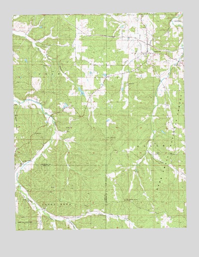
Cherryville, MO USGS Topographic Map
Click on map above to begin viewing in our Map Viewer.

This topographic map contains these locations and features:
Feature Name Type Latitude Longitude GNIS ID View Map
Anderson Iron BankMineN37.8092°W91.3346°736589View Map
Asher Lake DamDamN37.8634°W91.2601°764577View Map
Ballard Lake Section 13ReservoirN37.8394°W91.3080°765276View Map
Ballard Lake Section 13 DamDamN37.8400°W91.3068°765275View Map
Ballard Lake Section 14ReservoirN37.8300°W91.3255°764581View Map
Ballard Lake Section 14 DamDamN37.8317°W91.3268°764580View Map
Bates HollowValleyN37.8237°W91.3707°748712View Map
Benkey School (historical)SchoolN37.8075°W91.3471°736590View Map
Camels HumpSummitN37.7667°W91.2943°749168View Map
Carson Iron BanksMineN37.7545°W91.2671°736588View Map
CherryvillePopulated PlaceN37.8520°W91.2768°749342View Map
Cherryville Post OfficePost OfficeN37.8514°W91.2778°2783114View Map
Dry Creek Iron BankMineN37.8317°W91.2532°736587View Map
Dry HollowValleyN37.7587°W91.3513°749734View Map
Earney CemeteryCemeteryN37.7934°W91.2712°749765View Map
Earney MillLocaleN37.7909°W91.2707°736586View Map
East Prong Crooked CreekStreamN37.7587°W91.3513°749783View Map
Eaton Lead MineMineN37.8478°W91.2518°736585View Map
Freeman CemeteryCemeteryN37.8342°W91.2915°749993View Map
Geize LakeReservoirN37.8131°W91.3061°764579View Map
Geize Lake DamDamN37.8134°W91.3068°764578View Map
Gregory CemeteryCemeteryN37.7931°W91.2593°750162View Map
Henry Eaton SchoolSchoolN37.8114°W91.2593°753149View Map
Hibler Iron BankMineN37.7909°W91.3607°736584View Map
Hopewell Church (historical)ChurchN37.7578°W91.3326°735461View Map
Hopewell School (historical)SchoolN37.7575°W91.3365°753150View Map
Hubbman LakeReservoirN37.8467°W91.2601°765117View Map
Hubbman Lake DamDamN37.8467°W91.2601°765116View Map
Key and Anderson Iron MineMineN37.8148°W91.3443°736583View Map
Key Iron BankMineN37.8084°W91.3479°736582View Map
LimberlostPopulated PlaceN37.8070°W91.3593°750717View Map
Lincoln School (historical)SchoolN37.7614°W91.2846°753151View Map
Martin CemeteryCemeteryN37.8445°W91.2532°750946View Map
Middle Prong Crooked CreekStreamN37.7553°W91.3365°751043View Map
Mountain Iron MineMineN37.7514°W91.2676°736581View Map
New Home CemeteryCemeteryN37.8456°W91.3474°751284View Map
New Home Church (historical)ChurchN37.8453°W91.3471°753147View Map
Rees Iron MineMineN37.8131°W91.3510°736580View Map
Roanoke SchoolSchoolN37.8381°W91.3149°753148View Map
Rovald Iron MineMineN37.8067°W91.3385°736579View Map
Steelville Fire Protection District Station 2BuildingN37.8509°W91.2776°2621721View Map
Thompson Iron MineMineN37.8028°W91.3354°736578View Map
Wilkerson Iron BankMineN37.7998°W91.3507°736577View Map
Wilkinson CemeteryCemeteryN37.8698°W91.2562°752905View Map

Note: Coordinates in the location and feature list above are referenced to NAD83 datum.


Copyright (C) 2008-2024 Ryan Niemi / Sunset Dynamics ... All Rights Reserved