TopoQuest Logo
Do you find TopoQuest useful?
Help keep TopoQuest running and adding new maps/features by donating!
Bitcoin:  19c7KJd3qBynnjoSw5npx9KScwjBe4ifkT
Litecoin:  LXs6TkuXGGXo1vDsWCkWVdjQX94eUKd6ui
Home View Maps Find Maps Find Places Resources & Links


Chatsworth North, Illinois Topographic Map

USGS Map Title: Chatsworth North, IL
USGS Map MRC: 40088G3
DRG (GeoTIFF) Download: o40088g3.tif


Neighboring USGS Topographic Map Quads:


  Saunemin, IL  
40088H4
 

  Cullom, IL  
40088H3
 

  Cabery, IL  
40088H2
 

  Forrest North, IL  
40088G4
 

  Chatsworth North, IL  
40088G3
 

  Piper City, IL  
40088G2
 

  Forrest South, IL  
40088F4
 

  Chatsworth South, IL  
40088F3
 

  Buckley NW, IL  
40088F2


Map MRC Location:

N41°
W89°
N41°
W88°
H8 H7 H6 H5 H4 H3 H2 H1
G8 G7 G6 G5 G4 G3 G2 G1
F8 F7 F6 F5 F4 F3 F2 F1
E8 E7 E6 E5 E4 E3 E2 E1
D8 D7 D6 D5 D4 D3 D2 D1
C8 C7 C6 C5 C4 C3 C2 C1
B8 B7 B6 B5 B4 B3 B2 B1
A8 A7 A6 A5 A4 A3 A2 A1
N40°
W89°
N40°
W88°

Chatsworth North, IL USGS 1:24K Topographic Map Preview:
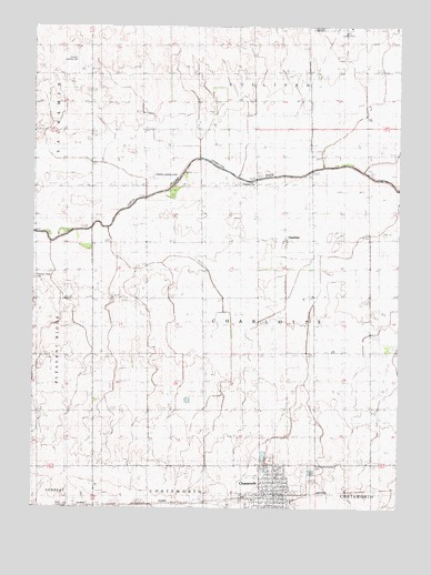
Chatsworth North, IL USGS Topographic Map
Click on map above to begin viewing in our Map Viewer.

This topographic map contains these locations and features:
Feature Name Type Latitude Longitude GNIS ID View Map
Bergan School (historical)SchoolN40.8045°W88.3370°404209View Map
Brooks School (historical)SchoolN40.8625°W88.3389°404920View Map
Calvary Baptist ChurchChurchN40.7545°W88.2878°2043886View Map
CharlottePopulated PlaceN40.8198°W88.2889°405985View Map
Charlotte United Methodist Church (historical)ChurchN40.8342°W88.2998°1719384View Map
ChatsworthPopulated PlaceN40.7536°W88.2920°405993View Map
Chatsworth Fire Protection DistrictBuildingN40.7520°W88.3038°2682366View Map
Chatsworth Post OfficePost OfficeN40.7545°W88.2918°2788178View Map
Chatsworth-Charlotte CemeteryCemeteryN40.7610°W88.2802°1719385View Map
Evergreen School (historical)SchoolN40.7534°W88.3745°408125View Map
Hubly School (historical)SchoolN40.8056°W88.2595°410645View Map
Lawless School (historical)SchoolN40.7753°W88.2964°411859View Map
Linn School (historical)SchoolN40.7767°W88.2595°412245View Map
Longmire School (historical)SchoolN40.8628°W88.3001°412618View Map
Madden School (historical)SchoolN40.8339°W88.3378°412821View Map
Maple Grove School (historical)SchoolN40.8620°W88.3748°412944View Map
Miller School (historical)SchoolN40.7509°W88.3353°413597View Map
Monahan School (historical)SchoolN40.8056°W88.2995°413716View Map
Ottmuller School (historical)SchoolN40.8342°W88.2609°415235View Map
Perkins Landing Strip (historical)AirportN40.8359°W88.3306°1719408View Map
Pleasant Ridge CemeteryCemeteryN40.8097°W88.3745°415880View Map
Riner School (historical)SchoolN40.8348°W88.2995°416683View Map
Rural School (historical)SchoolN40.7764°W88.3362°417048View Map
Saint Paul Lutheran ChurchChurchN40.7525°W88.2887°2043887View Map
Saints Peter and Paul ChurchChurchN40.7589°W88.2912°2043888View Map
Sancken Airport (historical)AirportN40.8664°W88.3601°427791View Map
School Number 7 (historical)SchoolN40.8045°W88.3737°425464View Map
Township of CharlotteCivilN40.7981°W88.2967°428791View Map
Weihermiller School (historical)SchoolN40.7745°W88.3745°420711View Map

Note: Coordinates in the location and feature list above are referenced to NAD83 datum.


Copyright (C) 2008-2024 Ryan Niemi / Sunset Dynamics ... All Rights Reserved