TopoQuest Logo
Do you find TopoQuest useful?
Help keep TopoQuest running and adding new maps/features by donating!
Bitcoin:  19c7KJd3qBynnjoSw5npx9KScwjBe4ifkT
Litecoin:  LXs6TkuXGGXo1vDsWCkWVdjQX94eUKd6ui
Home View Maps Find Maps Find Places Resources & Links


Center Moreland, Pennsylvania Topographic Map

USGS Map Title: Center Moreland, PA
USGS Map MRC: 41075D8
DRG (GeoTIFF) Download: o41075d8.tif


Neighboring USGS Topographic Map Quads:


  Meshoppen, PA  
41076E1
 

  Tunkhannock, PA  
41075E8
 

  Factoryville, PA  
41075E7
 

  Noxen, PA  
41076D1
 

  Center Moreland, PA  
41075D8
 

  Ransom, PA  
41075D7
 

  Harveys Lake, PA  
41076C1
 

  Kingston, PA  
41075C8
 

  Pittston, PA  
41075C7


Map MRC Location:

N42°
W76°
N42°
W75°
H8 H7 H6 H5 H4 H3 H2 H1
G8 G7 G6 G5 G4 G3 G2 G1
F8 F7 F6 F5 F4 F3 F2 F1
E8 E7 E6 E5 E4 E3 E2 E1
D8 D7 D6 D5 D4 D3 D2 D1
C8 C7 C6 C5 C4 C3 C2 C1
B8 B7 B6 B5 B4 B3 B2 B1
A8 A7 A6 A5 A4 A3 A2 A1
N41°
W76°
N41°
W75°

Center Moreland, PA USGS 1:24K Topographic Map Preview:
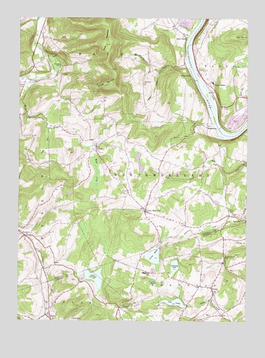
Center Moreland, PA USGS Topographic Map
Click on map above to begin viewing in our Map Viewer.

This topographic map contains these locations and features:
Feature Name Type Latitude Longitude GNIS ID View Map
BeaumontPopulated PlaceN41.4101°W75.9963°1198385View Map
Center MorelandPopulated PlaceN41.4201°W75.9302°1198553View Map
Cummings PondReservoirN41.3979°W75.9138°1198628View Map
Demunds CornersPopulated PlaceN41.3806°W75.9438°1198648View Map
Eaton CemeteryCemeteryN41.3776°W75.8935°1198694View Map
Finchs CornersLocaleN41.4187°W75.8841°1212585View Map
Fitch CemeteryCemeteryN41.4190°W75.8821°1198737View Map
Fitch SchoolSchoolN41.4206°W75.8841°1198738View Map
Forest Grove SchoolSchoolN41.4012°W75.8866°1198752View Map
Franklin Northmoreland Township AmbulanceBuildingN41.3895°W75.8962°2722281View Map
Franklin Township Volunteer Fire CompanyBuildingN41.3895°W75.8962°2653438View Map
Hirsh DamDamN41.4734°W75.9480°1195605View Map
Hirsh PondReservoirN41.4734°W75.9480°1195606View Map
Hoban HeightsPopulated PlaceN41.4720°W75.8949°1203819View Map
Hunter SchoolSchoolN41.4804°W75.9777°1198918View Map
JenksPopulated PlaceN41.4767°W75.9760°1203893View Map
KeelersburgPopulated PlaceN41.4551°W75.8963°1203917View Map
KunklePopulated PlaceN41.3784°W75.9824°1198984View Map
Kunkle Fire Company Station 122BuildingN41.3777°W75.9829°2653069View Map
Lake CatalpaReservoirN41.3929°W75.9575°1198547View Map
Lake Catalpa DamDamN41.3934°W75.9930°1195535View Map
Lake LouiseReservoirN41.3826°W75.9142°1199089View Map
Lake Louise DamDamN41.3817°W75.9096°1195524View Map
Lake ManjoReservoirN41.3907°W75.9252°1199105View Map
Lake Manjo DamDamN41.3901°W75.9230°1195530View Map
LockvillePopulated PlaceN41.4170°W75.8777°1199071View Map
Marsh CreekStreamN41.4737°W75.9899°1199111View Map
Martin CreekStreamN41.4554°W75.8924°1199117View Map
Michigan SchoolSchoolN41.3948°W75.9271°1199148View Map
Mill City (historical)Populated PlaceN41.3981°W75.9791°1202175View Map
Miller MountainSummitN41.4892°W75.9519°1199167View Map
Moneypenny CreekStreamN41.4809°W75.9069°1199179View Map
Northmoreland Township Volunteer Fire CompanyBuildingN41.4195°W75.9298°2653578View Map
OrangePopulated PlaceN41.3887°W75.8935°1199255View Map
Perrins MarshReservoirN41.4019°W75.9253°1199293View Map
Perrins Marsh DamDamN41.4051°W75.9230°1195545View Map
Post HillSummitN41.4926°W75.8769°1199334View Map
Shaver MountainSummitN41.4729°W75.9521°1199516View Map
South EatonPopulated PlaceN41.4923°W75.9088°1199567View Map
Sugar RunStreamN41.4542°W75.9838°1199638View Map
ThurstonLocaleN41.4642°W75.9305°1212586View Map
Thurston ChurchChurchN41.4731°W75.9316°1199679View Map
Thurston HollowValleyN41.4774°W75.9240°1199681View Map
Township of FranklinCivilN41.3846°W75.8977°1216714View Map
Township of NorthmorelandCivilN41.4349°W75.9285°1217274View Map
Twin Oaks Golf CourseLocaleN41.3995°W75.9169°1205625View Map
VernonPopulated PlaceN41.4467°W75.9571°1199729View Map
WARM-AM (Scranton)TowerN41.4790°W75.8805°1200506View Map
Whites FerryLocaleN41.4745°W75.9038°1199789View Map

Note: Coordinates in the location and feature list above are referenced to NAD83 datum.


Copyright (C) 2008-2024 Ryan Niemi / Sunset Dynamics ... All Rights Reserved