TopoQuest Logo
Do you find TopoQuest useful?
Help keep TopoQuest running and adding new maps/features by donating!
Bitcoin:  19c7KJd3qBynnjoSw5npx9KScwjBe4ifkT
Litecoin:  LXs6TkuXGGXo1vDsWCkWVdjQX94eUKd6ui
Home View Maps Find Maps Find Places Resources & Links


Schroder Arroyo, Texas Topographic Map

USGS Map Title: Schroder Arroyo, TX
USGS Map MRC: 30105H4
DRG (GeoTIFF) Download: o30105h4.tif


Neighboring USGS Topographic Map Quads:


  Neely Arroyo, TX  
31105A5
 

  Sierra Blanca SW, TX  
31105A4
 

  Devil Ridge, TX  
31105A3


  Schroder Arroyo, TX  
30105H4
 

  Cedar Arroyo, TX  
30105H3


  Indian Hot Springs, TX  
30105G3


Map MRC Location:

N31°
W106°
N31°
W105°
H8 H7 H6 H5 H4 H3 H2 H1
G8 G7 G6 G5 G4 G3 G2 G1
F8 F7 F6 F5 F4 F3 F2 F1
E8 E7 E6 E5 E4 E3 E2 E1
D8 D7 D6 D5 D4 D3 D2 D1
C8 C7 C6 C5 C4 C3 C2 C1
B8 B7 B6 B5 B4 B3 B2 B1
A8 A7 A6 A5 A4 A3 A2 A1
N30°
W106°
N30°
W105°

Schroder Arroyo, TX USGS 1:24K Topographic Map Preview:
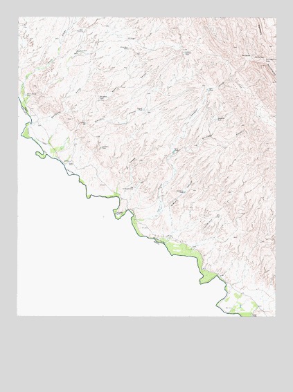
Schroder Arroyo, TX USGS Topographic Map
Click on map above to begin viewing in our Map Viewer.

This topographic map contains these locations and features:
Feature Name Type Latitude Longitude GNIS ID View Map
Asebuches ArroyoValleyN30.9640°W105.4991°1351297View Map
Binocular CanyonValleyN30.9423°W105.4259°1352211View Map
Buckhorn TankReservoirN30.9272°W105.4195°1353165View Map
Camp TankReservoirN30.9440°W105.4249°1353680View Map
Central TankReservoirN30.9616°W105.4397°1354234View Map
Cow ArroyoValleyN30.9154°W105.4438°1373253View Map
Davis Arroyo TankReservoirN30.9675°W105.4969°1355686View Map
Deer SpringSpringN30.9842°W105.3881°1355865View Map
Echo TankReservoirN30.9702°W105.4083°1356794View Map
ElPadre CanyonValleyN30.9191°W105.4267°1356877View Map
Escondido TankReservoirN30.9576°W105.4043°1357059View Map
Faultline TankReservoirN30.9455°W105.4600°1357267View Map
Hackberry ArroyoStreamN30.9554°W105.4941°1373958View Map
Love RanchLocaleN30.9168°W105.4038°1361879View Map
Mesa WindmillLocaleN30.9940°W105.4688°1362647View Map
Porcher CanalCanalN30.9490°W105.4919°1365591View Map
Porcher RanchLocaleN30.9390°W105.4741°1365592View Map
Red Rock TankReservoirN30.9855°W105.4199°1366212View Map
Schroder ArroyoStreamN30.9407°W105.4813°1367855View Map
Smugglers ArroyoValleyN30.9427°W105.4256°1368523View Map
Smugglers GapGapN30.9824°W105.3805°1368525View Map
The GapGapN30.9560°W105.4691°1369781View Map
The Ice Cream ConePillarN30.9287°W105.4441°1369785View Map
The Little Big BendBendN30.9171°W105.4516°1369794View Map
The PalisadesCliffN30.9382°W105.4463°1369804View Map
The Pot HoleBendN30.9835°W105.3858°1369809View Map
Water CanyonValleyN30.9566°W105.4679°1370898View Map
White Hill TankReservoirN30.9871°W105.4471°1371375View Map
Windmill TankReservoirN30.9665°W105.4609°1371784View Map

Note: Coordinates in the location and feature list above are referenced to NAD83 datum.


Copyright (C) 2008-2024 Ryan Niemi / Sunset Dynamics ... All Rights Reserved