TopoQuest Logo
Do you find TopoQuest useful?
Help keep TopoQuest running and adding new maps/features by donating!
Bitcoin:  19c7KJd3qBynnjoSw5npx9KScwjBe4ifkT
Litecoin:  LXs6TkuXGGXo1vDsWCkWVdjQX94eUKd6ui
Home View Maps Find Maps Find Places Resources & Links


Catawba, Virginia Topographic Map

USGS Map Title: Catawba, VA
USGS Map MRC: 37080D1
DRG (GeoTIFF) Download: o37080d1.tif


Neighboring USGS Topographic Map Quads:


  Potts Creek, VA  
37080E2
 

  New Castle, VA  
37080E1
 

  Oriskany, VA  
37079E8
 

  Looney, VA  
37080D2
 

  Catawba, VA  
37080D1
 

  Daleville, VA  
37079D8
 

  Glenvar, VA  
37080C2
 

  Salem, VA  
37080C1
 

  Roanoke, VA  
37079C8


Map MRC Location:

N38°
W81°
N38°
W80°
H8 H7 H6 H5 H4 H3 H2 H1
G8 G7 G6 G5 G4 G3 G2 G1
F8 F7 F6 F5 F4 F3 F2 F1
E8 E7 E6 E5 E4 E3 E2 E1
D8 D7 D6 D5 D4 D3 D2 D1
C8 C7 C6 C5 C4 C3 C2 C1
B8 B7 B6 B5 B4 B3 B2 B1
A8 A7 A6 A5 A4 A3 A2 A1
N37°
W81°
N37°
W80°

Catawba, VA USGS 1:24K Topographic Map Preview:
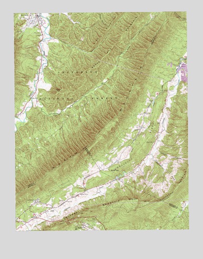
Catawba, VA USGS Topographic Map
Click on map above to begin viewing in our Map Viewer.

This topographic map contains these locations and features:
Feature Name Type Latitude Longitude GNIS ID View Map
Broad RunStreamN37.4515°W80.1120°1482012View Map
Buchanan BranchStreamN37.4207°W80.0231°1482094View Map
CatawbaPopulated PlaceN37.3826°W80.1095°1492727View Map
Catawba CemeteryCemeteryN37.3918°W80.0887°1482375View Map
Catawba Elementary SchoolSchoolN37.3835°W80.1067°1706620View Map
Catawba HospitalHospitalN37.3915°W80.1102°1488705View Map
Catawba MountainSummitN37.3893°W80.0625°1492728View Map
Catawba Post OfficePost OfficeN37.3827°W80.1086°2766171View Map
Catawba Valley ChurchChurchN37.4254°W80.0239°1482378View Map
Gravelly RidgeRidgeN37.4179°W80.0381°1483768View Map
Haymaker BranchStreamN37.4162°W80.0253°1483989View Map
Lick BranchStreamN37.4857°W80.0981°1484812View Map
Lick MountainSummitN37.4982°W80.0489°1493553View Map
Little Catawba CreekStreamN37.4565°W80.0089°1484880View Map
McAfee KnobSummitN37.3929°W80.0367°1485250View Map
Meadow CreekStreamN37.4910°W80.1017°1485335View Map
Medley CampLocaleN37.3804°W80.0684°1485348View Map
Morgan CemeteryCemeteryN37.3915°W80.0878°1485552View Map
Mountain View ChurchChurchN37.3962°W80.0784°1485703View Map
New Castle International AirportAirportN37.4815°W80.1023°1498756View Map
New Castle Volunteer Fire DepartmentBuildingN37.4987°W80.1070°2086305View Map
New Hope ChurchChurchN37.4321°W80.0337°1485846View Map
North MountainSummitN37.4196°W80.0795°1493558View Map
North Mountain TrailTrailN37.4229°W80.0759°1488675View Map
Roanoke County Fire and Rescue Station 4 - Catawba Fire DepartmentBuildingN37.3896°W80.1140°2086053View Map
Roanoke County Sheriffs OfficeBuildingN37.4953°W80.0944°2085995View Map
Roanoke Red Sulphur SpringsPopulated PlaceN37.3924°W80.1089°1706815View Map
Spesard KnobSummitN37.4549°W80.0931°1487434View Map
The Murder HoleBendN37.4090°W80.0528°1487835View Map
Tinker (historical)Populated PlaceN37.4537°W80.0139°1674372View Map

Note: Coordinates in the location and feature list above are referenced to NAD83 datum.


Copyright (C) 2008-2024 Ryan Niemi / Sunset Dynamics ... All Rights Reserved