TopoQuest Logo
Do you find TopoQuest useful?
Help keep TopoQuest running and adding new maps/features by donating!
Bitcoin:  19c7KJd3qBynnjoSw5npx9KScwjBe4ifkT
Litecoin:  LXs6TkuXGGXo1vDsWCkWVdjQX94eUKd6ui
Home View Maps Find Maps Find Places Resources & Links


Cass City, Michigan Topographic Map

USGS Map Title: Cass City, MI
USGS Map MRC: 43083E2
DRG (GeoTIFF) Download: o43083e2.tif


Neighboring USGS Topographic Map Quads:


  Owendale, MI  
43083F3
 

  Gagetown, MI  
43083F2
 

  New Greenleaf, MI  
43083F1
 

  Ellington, MI  
43083E3
 

  Cass City, MI  
43083E2
 

  Shabbona, MI  
43083E1
 

  East Dayton, MI  
43083D3
 

  Kingston, MI  
43083D2
 

  Decker, MI  
43083D1


Map MRC Location:

N44°
W84°
N44°
W83°
H8 H7 H6 H5 H4 H3 H2 H1
G8 G7 G6 G5 G4 G3 G2 G1
F8 F7 F6 F5 F4 F3 F2 F1
E8 E7 E6 E5 E4 E3 E2 E1
D8 D7 D6 D5 D4 D3 D2 D1
C8 C7 C6 C5 C4 C3 C2 C1
B8 B7 B6 B5 B4 B3 B2 B1
A8 A7 A6 A5 A4 A3 A2 A1
N43°
W84°
N43°
W83°

Cass City, MI USGS 1:24K Topographic Map Preview:
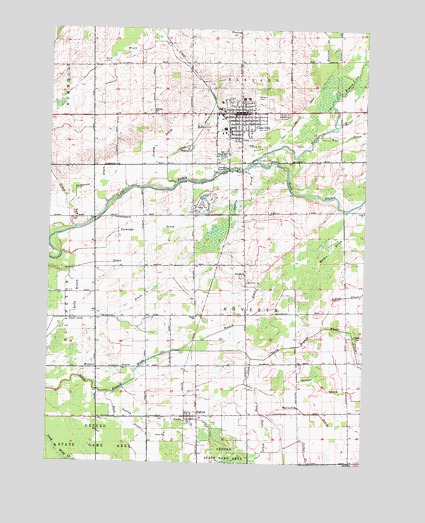
Cass City, MI USGS Topographic Map
Click on map above to begin viewing in our Map Viewer.

This topographic map contains these locations and features:
Feature Name Type Latitude Longitude GNIS ID View Map
Baker College of Cass CitySchoolN43.6011°W83.1700°2553923View Map
Calvary Bible Baptist ChurchChurchN43.5997°W83.1692°2553908View Map
Cass CityPopulated PlaceN43.6009°W83.1747°622846View Map
Cass City Elementary SchoolSchoolN43.6050°W83.1736°2553925View Map
Cass City High SchoolSchoolN43.6117°W83.1750°2553926View Map
Cass City Methodist ChurchChurchN43.6181°W83.1550°2553906View Map
Cass City Middle SchoolSchoolN43.6050°W83.1717°2553927View Map
Cass City Missionary ChurchChurchN43.5992°W83.1944°2553928View Map
Cass City Mobile Medical ResponseBuildingN43.6018°W83.1685°2661947View Map
Cass City Police DepartmentBuildingN43.6007°W83.1741°2737595View Map
Cass City Post OfficePost OfficeN43.6017°W83.1708°2553910View Map
Cass City Station (historical)LocaleN43.6003°W83.1822°2553912View Map
Cedar RunStreamN43.5672°W83.2405°622949View Map
Center DrainCanalN43.5936°W83.1924°622976View Map
Church of NazareneChurchN43.5975°W83.1736°2553916View Map
Deer Lick DrainCanalN43.5445°W83.2277°624493View Map
DefordPopulated PlaceN43.5134°W83.1924°624510View Map
Deford Christian AcademySchoolN43.5125°W83.1889°2554623View Map
Deford Community ChurchChurchN43.5125°W83.1889°2554624View Map
Deford Post OfficePost OfficeN43.5136°W83.1953°2554621View Map
Deford Station (historical)LocaleN43.5131°W83.1953°2554622View Map
Dickinson DrainCanalN43.5789°W83.2336°624664View Map
Dillman SchoolSchoolN43.6006°W83.2091°624679View Map
Elkland CemeteryCemeteryN43.6006°W83.1577°625464View Map
Elkland Township Fire DepartmentBuildingN43.6023°W83.1700°2553907View Map
Elkland Township Hall Historical MarkerParkN43.6008°W83.1767°2554532View Map
Evangelical Free ChurchChurchN43.6119°W83.1764°2553913View Map
First Baptist ChurchChurchN43.5986°W83.1764°2553917View Map
First Presbyterian ChurchChurchN43.6019°W83.1742°2553919View Map
Flying T Ranch Airport (historical)AirportN43.5875°W83.2114°1623824View Map
Galspie DrainCanalN43.5236°W83.1430°626617View Map
Gekeler DrainCanalN43.5484°W83.1327°626709View Map
Good Shepherd Lutheran ChurchChurchN43.6008°W83.1628°2553911View Map
Gowing DrainCanalN43.5131°W83.2033°627033View Map
Hack DrainCanalN43.5122°W83.2202°627572View Map
Hills and Dales General HospitalHospitalN43.6041°W83.1828°2553921View Map
Holts DrainCanalN43.5086°W83.1627°628465View Map
Huntsville ParkPopulated PlaceN43.5978°W83.1647°2553924View Map
Internal Medicine ClinicHospitalN43.6028°W83.1803°2553922View Map
Kelly BranchCanalN43.5475°W83.2388°629539View Map
Living Word Church of GodChurchN43.5986°W83.1736°2553918View Map
McCallum DrainCanalN43.5114°W83.1324°631813View Map
Mud CreekStreamN43.5306°W83.1694°632877View Map
Mulligan's Irish LinksLocaleN43.6067°W83.1828°2553920View Map
North Branch Cass RiverStreamN43.5861°W83.1708°633494View Map
Novesta ChurchChurchN43.5542°W83.1722°633772View Map
Novesta Church CemeteryCemeteryN43.5539°W83.1728°2554508View Map
Novesta Post Office (historical)Post OfficeN43.5153°W83.1292°2553968View Map
Parks DrainCanalN43.5120°W83.1952°634404View Map
Potters House Christian Fellowship ChurchChurchN43.5947°W83.1756°2553914View Map
Quick SchoolSchoolN43.5422°W83.1911°635562View Map
Rawson Memorial LibraryBuildingN43.6000°W83.1708°2553909View Map
Reid DrainCanalN43.6175°W83.2249°635781View Map
Riverside ChurchChurchN43.5703°W83.2224°635997View Map
Rolling Hills Golf CourseLocaleN43.6139°W83.1700°2553929View Map
Saint Pancratius ChurchChurchN43.5969°W83.1742°2553915View Map
South Branch Cass RiverStreamN43.5861°W83.1708°638276View Map
Spencer DrainCanalN43.5778°W83.1702°638499View Map
State Reward Road Number One Historical MarkerParkN43.6011°W83.1544°2554523View Map
Talmadge DrainCanalN43.5667°W83.2102°1614556View Map
Township of NovestaCivilN43.5430°W83.1715°1626828View Map
Tracy DrainCanalN43.5561°W83.2374°1615024View Map
Tuckey DrainCanalN43.5925°W83.2063°1615158View Map
Village of Cass CityCivilN43.6006°W83.1767°2397570View Map
Vorhes DrainCanalN43.5034°W83.1469°1615627View Map
Walton DrainCanalN43.5528°W83.1633°1615748View Map
Webster DrainCanalN43.5272°W83.2255°1615951View Map
Whitney DrainCanalN43.6239°W83.1355°1616393View Map

Note: Coordinates in the location and feature list above are referenced to NAD83 datum.


Copyright (C) 2008-2024 Ryan Niemi / Sunset Dynamics ... All Rights Reserved