TopoQuest Logo
Do you find TopoQuest useful?
Help keep TopoQuest running and adding new maps/features by donating!
Bitcoin:  19c7KJd3qBynnjoSw5npx9KScwjBe4ifkT
Litecoin:  LXs6TkuXGGXo1vDsWCkWVdjQX94eUKd6ui
Home View Maps Find Maps Find Places Resources & Links


Carracas Canyon, New Mexico Topographic Map

USGS Map Title: Carracas Canyon, NM
USGS Map MRC: 36107H2
DRG (GeoTIFF) Download: o36107h2.tif


Neighboring USGS Topographic Map Quads:


  Carracas, CO  
37107A3
 

  Pagosa Junction, CO  
37107A2
 

  Trujillo, CO  
37107A1
 

  Bancos Mesa, NM  
36107H3
 

  Carracas Canyon, NM  
36107H2
 

  Wirt Canyon, NM  
36107H1
 

  Espinosa Ranch, NM  
36107G3
 

  Bixler Ranch, NM  
36107G2
 

  John Mills Lake, NM  
36107G1


Map MRC Location:

N37°
W108°
N37°
W107°
H8 H7 H6 H5 H4 H3 H2 H1
G8 G7 G6 G5 G4 G3 G2 G1
F8 F7 F6 F5 F4 F3 F2 F1
E8 E7 E6 E5 E4 E3 E2 E1
D8 D7 D6 D5 D4 D3 D2 D1
C8 C7 C6 C5 C4 C3 C2 C1
B8 B7 B6 B5 B4 B3 B2 B1
A8 A7 A6 A5 A4 A3 A2 A1
N36°
W108°
N36°
W107°

Carracas Canyon, NM USGS 1:24K Topographic Map Preview:
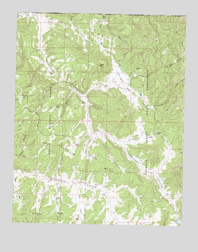
Carracas Canyon, NM USGS Topographic Map
Click on map above to begin viewing in our Map Viewer.

This topographic map contains these locations and features:
Feature Name Type Latitude Longitude GNIS ID View Map
Bancos PitsReservoirN36.9007°W107.2197°2678806View Map
Boiler SpringSpringN36.9469°W107.1986°2678804View Map
Buzzard CanyonValleyN36.8992°W107.2167°904255View Map
Buzzard Park CampgroundLocaleN36.8814°W107.2170°904258View Map
Cabin CanyonValleyN36.9017°W107.2273°904279View Map
CarracasPopulated PlaceN36.9986°W107.2450°904787View Map
Carracas CanyonValleyN36.9998°W107.2367°904788View Map
Carracas MesaSummitN36.9097°W107.1959°904790View Map
Coronilla CanyonValleyN36.9967°W107.1865°905361View Map
Dike CanyonValleyN36.9017°W107.2178°905761View Map
Ed Ladd LakeReservoirN36.8780°W107.1284°933075View Map
Estufa CanyonValleyN36.9045°W107.2495°906200View Map
Estufa RidgeRidgeN36.8806°W107.2370°906201View Map
Frijoles PeakSummitN36.9695°W107.1887°906410View Map
Grosbeck TankReservoirN36.9225°W107.2264°2678808View Map
La Chamisalosa CanyonValleyN36.9233°W107.1717°907620View Map
Los Cuates BasinBasinN36.9583°W107.1714°908208View Map
Los Cuates CanyonValleyN36.9497°W107.2006°908209View Map
Los Cuates PondReservoirN36.9825°W107.1878°2678810View Map
Mule CanyonValleyN36.8995°W107.2064°908971View Map
Mule TankReservoirN36.8781°W107.2039°2678805View Map
Salada CanyonValleyN36.9945°W107.2304°2678803View Map
Santiago PondLakeN36.9301°W107.1453°910794View Map
Tee Quee CanyonValleyN36.9967°W107.1867°911584View Map
Toro CanyonValleyN36.9539°W107.2073°911752View Map
Toro SpringSpringN36.9343°W107.2210°2678809View Map
Toro SpringSpringN36.9322°W107.2250°911753View Map
Turkey CanyonValleyN36.9603°W107.2184°911862View Map
Vallo SpringSpringN36.9450°W107.2198°912065View Map
Willow CanyonValleyN36.9289°W107.1928°912399View Map
Willow SpringSpringN36.9221°W107.2054°2678807View Map

Note: Coordinates in the location and feature list above are referenced to NAD83 datum.


Copyright (C) 2008-2024 Ryan Niemi / Sunset Dynamics ... All Rights Reserved