TopoQuest Logo
Do you find TopoQuest useful?
Help keep TopoQuest running and adding new maps/features by donating!
Bitcoin:  19c7KJd3qBynnjoSw5npx9KScwjBe4ifkT
Litecoin:  LXs6TkuXGGXo1vDsWCkWVdjQX94eUKd6ui
Home View Maps Find Maps Find Places Resources & Links


Carpenter, Iowa Topographic Map

USGS Map Title: Carpenter, IA
USGS Map MRC: 43093D1
DRG (GeoTIFF) Download: o43093d1.tif


Neighboring USGS Topographic Map Quads:


  Myrtle, MN  
43093E2
 

  London, MN  
43093E1
 

  Lyle, MN  
43092E8
 

  Northwood, IA  
43093D2
 

  Carpenter, IA  
43093D1
 

  Saint Ansgar, IA  
43092D8
 

  Manly, IA  
43093C2
 

  Grafton, IA  
43093C1
 

  Osage SW, IA  
43092C8


Map MRC Location:

N44°
W94°
N44°
W93°
H8 H7 H6 H5 H4 H3 H2 H1
G8 G7 G6 G5 G4 G3 G2 G1
F8 F7 F6 F5 F4 F3 F2 F1
E8 E7 E6 E5 E4 E3 E2 E1
D8 D7 D6 D5 D4 D3 D2 D1
C8 C7 C6 C5 C4 C3 C2 C1
B8 B7 B6 B5 B4 B3 B2 B1
A8 A7 A6 A5 A4 A3 A2 A1
N43°
W94°
N43°
W93°

Carpenter, IA USGS 1:24K Topographic Map Preview:
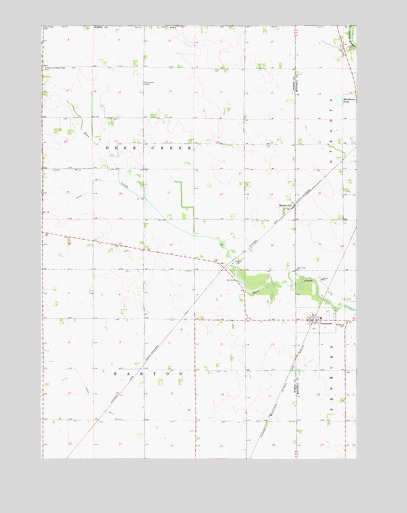
Carpenter, IA USGS Topographic Map
Click on map above to begin viewing in our Map Viewer.

This topographic map contains these locations and features:
Feature Name Type Latitude Longitude GNIS ID View Map
Birdsal Family PlotCemeteryN43.4083°W93.0919°1944592View Map
CarpenterPopulated PlaceN43.4150°W93.0149°455180View Map
CarpenterLocaleN43.4152°W93.0169°1944932View Map
Carpenter Post OfficePost OfficeN43.4150°W93.0149°1944934View Map
City of CarpenterCivilN43.4150°W93.0173°2393752View Map
Deer Creek CemeteryCemeteryN43.4297°W93.0238°1944937View Map
Deer Creek ChurchChurchN43.4294°W93.0238°455866View Map
Deer Creek ForestForestN43.4305°W93.0460°1944548View Map
Deer Creek Rest AreaLocaleN43.4264°W93.0474°1944549View Map
Deer Creek Wildlife AreaParkN43.4500°W93.0669°1944553View Map
London and Deer Creek CemeteryCemeteryN43.4875°W93.1241°458572View Map
Markhams PondLakeN43.4784°W93.0070°458812View Map
MeltonvillePopulated PlaceN43.4472°W93.0263°458960View Map
Meltonville (historical)LocaleN43.4466°W93.0266°1944571View Map
Meltonville Post Office (historical)Post OfficeN43.4472°W93.0263°1944572View Map
NE Lutheran Congregational Carpenter CemeteryCemeteryN43.4286°W93.0238°1944938View Map
Newburg CemeteryCemeteryN43.4144°W93.0049°459503View Map
Northwood Co-op ElevatorLocaleN43.4150°W93.0149°1944933View Map
OtrantoLocaleN43.4936°W93.0074°463976View Map
Otranto Post Office (historical)Post OfficeN43.4939°W93.0058°1944824View Map
Township of BartonCivilN43.3858°W93.0827°467416View Map
Township of Deer CreekCivilN43.4645°W93.0828°467695View Map

Note: Coordinates in the location and feature list above are referenced to NAD83 datum.


Copyright (C) 2008-2024 Ryan Niemi / Sunset Dynamics ... All Rights Reserved