TopoQuest Logo
Do you find TopoQuest useful?
Help keep TopoQuest running and adding new maps/features by donating!
Bitcoin:  19c7KJd3qBynnjoSw5npx9KScwjBe4ifkT
Litecoin:  LXs6TkuXGGXo1vDsWCkWVdjQX94eUKd6ui
Home View Maps Find Maps Find Places Resources & Links


Keller, Washington Topographic Map

USGS Map Title: Keller, WA
USGS Map MRC: 48118A6
DRG (GeoTIFF) Download: o48118a6.tif


Neighboring USGS Topographic Map Quads:


  Nespelem NE, WA  
48118B7
 

  Louie Creek, WA  
48118B6
 

  Frosty Meadow, WA  
48118B5
 

  Keller Butte, WA  
48118A7
 

  Keller, WA  
48118A6
 

  Friedlander Meadows, WA  
48118A5
 

  Mica Mountain, WA  
47118H7
 

  Keller Ferry, WA  
47118H6
 

  Whitestone Rock, WA  
47118H5


Map MRC Location:

N49°
W119°
N49°
W118°
H8 H7 H6 H5 H4 H3 H2 H1
G8 G7 G6 G5 G4 G3 G2 G1
F8 F7 F6 F5 F4 F3 F2 F1
E8 E7 E6 E5 E4 E3 E2 E1
D8 D7 D6 D5 D4 D3 D2 D1
C8 C7 C6 C5 C4 C3 C2 C1
B8 B7 B6 B5 B4 B3 B2 B1
A8 A7 A6 A5 A4 A3 A2 A1
N48°
W119°
N48°
W118°

Keller, WA USGS 1:24K Topographic Map Preview:
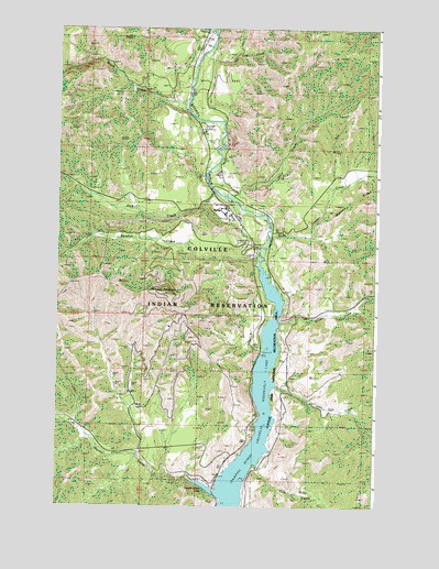
Keller, WA USGS Topographic Map
Click on map above to begin viewing in our Map Viewer.

This topographic map contains these locations and features:
Feature Name Type Latitude Longitude GNIS ID View Map
Alice CreekStreamN48.0790°W118.6795°1502983View Map
Brush CreekStreamN48.1035°W118.6995°1503589View Map
Colville Tribal Emergency Medical ServicesBuildingN48.0773°W118.6831°2643529View Map
Consolidated MinesMineN48.0482°W118.6950°1504109View Map
Copper CreekStreamN48.0704°W118.6675°1504140View Map
Cow CreekStreamN48.1188°W118.6925°1504210View Map
Dick CreekStreamN48.0104°W118.6711°1504476View Map
Empire CreekStreamN48.1243°W118.6889°1504754View Map
French Johns LakeLakeN48.0057°W118.6925°1505037View Map
Jack CreekStreamN48.0815°W118.6847°1505771View Map
John Tom CreekStreamN48.0315°W118.6642°1505829View Map
KellerPopulated PlaceN48.0788°W118.6850°1511063View Map
Keller Census Designated PlaceCensusN48.0852°W118.7164°2584987View Map
Keller Elementary SchoolSchoolN48.0785°W118.6878°1514803View Map
Keller Post OfficePost OfficeN48.0783°W118.6852°2769257View Map
Manila CreekStreamN48.0068°W118.6978°1506445View Map
Meadow CreekStreamN48.0638°W118.6714°1506598View Map
Meadow Creek MineMineN48.0710°W118.7378°1506599View Map
Mount TolmanSummitN48.0557°W118.7081°1509043View Map
Silver CreekStreamN48.0482°W118.6631°1508340View Map

Note: Coordinates in the location and feature list above are referenced to NAD83 datum.


Copyright (C) 2008-2024 Ryan Niemi / Sunset Dynamics ... All Rights Reserved