TopoQuest Logo
Do you find TopoQuest useful?
Help keep TopoQuest running and adding new maps/features by donating!
Bitcoin:  19c7KJd3qBynnjoSw5npx9KScwjBe4ifkT
Litecoin:  LXs6TkuXGGXo1vDsWCkWVdjQX94eUKd6ui
Home View Maps Find Maps Find Places Resources & Links


Canyon of Lodore North, Colorado Topographic Map

USGS Map Title: Canyon of Lodore North, CO
USGS Map MRC: 40108F8
DRG (GeoTIFF) Download: o40108f8.tif


Neighboring USGS Topographic Map Quads:


  Swallow Canyon, UT  
40109G1
 

  Lodore School, CO  
40108G8
 

  Big Joe Basin, CO  
40108G7
 

  Hoy Mountain, UT  
40109F1
 

  Canyon of Lodore North, CO  
40108F8
 

  Jack Springs, CO  
40108F7
 

  Jones Hole, UT  
40109E1
 

  Canyon of Lodore South, CO  
40108E8
 

  Zenobia Peak, CO  
40108E7


Map MRC Location:

N41°
W109°
N41°
W108°
H8 H7 H6 H5 H4 H3 H2 H1
G8 G7 G6 G5 G4 G3 G2 G1
F8 F7 F6 F5 F4 F3 F2 F1
E8 E7 E6 E5 E4 E3 E2 E1
D8 D7 D6 D5 D4 D3 D2 D1
C8 C7 C6 C5 C4 C3 C2 C1
B8 B7 B6 B5 B4 B3 B2 B1
A8 A7 A6 A5 A4 A3 A2 A1
N40°
W109°
N40°
W108°

Canyon of Lodore North, CO USGS 1:24K Topographic Map Preview:
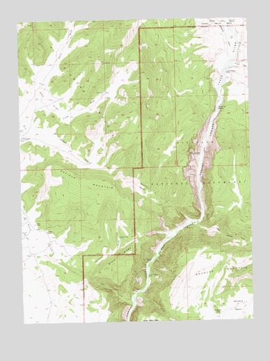
Canyon of Lodore North, CO USGS Topographic Map
Click on map above to begin viewing in our Map Viewer.

This topographic map contains these locations and features:
Feature Name Type Latitude Longitude GNIS ID View Map
Black RidgeRidgeN40.6472°W108.9557°170543View Map
Buster BasinBasinN40.6805°W108.9340°170551View Map
Conway DrawValleyN40.7313°W108.8831°170555View Map
Craig DrawValleyN40.7035°W108.9983°201742View Map
Craig PlacePopulated PlaceN40.7202°W108.9543°170535View Map
Deerlick DrawValleyN40.7029°W108.9883°170552View Map
Diamond MountainSummitN40.7325°W108.9535°170534View Map
Dry CreekStreamN40.6608°W108.9937°170536View Map
Ecklund CabinLocaleN40.6602°W108.9479°170544View Map
Ecklund DrawValleyN40.6437°W108.9665°170545View Map
Gates of LodoreGapN40.7133°W108.8929°170556View Map
Hoy FlatFlatN40.7175°W108.9854°170553View Map
Jack Springs DrawValleyN40.6660°W108.9058°170539View Map
Lodore Ranger StationLocaleN40.7275°W108.8882°170554View Map
Lower Disaster FallsFallsN40.6439°W108.9329°170540View Map
Miles PlaceLocaleN40.6658°W108.9926°170547View Map
Offield MountainSummitN40.6833°W108.9562°170550View Map
Old Bassett CampLocaleN40.6280°W108.8937°170537View Map
Pot CreekStreamN40.6325°W108.9407°201946View Map
Tittle CabinLocaleN40.7019°W108.9854°170548View Map
Tittle ReservoirReservoirN40.7038°W108.9995°170549View Map
Upper Disaster FallsFallsN40.6502°W108.9335°170542View Map
Wade and Curtis CabinLocaleN40.6939°W108.9029°170557View Map
Zenobia CreekStreamN40.6366°W108.9390°170541View Map

Note: Coordinates in the location and feature list above are referenced to NAD83 datum.


Copyright (C) 2008-2024 Ryan Niemi / Sunset Dynamics ... All Rights Reserved