TopoQuest Logo
Do you find TopoQuest useful?
Help keep TopoQuest running and adding new maps/features by donating!
Bitcoin:  19c7KJd3qBynnjoSw5npx9KScwjBe4ifkT
Litecoin:  LXs6TkuXGGXo1vDsWCkWVdjQX94eUKd6ui
Home View Maps Find Maps Find Places Resources & Links


Selma, Oregon Topographic Map

USGS Map Title: Selma, OR
USGS Map MRC: 42123C5
DRG (GeoTIFF) Download: o42123c5.tif


Neighboring USGS Topographic Map Quads:


  Chrome Ridge, OR  
42123D6
 

  Onion Mountain, OR  
42123D5
 

  Wilderville, OR  
42123D4
 

  Eight Dollar Mountain, OR  
42123C6
 

  Selma, OR  
42123C5
 

  Murphy Mountain, OR  
42123C4
 

  Cave Junction, OR  
42123B6
 

  Holland, OR  
42123B5
 

  Kerby Peak, OR  
42123B4


Map MRC Location:

N43°
W124°
N43°
W123°
H8 H7 H6 H5 H4 H3 H2 H1
G8 G7 G6 G5 G4 G3 G2 G1
F8 F7 F6 F5 F4 F3 F2 F1
E8 E7 E6 E5 E4 E3 E2 E1
D8 D7 D6 D5 D4 D3 D2 D1
C8 C7 C6 C5 C4 C3 C2 C1
B8 B7 B6 B5 B4 B3 B2 B1
A8 A7 A6 A5 A4 A3 A2 A1
N42°
W124°
N42°
W123°

Selma, OR USGS 1:24K Topographic Map Preview:
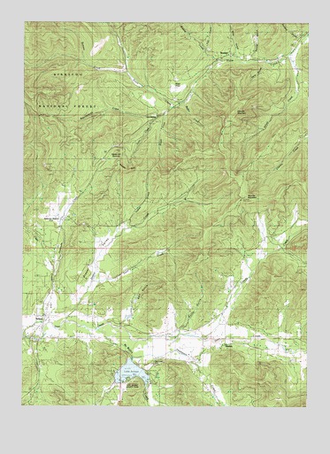
Selma, OR USGS Topographic Map
Click on map above to begin viewing in our Map Viewer.

This topographic map contains these locations and features:
Feature Name Type Latitude Longitude GNIS ID View Map
Anderson CreekStreamN42.2932°W123.6123°1137197View Map
Anderson Post Office (historical)Post OfficeN42.3121°W123.6076°1164837View Map
Anderson StationLocaleN42.3121°W123.6076°1137210View Map
Azalea SpringSpringN42.2818°W123.5428°1154362View Map
Backachers Ranch AirportAirportN42.2840°W123.5335°1153959View Map
Bonham SpringSpringN42.2859°W123.5595°1154360View Map
Booker CreekStreamN42.3012°W123.5623°1154358View Map
Brockhurst CreekStreamN42.2859°W123.5345°1154363View Map
Butcherknife CreekStreamN42.3443°W123.5701°1139041View Map
Crooks CreekStreamN42.2732°W123.5470°1140477View Map
Davis CreekStreamN42.2901°W123.5967°1140654View Map
Deer Creek CemeteryCemeteryN42.2640°W123.5695°1140845View Map
Draper CreekStreamN42.2768°W123.6092°1141231View Map
Draper ValleyValleyN42.2832°W123.6053°1159162View Map
DrydenPopulated PlaceN42.2696°W123.5373°1141364View Map
Dryden Post Office (historical)Post OfficeN42.2696°W123.5373°1165182View Map
Elliott CreekStreamN42.3637°W123.5095°1141833View Map
Fort Hayes (historical)LocaleN42.2998°W123.6012°1851683View Map
Grantham GulchValleyN42.3582°W123.5017°1142946View Map
Hansen CreekStreamN42.2721°W123.5637°1154357View Map
Hare GulchValleyN42.3609°W123.5220°1143305View Map
Hayes HillSummitN42.3262°W123.5784°1143405View Map
Hayes Hill SummitGapN42.3326°W123.5853°1159161View Map
Hegan CreekStreamN42.2721°W123.6234°1154354View Map
Illinois Valley Fire District Station 2BuildingN42.2769°W123.6162°2576685View Map
Illinois Valley Fire District Station 5BuildingN42.2657°W123.5501°2576682View Map
Indian CreekStreamN42.3071°W123.5826°1159163View Map
Josephine CountyCivilN42.3655°W123.5555°1155133View Map
Knight CreekStreamN42.3465°W123.5648°1144681View Map
Lake MerrittStreamN42.3722°W123.5014°1163804View Map
Lake SelmacReservoirN42.2607°W123.5785°1159160View Map
Lake Selmac Boat DockLocaleN42.2627°W123.5751°2668512View Map
Lake Selmac Boat DockLocaleN42.2629°W123.5820°2668103View Map
Lake Selmac Boat DockLocaleN42.2622°W123.5830°2668227View Map
Lake Selmac County ParkParkN42.2568°W123.5781°1163823View Map
Lake Selmac DamDamN42.2655°W123.5794°1159127View Map
Lake Selmac McMullen Creek Boat LaunchLocaleN42.2576°W123.5707°2668434View Map
Lake Selmac Reeves Creek Boat LaunchLocaleN42.2590°W123.5779°2668511View Map
Love CreekStreamN42.3421°W123.5723°1145581View Map
Love StationLocaleN42.3443°W123.5681°1145582View Map
McMullin CreekStreamN42.2751°W123.5931°1146026View Map
Mooney MountainSummitN42.3187°W123.5298°1146426View Map
Newt GulchValleyN42.3679°W123.5351°1146815View Map
Pollard CreekStreamN42.3693°W123.5040°1158957View Map
Pollard GulchValleyN42.3701°W123.5059°1116455View Map
Potter GulchValleyN42.2762°W123.5540°1154359View Map
Quedo CreekStreamN42.2637°W123.5790°1155075View Map
Ramsey CreekStreamN42.3584°W123.5823°1148192View Map
Red FlatFlatN42.3540°W123.5578°1148296View Map
Salt CreekStreamN42.3662°W123.5478°1148995View Map
Salt GulchValleyN42.2762°W123.5845°1154356View Map
Schmitts BayouGutN42.2721°W123.6137°1154355View Map
SelmaPopulated PlaceN42.2790°W123.6159°1149227View Map
Selma CemeteryCemeteryN42.2832°W123.6164°1154353View Map
Selma Census Designated PlaceCensusN42.2797°W123.6151°2611777View Map
Selma Post OfficePost OfficeN42.2795°W123.6165°1165928View Map
Slate CreekStreamN42.3482°W123.5617°1149663View Map
Squaw GulchValleyN42.3632°W123.5251°1150275View Map
Tall Timber DamDamN42.2782°W123.5806°1155661View Map
Tall Timber ReservoirReservoirN42.2789°W123.5801°1155662View Map
Thompson CreekStreamN42.2684°W123.5809°1151096View Map
Waters CreekStreamN42.3626°W123.5431°1151954View Map
Welter CreekStreamN42.3493°W123.5565°1152013View Map
WonderPopulated PlaceN42.3643°W123.5356°1152614View Map
Wonder AirportAirportN42.3712°W123.5268°1153874View Map
Wonder MountainSummitN42.3463°W123.5337°1154361View Map
Wonder Post Office (historical)Post OfficeN42.3643°W123.5356°1166207View Map

Note: Coordinates in the location and feature list above are referenced to NAD83 datum.


Copyright (C) 2008-2024 Ryan Niemi / Sunset Dynamics ... All Rights Reserved