TopoQuest Logo
Do you find TopoQuest useful?
Help keep TopoQuest running and adding new maps/features by donating!
Bitcoin:  19c7KJd3qBynnjoSw5npx9KScwjBe4ifkT
Litecoin:  LXs6TkuXGGXo1vDsWCkWVdjQX94eUKd6ui
Home View Maps Find Maps Find Places Resources & Links


Carbury, North Dakota Topographic Map

USGS Map Title: Carbury, ND
USGS Map MRC: 48100H5
DRG (GeoTIFF) Download: o48100h5.tif


Neighboring USGS Topographic Map Quads:


  Souris, ND  
48100H6
 

  Carbury, ND  
48100H5
 

  Lake Klingenberg, ND  
48100H4
 

  Souris SW, ND  
48100G6
 

  Souris SE, ND  
48100G5
 

  Bottineau, ND  
48100G4


Map MRC Location:

N49°
W101°
N49°
W100°
H8 H7 H6 H5 H4 H3 H2 H1
G8 G7 G6 G5 G4 G3 G2 G1
F8 F7 F6 F5 F4 F3 F2 F1
E8 E7 E6 E5 E4 E3 E2 E1
D8 D7 D6 D5 D4 D3 D2 D1
C8 C7 C6 C5 C4 C3 C2 C1
B8 B7 B6 B5 B4 B3 B2 B1
A8 A7 A6 A5 A4 A3 A2 A1
N48°
W101°
N48°
W100°

Carbury, ND USGS 1:24K Topographic Map Preview:
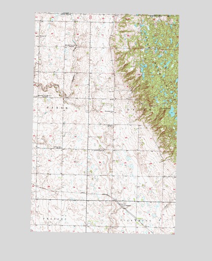
Carbury, ND USGS Topographic Map
Click on map above to begin viewing in our Map Viewer.

This topographic map contains these locations and features:
Feature Name Type Latitude Longitude GNIS ID View Map
CarburyPopulated PlaceN48.8908°W100.5446°1028276View Map
Eidsvold School Number 2SchoolN48.9364°W100.5557°1028824View Map
Emmanuel ChurchChurchN48.9442°W100.5557°1028883View Map
Emmanuel Lutheran Brethren CemeteryCemeteryN48.9439°W100.5562°2782161View Map
Mountain View School Number 1SchoolN48.9811°W100.5985°1030314View Map
Mountain View School Number 2SchoolN48.9231°W100.5993°1030315View Map
Mountain View School Number 4SchoolN48.9517°W100.6202°1030317View Map
Mystical Horizons Scenic OverlookLocaleN48.9488°W100.5229°2749208View Map
Sjule Private AirstripAirportN48.9320°W100.5779°2646261View Map
Strawberry LakeLakeN48.9446°W100.5050°1032366View Map
Strawberry Lake Recreation AreaParkN48.9465°W100.5081°2749207View Map
Swedish ChurchChurchN48.9861°W100.6218°1032413View Map
Swedish Lutheran CemeteryCemeteryN48.9857°W100.6218°2782191View Map
Township of DalenCivilN48.9463°W100.5116°1759273View Map
Turtle Mountain ChurchChurchN48.9220°W100.5732°1032554View Map
Turtle Mountain Lutheran CemeteryCemeteryN48.9217°W100.5732°2782462View Map
Twisted Oaks Equestrian CampgroundLocaleN48.9472°W100.5228°2749209View Map

Note: Coordinates in the location and feature list above are referenced to NAD83 datum.


Copyright (C) 2008-2024 Ryan Niemi / Sunset Dynamics ... All Rights Reserved