TopoQuest Logo
Do you find TopoQuest useful?
Help keep TopoQuest running and adding new maps/features by donating!
Bitcoin:  19c7KJd3qBynnjoSw5npx9KScwjBe4ifkT
Litecoin:  LXs6TkuXGGXo1vDsWCkWVdjQX94eUKd6ui
Home View Maps Find Maps Find Places Resources & Links


Maness Peak, Arizona Topographic Map

USGS Map Title: Maness Peak, AZ
USGS Map MRC: 33109F1
DRG (GeoTIFF) Download: o33109f1.tif


Neighboring USGS Topographic Map Quads:


  Alpine, AZ  
33109G2
 

  Luna Lake, AZ  
33109G1
 

  Luna, NM  
33108G8
 

  Beaverhead, AZ  
33109F2
 

  Maness Peak, AZ  
33109F1
 

  Bull Basin, NM  
33108F8
 

  Bear Mountain, AZ  
33109E2
 

  Blue, AZ  
33109E1
 

  Saliz Pass, NM  
33108E8


Map MRC Location:

N34°
W110°
N34°
W109°
H8 H7 H6 H5 H4 H3 H2 H1
G8 G7 G6 G5 G4 G3 G2 G1
F8 F7 F6 F5 F4 F3 F2 F1
E8 E7 E6 E5 E4 E3 E2 E1
D8 D7 D6 D5 D4 D3 D2 D1
C8 C7 C6 C5 C4 C3 C2 C1
B8 B7 B6 B5 B4 B3 B2 B1
A8 A7 A6 A5 A4 A3 A2 A1
N33°
W110°
N33°
W109°

Maness Peak, AZ USGS 1:24K Topographic Map Preview:
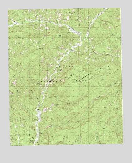
Maness Peak, AZ USGS Topographic Map
Click on map above to begin viewing in our Map Viewer.

This topographic map contains these locations and features:
Feature Name Type Latitude Longitude GNIS ID View Map
Apache National ForestForestN33.7429°W109.0822°1851849View Map
Bentonite TankReservoirN33.6787°W109.0601°39915View Map
Blue CemeteryCemeteryN33.6491°W109.0946°25376View Map
Blue CrossingCrossingN33.6273°W109.0981°25377View Map
Blue Crossing CampgroundLocaleN33.6289°W109.0976°39921View Map
Blue Elementary SchoolSchoolN33.6364°W109.0919°39924View Map
Blue River RanchLocaleN33.7295°W109.0562°44774View Map
Bobcat FlatFlatN33.7176°W109.0490°25375View Map
Bobcat TankReservoirN33.7032°W109.1032°39925View Map
Box CanyonValleyN33.7323°W109.0565°26682View Map
Brooks RanchLocaleN33.7392°W109.1159°42286View Map
Burke RanchLocaleN33.6487°W109.0909°39931View Map
Campbell Blue CreekStreamN33.7198°W109.0448°27221View Map
Cat CreekStreamN33.7364°W109.1123°27354View Map
Centerfire CreekStreamN33.6501°W109.0931°27466View Map
Clay Hunter CanyonValleyN33.6826°W109.1217°25374View Map
Clay Hunter SpringSpringN33.6937°W109.1120°1851972View Map
Colyer CanyonValleyN33.7428°W109.0306°905270View Map
Dam CanyonValleyN33.6278°W109.0981°28253View Map
Fall CreekStreamN33.7364°W109.0737°28956View Map
Fogg 8 RanchLocaleN33.7076°W109.0590°42285View Map
Fogg CabinLocaleN33.7076°W109.0590°39978View Map
Frieborn CanyonValleyN33.7231°W109.0406°906404View Map
Hinkle ParkFlatN33.6392°W109.0192°899339View Map
Holbrook SpringSpringN33.6507°W109.0900°42283View Map
Jack SpringSpringN33.7245°W109.1141°40006View Map
Jackson BoxBasinN33.6848°W109.0767°30480View Map
Jackson CanyonValleyN33.6867°W109.0792°30482View Map
Johnson CanyonValleyN33.6351°W109.0948°30578View Map
Jones CanyonValleyN33.6798°W109.0851°30599View Map
K E CanyonValleyN33.7401°W109.0942°30689View Map
Lazy YJ RanchLocaleN33.6576°W109.0937°25373View Map
Lazy YJ RanchLocaleN33.6589°W109.0954°42288View Map
Luce RanchLocaleN33.7384°W109.1165°25372View Map
Maness MountainSummitN33.6895°W109.0492°31477View Map
Maness MountainSummitN33.6917°W109.0451°899748View Map
Maness PeakSummitN33.6870°W109.0595°31478View Map
Mexican SpringSpringN33.6984°W109.1066°1851973View Map
Milligan LakeLakeN33.7249°W109.0696°31890View Map
Milligan PeakSummitN33.7142°W109.0881°31891View Map
Mother Hubbard CanyonValleyN33.7267°W109.0478°32070View Map
Mud SpringSpringN33.6259°W109.0473°896887View Map
Mud SpringsSpringN33.6256°W109.0476°32129View Map
Muddy Canyon Spring TankReservoirN33.6270°W109.0617°1984357View Map
Muddy Canyon Spring TankReservoirN33.6273°W109.0537°2038581View Map
Muddy TankReservoirN33.6273°W109.0531°40041View Map
Noland CreekStreamN33.6562°W109.0912°32341View Map
Noland MountainSummitN33.6698°W109.0754°1813162View Map
Noland SpringSpringN33.6618°W109.0735°44729View Map
Noland TankReservoirN33.6869°W109.0500°44809View Map
North Fork SpringSpringN33.6548°W109.0706°42284View Map
Pace CreekStreamN33.7487°W109.0184°32612View Map
School House CanyonValleyN33.6287°W109.0970°40080View Map
Schoolhouse SpringSpringN33.6428°W109.0781°42282View Map
Sheep BasinBasinN33.6337°W109.0301°894768View Map
Spring BranchStreamN33.7426°W109.0265°895244View Map
Stateline Tank Number 2ReservoirN33.6800°W109.0537°1851971View Map
Swafford CanyonValleyN33.6637°W109.0898°34992View Map
Turkey CreekStreamN33.7362°W109.0690°35544View Map
Tutt CreekStreamN33.6289°W109.1167°35600View Map
Tutt Creek TrailheadLocaleN33.6314°W109.1106°1985061View Map
Twin Tubs SpringSpringN33.7195°W109.0947°25371View Map
Upper Blue CampgroundLocaleN33.6951°W109.0720°40119View Map
Upper Blue SpringSpringN33.6938°W109.0701°35670View Map
Upper TankReservoirN33.7406°W109.0051°914065View Map
Whispering PinesPopulated PlaceN33.7303°W109.0562°40132View Map

Note: Coordinates in the location and feature list above are referenced to NAD83 datum.


Copyright (C) 2008-2024 Ryan Niemi / Sunset Dynamics ... All Rights Reserved