TopoQuest Logo
Do you find TopoQuest useful?
Help keep TopoQuest running and adding new maps/features by donating!
Bitcoin:  19c7KJd3qBynnjoSw5npx9KScwjBe4ifkT
Litecoin:  LXs6TkuXGGXo1vDsWCkWVdjQX94eUKd6ui
Home View Maps Find Maps Find Places Resources & Links


Woody Canyon, Nevada Topographic Map

USGS Map Title: Woody Canyon, NV
USGS Map MRC: 40118G2
DRG (GeoTIFF) Download: o40118g2.tif


Neighboring USGS Topographic Map Quads:


  Gaskell, NV  
40118H2
 

  Pronto, NV  
40118H1


  Woody Canyon, NV  
40118G2
 

  Cosgrave, NV  
40118G1
 

  Rye Patch Reservoir North, NV  
40118F3
 

  Imlay, NV  
40118F2
 

  Mill City, NV  
40118F1


Map MRC Location:

N41°
W119°
N41°
W118°
H8 H7 H6 H5 H4 H3 H2 H1
G8 G7 G6 G5 G4 G3 G2 G1
F8 F7 F6 F5 F4 F3 F2 F1
E8 E7 E6 E5 E4 E3 E2 E1
D8 D7 D6 D5 D4 D3 D2 D1
C8 C7 C6 C5 C4 C3 C2 C1
B8 B7 B6 B5 B4 B3 B2 B1
A8 A7 A6 A5 A4 A3 A2 A1
N40°
W119°
N40°
W118°

Woody Canyon, NV USGS 1:24K Topographic Map Preview:
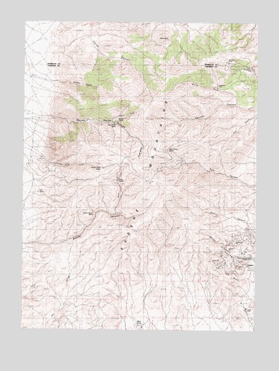
Woody Canyon, NV USGS Topographic Map
Click on map above to begin viewing in our Map Viewer.

This topographic map contains these locations and features:
Feature Name Type Latitude Longitude GNIS ID View Map
Alpha ButteSummitN40.8682°W118.1779°845342View Map
Blackbird MineMineN40.8591°W118.1426°848285View Map
Bonita CanyonValleyN40.7841°W118.2476°838969View Map
Bonita Canyon SpringSpringN40.7979°W118.2132°850090View Map
CCC SpringSpringN40.8059°W118.2423°850089View Map
Central (historical)Populated PlaceN40.7821°W118.1335°846124View Map
Chicken Basin CreekStreamN40.8232°W118.2493°850087View Map
Chicken Basin SpringSpringN40.8160°W118.2087°850088View Map
Corral CanyonValleyN40.8621°W118.2301°839697View Map
Danner SpringSpringN40.8360°W118.1974°850080View Map
Dry CreekStreamN40.7560°W118.2332°850099View Map
Eugene MountainsRangeN40.8071°W118.1751°857985View Map
Forge MineMineN40.7588°W118.1310°850097View Map
Glidden CanyonValleyN40.8507°W118.2349°850077View Map
Humboldt HillSummitN40.7871°W118.1368°850092View Map
Mill City Mining DistrictCivilN40.7855°W118.1704°854050View Map
Millers CabinLocaleN40.7516°W118.1865°863362View Map
Millers SpringSpringN40.7525°W118.1867°850098View Map
Nevada Massachusetts Tungsten MineMineN40.7780°W118.1343°856605View Map
New Central (historical)LocaleN40.8668°W118.2382°846125View Map
North Fork Bonita CanyonValleyN40.7971°W118.2010°850086View Map
North Fork Central CanyonValleyN40.8413°W118.1368°850078View Map
North Fork Woody CanyonValleyN40.8349°W118.2038°850079View Map
Red Hawk MineMineN40.7988°W118.1382°846135View Map
Republican MineMineN40.8496°W118.1471°850101View Map
Sage Chicken SpringSpringN40.8230°W118.1737°850083View Map
Souza SpringSpringN40.8106°W118.1996°850085View Map
Springer CanyonValleyN40.7791°W118.1274°850091View Map
Springer HillSummitN40.7838°W118.1407°850093View Map
Stank CanyonValleyN40.7713°W118.1296°850096View Map
Stank HillSummitN40.7791°W118.1451°850095View Map
Sutton HillSummitN40.7755°W118.1357°850094View Map
Three ForksBendN40.8343°W118.2046°850082View Map
Three Forks SpringSpringN40.8335°W118.2015°850081View Map
TungstenPopulated PlaceN40.7791°W118.1251°856157View Map
Tungsten Post Office (historical)Post OfficeN40.7791°W118.1251°864863View Map
Wheelbarrow MineMineN40.8557°W118.1285°850100View Map
Woody CanyonValleyN40.8360°W118.2404°847220View Map
Woody SpringsSpringN40.8219°W118.1873°850084View Map

Note: Coordinates in the location and feature list above are referenced to NAD83 datum.


Copyright (C) 2008-2024 Ryan Niemi / Sunset Dynamics ... All Rights Reserved