TopoQuest Logo
Do you find TopoQuest useful?
Help keep TopoQuest running and adding new maps/features by donating!
Bitcoin:  19c7KJd3qBynnjoSw5npx9KScwjBe4ifkT
Litecoin:  LXs6TkuXGGXo1vDsWCkWVdjQX94eUKd6ui
Home View Maps Find Maps Find Places Resources & Links


White Oaks South, New Mexico Topographic Map

USGS Map Title: White Oaks South, NM
USGS Map MRC: 33105F6
DRG (GeoTIFF) Download: o33105f6.tif


Neighboring USGS Topographic Map Quads:


  Lone Mountain, NM  
33105G7
 

  White Oaks North, NM  
33105G6
 

  Jicarilla Peak, NM  
33105G5
 

  Carrizozo East, NM  
33105F7
 

  White Oaks South, NM  
33105F6
 

  Jacob Spring, NM  
33105F5
 

  Church Mountain, NM  
33105E7
 

  Nogal, NM  
33105E6
 

  Capitan, NM  
33105E5


Map MRC Location:

N34°
W106°
N34°
W105°
H8 H7 H6 H5 H4 H3 H2 H1
G8 G7 G6 G5 G4 G3 G2 G1
F8 F7 F6 F5 F4 F3 F2 F1
E8 E7 E6 E5 E4 E3 E2 E1
D8 D7 D6 D5 D4 D3 D2 D1
C8 C7 C6 C5 C4 C3 C2 C1
B8 B7 B6 B5 B4 B3 B2 B1
A8 A7 A6 A5 A4 A3 A2 A1
N33°
W106°
N33°
W105°

White Oaks South, NM USGS 1:24K Topographic Map Preview:
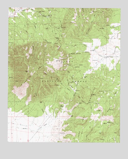
White Oaks South, NM USGS Topographic Map
Click on map above to begin viewing in our Map Viewer.

This topographic map contains these locations and features:
Feature Name Type Latitude Longitude GNIS ID View Map
Alto SpringSpringN33.7170°W105.6994°885711View Map
Barber SpringSpringN33.7316°W105.6916°903555View Map
Barber Springs TrailTrailN33.7387°W105.6944°903556View Map
Benado CanyonValleyN33.6473°W105.6983°903742View Map
Benado GapGapN33.6856°W105.6661°903743View Map
Benado SpringSpringN33.6779°W105.6936°903744View Map
Bragg CanyonValleyN33.6756°W105.6742°904056View Map
Bragg SpringSpringN33.6813°W105.6772°904057View Map
Carrizo CanyonValleyN33.7062°W105.6300°904798View Map
Carrizo MountainSummitN33.6906°W105.7286°924759View Map
Carrizo PeakSummitN33.6906°W105.7286°904807View Map
Carrizo Peak TrailTrailN33.6873°W105.7061°904808View Map
Cedarvale CemeteryCemeteryN33.7412°W105.7461°904882View Map
Coal Dump CanyonValleyN33.7379°W105.7064°905219View Map
Coal Dump SpringSpringN33.7219°W105.6948°905220View Map
Cottonwood TankReservoirN33.7015°W105.6506°905430View Map
Dark CanyonValleyN33.7367°W105.7497°905597View Map
Emeline MineMineN33.7476°W105.7455°939656View Map
Felix SpringSpringN33.6280°W105.6429°906248View Map
Goat MountainSummitN33.6695°W105.6567°906586View Map
Goat SpringSpringN33.6617°W105.6606°906591View Map
Goat SpringSpringN33.6851°W105.7449°906592View Map
Goodloe RanchLocaleN33.7045°W105.6403°906647View Map
In-Situ M and T Corporation of AmericaMineN33.7429°W105.7464°915309View Map
Jims TankReservoirN33.7107°W105.6552°907375View Map
Johnnie CanyonValleyN33.6679°W105.6769°907395View Map
Johnnie TankReservoirN33.6732°W105.6757°907396View Map
Kudner TankReservoirN33.6493°W105.6802°907592View Map
Lake MountainSummitN33.6548°W105.6475°907827View Map
Lincoln Light and Power Company MineMineN33.7426°W105.7269°915321View Map
Little Bragg CanyonValleyN33.6729°W105.6747°907998View Map
Lost SpringSpringN33.6844°W105.7150°908254View Map
Madden CanyonValleyN33.7045°W105.6394°908334View Map
Madden SpringSpringN33.7080°W105.6751°908335View Map
Madden TankReservoirN33.7012°W105.6973°908336View Map
Martin MineMineN33.7476°W105.7455°939487View Map
Meyer SpringSpringN33.7174°W105.7068°908671View Map
Mud SpringSpringN33.6556°W105.6373°908945View Map
Northwest TankReservoirN33.6337°W105.6928°909212View Map
O Bar O RanchLocaleN33.6584°W105.6894°909231View Map
Old Abe Mine Number 1 MineMineN33.7317°W105.7072°939951View Map
Old Abe Mine Number 2 MineMineN33.7317°W105.7072°939952View Map
Old Abe MinesMineN33.7317°W105.7072°909332View Map
Old Price MineMineN33.7309°W105.6967°909343View Map
Outlaw CanyonValleyN33.7029°W105.6444°909401View Map
Patos MountainSummitN33.7448°W105.6628°909501View Map
Patos Mountain TrailTrailN33.7334°W105.6603°909502View Map
Patos SpringSpringN33.7312°W105.6437°909503View Map
Powder Magazine SpringSpringN33.7463°W105.7164°909825View Map
Powell CanyonValleyN33.6473°W105.7094°909829View Map
Powell SpringSpringN33.6620°W105.7122°909830View Map
PriceMineN33.7423°W105.7200°916974View Map
Roadside TankReservoirN33.6952°W105.6761°910342View Map
Robinson RanchLocaleN33.7326°W105.6328°910356View Map
Section Thirty-four TankReservoirN33.6617°W105.6713°910915View Map
Section Twenty-six TankReservoirN33.6728°W105.6434°910911View Map
Tucson MountainSummitN33.6440°W105.6361°1985274View Map
Tucson Mountain TrailTrailN33.6409°W105.6455°911847View Map
Water CanyonValleyN33.7459°W105.7400°912172View Map
Wells and Parker MineMineN33.7229°W105.6950°914771View Map
Wells SpringSpringN33.7416°W105.7071°912213View Map
White OaksPopulated PlaceN33.7476°W105.7364°912313View Map
White Oaks Historic DistrictLocaleN33.7476°W105.7364°934428View Map
White Oaks Post Office (historical)Post OfficeN33.7476°W105.7364°938240View Map
White Oaks SpringSpringN33.7429°W105.7063°912317View Map
WildcatMineN33.7348°W105.7083°916179View Map
WilliamsMineN33.7262°W105.6980°916180View Map
Wilson SpringSpringN33.7170°W105.7444°912439View Map
York SpringSpringN33.7343°W105.6379°912530View Map

Note: Coordinates in the location and feature list above are referenced to NAD83 datum.


Copyright (C) 2008-2024 Ryan Niemi / Sunset Dynamics ... All Rights Reserved