TopoQuest Logo
Do you find TopoQuest useful?
Help keep TopoQuest running and adding new maps/features by donating!
Bitcoin:  19c7KJd3qBynnjoSw5npx9KScwjBe4ifkT
Litecoin:  LXs6TkuXGGXo1vDsWCkWVdjQX94eUKd6ui
Home View Maps Find Maps Find Places Resources & Links


Wabasso, Minnesota Topographic Map

USGS Map Title: Wabasso, MN
USGS Map MRC: 44095D3
DRG (GeoTIFF) Download: o44095d3.tif


Neighboring USGS Topographic Map Quads:


  Echo, MN  
44095E4
 

  Belview, MN  
44095E3
 

  Delhi, MN  
44095E2
 

  Lucan, MN  
44095D4
 

  Wabasso, MN  
44095D3
 

  Rowena, MN  
44095D2
 

  Wabasso SW, MN  
44095C4
 

  Wabasso SE, MN  
44095C3
 

  Wanda, MN  
44095C2


Map MRC Location:

N45°
W96°
N45°
W95°
H8 H7 H6 H5 H4 H3 H2 H1
G8 G7 G6 G5 G4 G3 G2 G1
F8 F7 F6 F5 F4 F3 F2 F1
E8 E7 E6 E5 E4 E3 E2 E1
D8 D7 D6 D5 D4 D3 D2 D1
C8 C7 C6 C5 C4 C3 C2 C1
B8 B7 B6 B5 B4 B3 B2 B1
A8 A7 A6 A5 A4 A3 A2 A1
N44°
W96°
N44°
W95°

Wabasso, MN USGS 1:24K Topographic Map Preview:
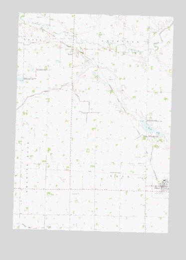
Wabasso, MN USGS Topographic Map
Click on map above to begin viewing in our Map Viewer.

This topographic map contains these locations and features:
Feature Name Type Latitude Longitude GNIS ID View Map
Bernard FarmsLocaleN44.4800°W95.3047°2581947View Map
Bethany Evangelical Lutheran ChurchChurchN44.4047°W95.2517°2064447View Map
City of SeaforthCivilN44.4763°W95.3310°2396564View Map
City of WabassoCivilN44.4025°W95.2554°2397157View Map
Clear CreekStreamN44.4827°W95.3261°641270View Map
County Ditch Number NintyCanalN44.4375°W95.3181°642374View Map
County Ditch Number One HundredCanalN44.4827°W95.3647°641582View Map
County Ditch Number SeventythreeCanalN44.4191°W95.2650°642297View Map
County Ditch Number TwentyoneCanalN44.4333°W95.3606°641810View Map
Daubs LakeLakeN44.4341°W95.2642°642647View Map
Daubs Lake State Wildlife Management AreaParkN44.4366°W95.2686°642648View Map
Fuhr Flying ServiceAirportN44.4705°W95.2833°660411View Map
Jewish Burial Plot (historical)CemeteryN44.3917°W95.2528°2064538View Map
John and Apollenea Daub Family PlotCemeteryN44.4167°W95.2528°2064539View Map
Paul State Wildlife Management AreaParkN44.4677°W95.3631°649186View Map
Redwood CountyCivilN44.4037°W95.2538°659509View Map
Saint Anne's Elementary SchoolSchoolN44.4039°W95.2539°2064450View Map
Saint Anne's ParishChurchN44.4031°W95.2539°2064446View Map
Saint Marys CemeteryCemeteryN44.4797°W95.3378°650851View Map
Saint Pauls CemeteryCemeteryN44.4730°W95.3208°2064537View Map
SeaforthPopulated PlaceN44.4772°W95.3264°651812View Map
Seaforth (historical)LocaleN44.4797°W95.3267°2064375View Map
Seaforth Fire DepartmentBuildingN44.4771°W95.3270°2666481View Map
Seaforth Post OfficePost OfficeN44.4772°W95.3261°2064376View Map
Seaforth Town HallBuildingN44.4778°W95.3272°2064377View Map
Township of SheridanCivilN44.4997°W95.2885°665594View Map
Township of VailCivilN44.4131°W95.2902°665848View Map
WabassoPopulated PlaceN44.4019°W95.2558°653699View Map
Wabasso (historical)LocaleN44.4025°W95.2578°2064454View Map
Wabasso Health Care CenterHospitalN44.4047°W95.2508°2064448View Map
Wabasso Police DepartmentBuildingN44.4008°W95.2563°2064453View Map
Wabasso Post OfficePost OfficeN44.4019°W95.2556°2064449View Map
Wabasso Public LibraryBuildingN44.4028°W95.2556°2064452View Map
Wabasso Public SchoolSchoolN44.4056°W95.2544°2064451View Map
Wabasso Volunteer Fire Department and Ambulance AssociationBuildingN44.4006°W95.2563°2064455View Map

Note: Coordinates in the location and feature list above are referenced to NAD83 datum.


Copyright (C) 2008-2024 Ryan Niemi / Sunset Dynamics ... All Rights Reserved