TopoQuest Logo
Do you find TopoQuest useful?
Help keep TopoQuest running and adding new maps/features by donating!
Bitcoin:  19c7KJd3qBynnjoSw5npx9KScwjBe4ifkT
Litecoin:  LXs6TkuXGGXo1vDsWCkWVdjQX94eUKd6ui
Home View Maps Find Maps Find Places Resources & Links


Vale, Tennessee Topographic Map

USGS Map Title: Vale, TN
USGS Map MRC: 36088A3
DRG (GeoTIFF) Download: o36088a3.tif


Neighboring USGS Topographic Map Quads:


  Henry, TN  
36088B4
 

  Mansfield, TN  
36088B3
 

  Manleyville, TN  
36088B2
 

  Huntingdon, TN  
36088A4
 

  Vale, TN  
36088A3
 

  Bruceton, TN  
36088A2
 

  Palmer Shelter, TN  
35088H4
 

  Buena Vista, TN  
35088H3
 

  Seventeen Creek, TN  
35088H2


Map MRC Location:

N37°
W89°
N37°
W88°
H8 H7 H6 H5 H4 H3 H2 H1
G8 G7 G6 G5 G4 G3 G2 G1
F8 F7 F6 F5 F4 F3 F2 F1
E8 E7 E6 E5 E4 E3 E2 E1
D8 D7 D6 D5 D4 D3 D2 D1
C8 C7 C6 C5 C4 C3 C2 C1
B8 B7 B6 B5 B4 B3 B2 B1
A8 A7 A6 A5 A4 A3 A2 A1
N36°
W89°
N36°
W88°

Vale, TN USGS 1:24K Topographic Map Preview:
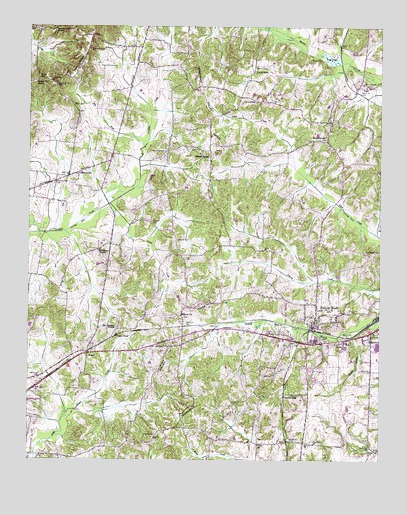
Vale, TN USGS Topographic Map
Click on map above to begin viewing in our Map Viewer.

This topographic map contains these locations and features:
Feature Name Type Latitude Longitude GNIS ID View Map
Abernathy CemeteryCemeteryN36.1181°W88.3534°1275425View Map
Barren SpringLocaleN36.0892°W88.3106°1276381View Map
Barren Spring School (historical)SchoolN36.0862°W88.3103°1320303View Map
Bethlehem ChurchChurchN36.0603°W88.3503°1326788View Map
Brooks BranchStreamN36.0373°W88.2603°1278464View Map
Bruceton Division (historical)CensusN36.0367°W88.2681°1652424View Map
Butler School (historical)SchoolN36.0101°W88.2939°1320312View Map
Cannon SchoolSchoolN36.0828°W88.3562°1279614View Map
Carn School (historical)SchoolN36.1142°W88.3328°1320313View Map
Carnsville (historical)Populated PlaceN36.1148°W88.3367°1311768View Map
Carroll County Rural Fire Department District 15 Twin CityBuildingN36.0340°W88.2720°2653625View Map
Carroll County Rural Fire Department District 2 ValeBuildingN36.1051°W88.2605°2653833View Map
Carroll County Rural Fire Department District 8 MixieBuildingN36.0838°W88.3535°2654270View Map
Carver CreekStreamN36.0739°W88.3462°1279832View Map
Central High SchoolSchoolN36.0337°W88.2614°1280169View Map
Chapel Hill CemeteryCemeteryN36.1089°W88.3737°1326655View Map
Chapel Hill ChurchChurchN36.1092°W88.3731°1305854View Map
Church of ChristChurchN36.0917°W88.2692°1646032View Map
Commissioner District 4CivilN36.0899°W88.3568°2464017View Map
Coopers SpurLocaleN36.0187°W88.2837°1281224View Map
Crews StoreLocaleN36.1117°W88.2948°1281615View Map
District 23 (historical)CivilN36.0501°W88.3667°1325896View Map
Dry ForkStreamN36.0903°W88.3339°1282958View Map
Hamilton CemeteryCemeteryN36.0070°W88.3289°1286649View Map
Harder CemeteryCemeteryN36.1095°W88.3712°1286807View Map
Hebron CemeteryCemeteryN36.0412°W88.3200°1326663View Map
Hebron ChurchChurchN36.0417°W88.3206°1306559View Map
Hollow RockPopulated PlaceN36.0381°W88.2737°1288081View Map
Hollow Rock Police DepartmentBuildingN36.0359°W88.2899°2766018View Map
Hollow Rock Post OfficePost OfficeN36.0346°W88.2737°1651411View Map
Mann CemeteryCemeteryN36.1023°W88.3589°1292584View Map
Marlborough CemeteryCemeteryN36.0928°W88.2692°1292702View Map
Marlborough CemeteryCemeteryN36.0928°W88.2695°1646041View Map
Marlborough School (historical)SchoolN36.0937°W88.2695°1320344View Map
Marlborough United Baptist ChurchChurchN36.0937°W88.2695°1646042View Map
Martin CemeteryCemeteryN36.1156°W88.2750°1292813View Map
Massey CemeteryCemeteryN36.1034°W88.2942°1292909View Map
Massey CemeteryCemeteryN36.1134°W88.2948°1292910View Map
Massey Chapel (historical)ChurchN36.1101°W88.3306°1320345View Map
Mebane CemeteryCemeteryN36.0689°W88.3312°1293526View Map
Moore CemeteryCemeteryN36.1248°W88.3748°1294271View Map
Morton School (historical)SchoolN36.0384°W88.3431°1320353View Map
Mount Pleasant ChurchChurchN36.0387°W88.3439°1294771View Map
Nesbitt CemeteryCemeteryN36.0634°W88.3220°1295399View Map
Old Pisgah CemeteryCemeteryN36.0603°W88.2553°1296347View Map
Old Union CemeteryCemeteryN36.0892°W88.3320°1296386View Map
Pea RidgeRidgeN36.1139°W88.3570°1297033View Map
Pisgah CemeteryCemeteryN36.0787°W88.2642°1326677View Map
Pisgah Church (historical)ChurchN36.0792°W88.2639°1326888View Map
Pleasant Grove ChurchChurchN36.1245°W88.3645°1297826View Map
Prospect Baptist ChurchChurchN36.0342°W88.2759°1298581View Map
Prospect CemeteryCemeteryN36.0348°W88.2703°1646053View Map
Rices Store (historical)LocaleN36.1189°W88.3356°1320363View Map
RosserPopulated PlaceN36.0309°W88.3537°1306973View Map
Rosser PondLakeN36.0362°W88.3436°1300135View Map
Sandy Bridge (historical)Populated PlaceN36.0337°W88.2756°1646055View Map
Thompson School (historical)SchoolN36.0487°W88.3645°1320376View Map
Town of Hollow RockCivilN36.0352°W88.2738°2405850View Map
ValePopulated PlaceN36.1067°W88.2589°1273324View Map
Vale PondSwampN36.1161°W88.2679°1273325View Map
Vale School (historical)SchoolN36.1089°W88.2600°1320381View Map
West Tennessee Seminary (historical)SchoolN36.0342°W88.2762°1646057View Map

Note: Coordinates in the location and feature list above are referenced to NAD83 datum.


Copyright (C) 2008-2024 Ryan Niemi / Sunset Dynamics ... All Rights Reserved