TopoQuest Logo
Do you find TopoQuest useful?
Help keep TopoQuest running and adding new maps/features by donating!
Bitcoin:  19c7KJd3qBynnjoSw5npx9KScwjBe4ifkT
Litecoin:  LXs6TkuXGGXo1vDsWCkWVdjQX94eUKd6ui
Home View Maps Find Maps Find Places Resources & Links


Alston, Georgia Topographic Map

USGS Map Title: Alston, GA
USGS Map MRC: 32082A4
DRG (GeoTIFF) Download: o32082a4.tif


Neighboring USGS Topographic Map Quads:


  Mount Vernon, GA  
32082B5
 

  Vidalia, GA  
32082B4
 

  Lyons, GA  
32082B3
 

  Uvalda, GA  
32082A5
 

  Alston, GA  
32082A4
 

  Johnson Corner, GA  
32082A3
 

  Hazlehurst North, GA  
31082H5
 

  Grays Landing, GA  
31082H4
 

  Baxley NE, GA  
31082H3


Map MRC Location:

N33°
W83°
N33°
W82°
H8 H7 H6 H5 H4 H3 H2 H1
G8 G7 G6 G5 G4 G3 G2 G1
F8 F7 F6 F5 F4 F3 F2 F1
E8 E7 E6 E5 E4 E3 E2 E1
D8 D7 D6 D5 D4 D3 D2 D1
C8 C7 C6 C5 C4 C3 C2 C1
B8 B7 B6 B5 B4 B3 B2 B1
A8 A7 A6 A5 A4 A3 A2 A1
N32°
W83°
N32°
W82°

Alston, GA USGS 1:24K Topographic Map Preview:
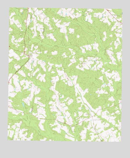
Alston, GA USGS Topographic Map
Click on map above to begin viewing in our Map Viewer.

This topographic map contains these locations and features:
Feature Name Type Latitude Longitude GNIS ID View Map
Alligator CreekStreamN32.0032°W82.4510°310476View Map
AlstonPopulated PlaceN32.0807°W82.4776°331031View Map
Alston Volunteer Fire DepartmentBuildingN32.0803°W82.4772°2604532View Map
Buckhorn CreekStreamN32.0941°W82.3987°311982View Map
Cedar CrossingPopulated PlaceN32.0257°W82.4079°331352View Map
Cedar Crossing ChurchChurchN32.0269°W82.4082°345162View Map
Cedar Crossing ChurchChurchN32.0288°W82.4093°345163View Map
Cedar Crossing Volunteer Fire DepartmentBuildingN32.0100°W82.4033°2604933View Map
Church of GodChurchN32.0144°W82.4262°345166View Map
Clarks Mill Pond DamDamN32.0769°W82.4699°336151View Map
Dry BranchStreamN32.1246°W82.4924°313650View Map
Galbreath CemeteryCemeteryN32.0991°W82.4621°314483View Map
Gator CreekStreamN32.0421°W82.4565°314535View Map
Gibbs CemeteryCemeteryN32.0268°W82.4873°314576View Map
Isle of Hope ChurchChurchN32.0019°W82.4960°315962View Map
Lake View Memorial GardensCemeteryN32.1177°W82.3835°316544View Map
Lower Cato LakeReservoirN32.0038°W82.3974°340357View Map
Lower Cato Lake DamDamN32.0035°W82.3982°340356View Map
McCortle CemeteryCemeteryN32.0091°W82.4287°317874View Map
Meadows Regional Emergency Medical ServicesBuildingN32.0100°W82.4033°2625451View Map
Mount Calvary ChurchChurchN32.0913°W82.4824°318580View Map
New Corinth ChurchChurchN32.1063°W82.4449°319300View Map
Oconee BridgeBridgeN32.0816°W82.4035°345201View Map
Oconee CreekStreamN32.0749°W82.3907°319898View Map
Odom BridgeBridgeN32.0349°W82.3796°345202View Map
Old Cedar Crossing CemeteryCemeteryN32.0207°W82.4048°319956View Map
Rock SpringsPopulated PlaceN32.0732°W82.4146°332886View Map
Rock Springs ChurchChurchN32.0582°W82.4174°345209View Map
Sharpe CemeteryCemeteryN32.0685°W82.4401°322798View Map
Sharpe CemeteryCemeteryN32.1024°W82.4826°322799View Map
Sharpe CemeteryCemeteryN32.1232°W82.4796°322800View Map
Town of AlstonCivilN32.0810°W82.4789°2405142View Map
Upper Cato LakeReservoirN32.0069°W82.4015°340355View Map
Upper Cato Lake DamDamN32.0069°W82.4015°340354View Map
Williams CemeteryCemeteryN32.0538°W82.3893°325329View Map
WLYU-FM (Lyons)TowerN32.1135°W82.3976°352724View Map

Note: Coordinates in the location and feature list above are referenced to NAD83 datum.


Copyright (C) 2008-2024 Ryan Niemi / Sunset Dynamics ... All Rights Reserved