TopoQuest Logo
Do you find TopoQuest useful?
Help keep TopoQuest running and adding new maps/features by donating!
Bitcoin:  19c7KJd3qBynnjoSw5npx9KScwjBe4ifkT
Litecoin:  LXs6TkuXGGXo1vDsWCkWVdjQX94eUKd6ui
Home View Maps Find Maps Find Places Resources & Links


Sumner SW, Iowa Topographic Map

USGS Map Title: Sumner SW, IA
USGS Map MRC: 42092G2
DRG (GeoTIFF) Download: o42092g2.tif


Neighboring USGS Topographic Map Quads:


  Frederika, IA  
42092H3
 

  Fredericksburg, IA  
42092H2
 

  Alpha, IA  
42092H1
 

  Tripoli, IA  
42092G3
 

  Sumner SW, IA  
42092G2
 

  Sumner, IA  
42092G1
 

  Denver, IA  
42092F3
 

  Readlyn, IA  
42092F2
 

  Fairbank, IA  
42092F1


Map MRC Location:

N43°
W93°
N43°
W92°
H8 H7 H6 H5 H4 H3 H2 H1
G8 G7 G6 G5 G4 G3 G2 G1
F8 F7 F6 F5 F4 F3 F2 F1
E8 E7 E6 E5 E4 E3 E2 E1
D8 D7 D6 D5 D4 D3 D2 D1
C8 C7 C6 C5 C4 C3 C2 C1
B8 B7 B6 B5 B4 B3 B2 B1
A8 A7 A6 A5 A4 A3 A2 A1
N42°
W93°
N42°
W92°

Sumner SW, IA USGS 1:24K Topographic Map Preview:
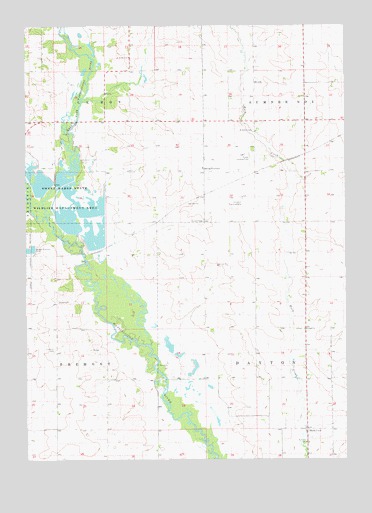
Sumner SW, IA USGS Topographic Map
Click on map above to begin viewing in our Map Viewer.

This topographic map contains these locations and features:
Feature Name Type Latitude Longitude GNIS ID View Map
BremerLocaleN42.8639°W92.2088°463996View Map
Buck CreekPopulated PlaceN42.7586°W92.1407°464475View Map
Buckcreek Post Office (historical)Post OfficeN42.7805°W92.1324°466473View Map
Dayton Post Office (historical)Post OfficeN42.8064°W92.1810°466472View Map
East Fork Wapsipinicon RiverStreamN42.8222°W92.2474°456150View Map
Fremont CemeteryCemeteryN42.7819°W92.2391°456763View Map
Grace CemeteryCemeteryN42.7955°W92.2388°456993View Map
Leroy Post Office (historical)Post OfficeN42.8639°W92.2085°1948282View Map
Maynard Co-op Company ElevatorLocaleN42.8333°W92.1405°1948391View Map
Mount Olivet CemeteryCemeteryN42.8657°W92.2094°1948420View Map
Pinhook CemeteryCemeteryN42.8658°W92.2088°1948419View Map
Plum Creek Wildlife AreaParkN42.8472°W92.2224°1948268View Map
Priebe Landing Field (historical)AirportN42.8378°W92.1643°1948496View Map
Saint Johns CemeteryCemeteryN42.8447°W92.1610°461030View Map
Saint Johns Evangelical Lutheran CemeteryCemeteryN42.7553°W92.1410°1948417View Map
Saint Johns Lutheran ChurchChurchN42.7547°W92.1402°1948415View Map
Saint Johns SchoolSchoolN42.7547°W92.1407°461081View Map
Saint Pauls ChurchChurchN42.7875°W92.1413°461306View Map
Saint Pauls United Church of Christ CemeteryCemeteryN42.7876°W92.1446°1948418View Map
Schwerin Landing Strip (historical)AirportN42.8250°W92.1652°1948495View Map
Spring FountainPopulated PlaceN42.8328°W92.1805°464753View Map
Sweet MarshSwampN42.8199°W92.2324°2741781View Map
Sweet Marsh State Wildlife Management AreaParkN42.8258°W92.2316°462150View Map
Sweet Water CreekStreamN42.8157°W92.2397°2750137View Map
Township of DaytonCivilN42.7740°W92.1404°467682View Map
Township of Le RoyCivilN42.8609°W92.2213°468207View Map
Township of Sumner Number 2CivilN42.8656°W92.1376°468769View Map
Wilsons GroveLocaleN42.8333°W92.1407°466271View Map

Note: Coordinates in the location and feature list above are referenced to NAD83 datum.


Copyright (C) 2008-2024 Ryan Niemi / Sunset Dynamics ... All Rights Reserved