TopoQuest Logo
Do you find TopoQuest useful?
Help keep TopoQuest running and adding new maps/features by donating!
Bitcoin:  19c7KJd3qBynnjoSw5npx9KScwjBe4ifkT
Litecoin:  LXs6TkuXGGXo1vDsWCkWVdjQX94eUKd6ui
Home View Maps Find Maps Find Places Resources & Links


Snow Hill, Tennessee Topographic Map

USGS Map Title: Snow Hill, TN
USGS Map MRC: 35085B1
DRG (GeoTIFF) Download: o35085b1.tif


Neighboring USGS Topographic Map Quads:


  Soddy, TN  
35085C2
 

  Grasshopper Creek, TN  
35085C1
 

  Birchwood, TN  
35084C8
 

  Daisy, TN  
35085B2
 

  Snow Hill, TN  
35085B1
 

  South Cleveland, TN  
35084B8
 

  East Chattanooga, TN  
35085A2
 

  Ooltewah, TN  
35085A1
 

  McDonald, TN  
35084A8


Map MRC Location:

N36°
W86°
N36°
W85°
H8 H7 H6 H5 H4 H3 H2 H1
G8 G7 G6 G5 G4 G3 G2 G1
F8 F7 F6 F5 F4 F3 F2 F1
E8 E7 E6 E5 E4 E3 E2 E1
D8 D7 D6 D5 D4 D3 D2 D1
C8 C7 C6 C5 C4 C3 C2 C1
B8 B7 B6 B5 B4 B3 B2 B1
A8 A7 A6 A5 A4 A3 A2 A1
N35°
W86°
N35°
W85°

Snow Hill, TN USGS 1:24K Topographic Map Preview:
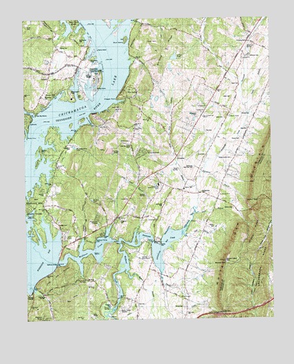
Snow Hill, TN USGS Topographic Map
Click on map above to begin viewing in our Map Viewer.

This topographic map contains these locations and features:
Feature Name Type Latitude Longitude GNIS ID View Map
Anderson CemeteryCemeteryN35.2342°W85.0102°1275695View Map
Anderson SpringSpringN35.2379°W85.0114°1275729View Map
Bass Bay MarinaHarborN35.2109°W85.1197°1312601View Map
Birchwood LandfillLocaleN35.1964°W85.0783°2677902View Map
Blair CemeteryCemeteryN35.2040°W85.0122°1277639View Map
Blue SpringSpringN35.2167°W85.0813°1312606View Map
Blue Spring CreekStreamN35.2165°W85.0830°1645140View Map
Blue SpringsPopulated PlaceN35.2201°W85.0727°1314702View Map
Blue Springs SloughBayN35.2159°W85.0775°1312607View Map
Camp HacobaLocaleN35.1834°W85.1058°1279392View Map
Camp JoyLocaleN35.1348°W85.1172°1279398View Map
Carson SpringSpringN35.1309°W85.0830°1279766View Map
Chigger PointCapeN35.2173°W85.0777°1280448View Map
City of Chattanooga LandfillLocaleN35.1969°W85.0781°2677799View Map
Commissioner District 9CivilN35.2058°W85.0495°2464723View Map
Cross Roads ChurchChurchN35.1767°W85.0261°1281712View Map
Currey PondReservoirN35.2341°W85.0485°1312636View Map
Daughtrey CemeteryCemeteryN35.1973°W85.1019°1282080View Map
Davis CemeteryCemeteryN35.2226°W85.0197°1306277View Map
Davis PondLakeN35.2091°W85.0206°1306289View Map
Denny BluffCliffN35.2115°W85.0861°1282342View Map
Denny CemeteryCemeteryN35.2132°W85.0806°1282343View Map
Denny CemeteryCemeteryN35.2306°W85.0697°1282344View Map
Denny Hill ChurchChurchN35.2056°W85.0872°1282347View Map
Elder CemeteryCemeteryN35.2173°W85.0202°1283600View Map
Eldridge CemeteryCemeteryN35.2420°W85.0738°1283612View Map
Freedom ChurchChurchN35.2117°W85.0336°1322855View Map
Frog Level BranchStreamN35.1576°W85.0708°1284967View Map
Fryar CemeteryCemeteryN35.1312°W85.0690°1285001View Map
Gann BluffCliffN35.2070°W85.1222°1285131View Map
Graveyard PointCapeN35.1884°W85.1197°1285980View Map
Green Acres Equestrian FarmLocaleN35.2392°W85.0031°2652556View Map
Green BranchStreamN35.1695°W85.0391°1286063View Map
Green GapGapN35.1276°W85.0266°1286089View Map
Greenwood ChurchChurchN35.1665°W85.0586°1286200View Map
Harrison Bay State ParkParkN35.1723°W85.1211°1286999View Map
Harrison Bay Vocational Technical CenterSchoolN35.1812°W85.0575°1322880View Map
Hide Out SloughBayN35.1978°W85.1130°1312683View Map
Highland ManorPopulated PlaceN35.1256°W85.1172°1312685View Map
Highway 58 Volunteer Fire Department Station 2BuildingN35.1832°W85.0616°2654680View Map
Hodges CemeteryCemeteryN35.1645°W85.1085°1287957View Map
Holder CemeteryCemeteryN35.1634°W85.0297°1322896View Map
Hunter HillsLocaleN35.2198°W85.1086°1288744View Map
Igou CemeteryCemeteryN35.2188°W85.0954°1288907View Map
Igous Ferry (historical)CrossingN35.2184°W85.0838°1312692View Map
Ison Spring BranchStreamN35.1604°W85.0461°1289109View Map
Jones BayBayN35.2123°W85.1244°1289686View Map
Kimbro CemeteryCemeteryN35.2103°W85.0152°1290168View Map
Lake CrestPopulated PlaceN35.1598°W85.1052°1312719View Map
Lakeway ChurchChurchN35.1748°W85.0733°1290531View Map
Lakewood ChurchChurchN35.1359°W85.1155°1304071View Map
Lauderback RidgeRidgeN35.1481°W85.0052°1290680View Map
Lewis BranchStreamN35.2137°W85.0130°1291062View Map
Locust HillSummitN35.2248°W85.0866°1291792View Map
Long Savannah CreekStreamN35.1587°W85.0833°1292007View Map
Loret VillaLocaleN35.1365°W85.1227°1292061View Map
Maddox School (historical)SchoolN35.1862°W85.1097°1322930View Map
Maddux CemeteryCemeteryN35.1956°W85.1169°1292475View Map
Mahan CemeteryCemeteryN35.1712°W85.0199°1292505View Map
Mahan GapGapN35.1742°W85.0075°1292507View Map
Maple Grove ChurchChurchN35.2045°W85.0697°1292620View Map
Maple HollowValleyN35.2438°W85.1073°1292628View Map
Masterson CemeteryCemeteryN35.2187°W85.1141°1292916View Map
McDonald CemeteryCemeteryN35.1726°W85.0549°1293251View Map
McDonald East View CemeteryCemeteryN35.1881°W85.0391°1322935View Map
McGill CemeteryCemeteryN35.2334°W85.0897°1293316View Map
Middle RidgeRidgeN35.1612°W85.0091°1293689View Map
Montgomery CemeteryCemeteryN35.1781°W85.0361°1294195View Map
Moon CurveLocaleN35.2353°W85.0708°1294224View Map
Moon ShadowsPopulated PlaceN35.1931°W85.0652°1312739View Map
Morgan EstatesPopulated PlaceN35.1362°W85.0813°1312740View Map
Morning Glory LakeReservoirN35.1970°W85.0998°1294393View Map
New Bethel Baptist ChurchChurchN35.1890°W85.1086°1295423View Map
New Shepherd Hill ChurchChurchN35.2092°W85.0344°1295647View Map
Oak Grove ChurchChurchN35.2134°W85.0327°1296083View Map
Old Penney CemeteryCemeteryN35.2415°W85.0969°1287456View Map
Ooltewah Lookout TowerTowerN35.1490°W85.0241°1647785View Map
Orr SloughGutN35.2081°W85.0919°1296495View Map
Owl HollowValleyN35.1296°W85.0098°1296593View Map
Padget CemeteryCemeteryN35.1601°W85.0856°1296644View Map
Penney CemeteryCemeteryN35.2387°W85.1066°1297148View Map
Pinebrook EstatesPopulated PlaceN35.1670°W85.0883°1312760View Map
Providence ChurchChurchN35.1342°W85.0463°1298603View Map
Rabbit IslandIslandN35.1529°W85.0877°1298775View Map
Ramsey HollowValleyN35.1540°W85.0973°1298893View Map
Ray CemeteryCemeteryN35.2028°W85.0333°1298988View Map
Rector SpringSpringN35.1770°W85.0644°1299034View Map
Rock Ledge EstatesPopulated PlaceN35.1298°W85.0766°1312771View Map
Rocky PointCapeN35.2015°W85.1236°1299920View Map
Roddy-Yarnell CemeteryCemeteryN35.1920°W85.0205°1299954View Map
Rogers BranchStreamN35.1459°W85.0738°1299980View Map
Runyan Spring BranchStreamN35.2423°W85.0019°1269917View Map
Savannah BayPopulated PlaceN35.1590°W85.0586°1312777View Map
Savannah BayBayN35.1542°W85.0569°1300821View Map
Savannah BridgeBridgeN35.1573°W85.0611°1300822View Map
Savannah ChurchChurchN35.2331°W85.0138°1300823View Map
Savannah HillsPopulated PlaceN35.1576°W85.0652°1312778View Map
Savannah PeninsulaPopulated PlaceN35.1640°W85.0841°1312779View Map
Scoggins CemeteryCemeteryN35.1665°W85.0774°1300912View Map
Scoggins Mill (historical)LocaleN35.1676°W85.0658°1323059View Map
Sequoyah Nuclear PlantLocaleN35.2267°W85.0919°1323064View Map
Sequoyah Volunteer Fire Department Station 1BuildingN35.2428°W85.1215°2654608View Map
Shirley CemeteryCemeteryN35.1565°W85.0572°1270132View Map
Shirley PondLakeN35.1750°W85.0912°1270134View Map
Short Tail SpringsSpringN35.1420°W85.0944°1270222View Map
Sims HollowValleyN35.1906°W85.0483°1270354View Map
Skull IslandIslandN35.2415°W85.0733°1270451View Map
Skull Island Recreation AreaParkN35.2417°W85.0730°1323080View Map
Smith CemeteryCemeteryN35.2473°W85.1230°1270594View Map
Snow CemeteryCemeteryN35.1934°W85.0374°1270776View Map
Snow HillPopulated PlaceN35.1795°W85.0444°1314310View Map
Snow Hill Division (historical)CensusN35.2273°W85.0388°1648739View Map
Snow Hill Elementary SchoolSchoolN35.1790°W85.0444°1323082View Map
Soap Box Derby TrackLocaleN35.1978°W85.0733°1323083View Map
Stover CemeteryCemeteryN35.1995°W85.0158°1271555View Map
Summer HavenPopulated PlaceN35.1606°W85.0863°1312791View Map
Taliaferro BranchStreamN35.1862°W85.0355°1272045View Map
Talley CemeteryCemeteryN35.2087°W85.0241°1272052View Map
Varnell CemeteryCemeteryN35.1303°W85.0461°1273390View Map
Varnell CreekStreamN35.1459°W85.0575°1273391View Map
Williamson CemeteryCemeteryN35.2098°W85.0374°1274724View Map
Wolfe BranchStreamN35.1809°W85.0383°1274981View Map
Wolfe SpringSpringN35.1878°W85.0472°1312805View Map
Wolftever BridgeBridgeN35.1487°W85.1091°1275002View Map
Wolftever CreekStreamN35.1486°W85.1093°1304654View Map
Wolftever Fishing ClubLocaleN35.1579°W85.0897°1275003View Map
WQLS-FM (Cleveland)TowerN35.1498°W85.0233°1640017View Map

Note: Coordinates in the location and feature list above are referenced to NAD83 datum.


Copyright (C) 2008-2024 Ryan Niemi / Sunset Dynamics ... All Rights Reserved