TopoQuest Logo
Do you find TopoQuest useful?
Help keep TopoQuest running and adding new maps/features by donating!
Bitcoin:  19c7KJd3qBynnjoSw5npx9KScwjBe4ifkT
Litecoin:  LXs6TkuXGGXo1vDsWCkWVdjQX94eUKd6ui
Home View Maps Find Maps Find Places Resources & Links


Snake River Butte, Idaho Topographic Map

USGS Map Title: Snake River Butte, ID
USGS Map MRC: 44111B3
DRG (GeoTIFF) Download: o44111b3.tif


Neighboring USGS Topographic Map Quads:


  Last Chance, ID  
44111C4
 

  Hatchery Butte, ID  
44111C3
 

  Big Grassy, ID  
44111C2
 

  Lookout Butte, ID  
44111B4
 

  Snake River Butte, ID  
44111B3
 

  Warm River Butte, ID  
44111B2
 

  Ashton, ID  
44111A4
 

  Warm River, ID  
44111A3
 

  Porcupine Lake, ID  
44111A2


Map MRC Location:

N45°
W112°
N45°
W111°
H8 H7 H6 H5 H4 H3 H2 H1
G8 G7 G6 G5 G4 G3 G2 G1
F8 F7 F6 F5 F4 F3 F2 F1
E8 E7 E6 E5 E4 E3 E2 E1
D8 D7 D6 D5 D4 D3 D2 D1
C8 C7 C6 C5 C4 C3 C2 C1
B8 B7 B6 B5 B4 B3 B2 B1
A8 A7 A6 A5 A4 A3 A2 A1
N44°
W112°
N44°
W111°

Snake River Butte, ID USGS 1:24K Topographic Map Preview:
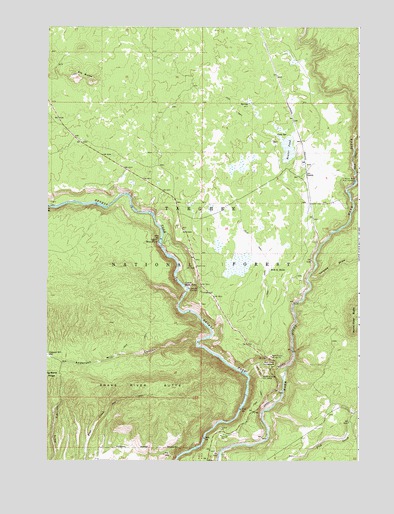
Snake River Butte, ID USGS Topographic Map
Click on map above to begin viewing in our Map Viewer.

This topographic map contains these locations and features:
Feature Name Type Latitude Longitude GNIS ID View Map
Anderson Mill CanyonValleyN44.1599°W111.3147°376624View Map
Bear Gulch CampgroundLocaleN44.1524°W111.2849°377157View Map
Bear Gulch Gravel PitMineN44.1555°W111.2852°377158View Map
Bear Gulch Ski AreaLocaleN44.1496°W111.2891°400260View Map
Beaver PondReservoirN44.2147°W111.2788°377283View Map
Cherry DamDamN44.1266°W111.3591°398938View Map
Cold SpringSpringN44.2188°W111.2836°2785912View Map
Elk ButteSummitN44.2371°W111.3633°397686View Map
Flat CanyonValleyN44.2430°W111.2636°381818View Map
GerritPopulated PlaceN44.2085°W111.2711°397736View Map
Grandview OverlookLocaleN44.1746°W111.3144°382512View Map
Hole in RocksBendN44.1805°W111.2863°383250View Map
Lower Mesa FallsFallsN44.1755°W111.3197°386232View Map
Moose CreekStreamN44.2002°W111.2530°387172View Map
Snake River ButteSummitN44.1460°W111.3383°394129View Map
Trail CanyonValleyN44.2146°W111.2522°392264View Map
Twisted DrawValleyN44.1771°W111.2699°392548View Map
Upper Mesa FallsFallsN44.1880°W111.3300°392638View Map
Warm River Fish HatcheryLocaleN44.2055°W111.2513°394128View Map
Warm River SpringSpringN44.2052°W111.2505°375733View Map

Note: Coordinates in the location and feature list above are referenced to NAD83 datum.


Copyright (C) 2008-2024 Ryan Niemi / Sunset Dynamics ... All Rights Reserved