TopoQuest Logo
Do you find TopoQuest useful?
Help keep TopoQuest running and adding new maps/features by donating!
Bitcoin:  19c7KJd3qBynnjoSw5npx9KScwjBe4ifkT
Litecoin:  LXs6TkuXGGXo1vDsWCkWVdjQX94eUKd6ui
Home View Maps Find Maps Find Places Resources & Links


Shelton, Nebraska Topographic Map

USGS Map Title: Shelton, NE
USGS Map MRC: 40098G6
DRG (GeoTIFF) Download: o40098g6.tif


Neighboring USGS Topographic Map Quads:


  Poole NE, NE  
40098H7
 

  Cameron, NE  
40098H6
 

  Shelton NE, NE  
40098H5
 

  Gibbon North, NE  
40098G7
 

  Shelton, NE  
40098G6
 

  Wood River, NE  
40098G5
 

  Gibbon South, NE  
40098F7
 

  Denman, NE  
40098F6
 

  Prosser, NE  
40098F5


Map MRC Location:

N41°
W99°
N41°
W98°
H8 H7 H6 H5 H4 H3 H2 H1
G8 G7 G6 G5 G4 G3 G2 G1
F8 F7 F6 F5 F4 F3 F2 F1
E8 E7 E6 E5 E4 E3 E2 E1
D8 D7 D6 D5 D4 D3 D2 D1
C8 C7 C6 C5 C4 C3 C2 C1
B8 B7 B6 B5 B4 B3 B2 B1
A8 A7 A6 A5 A4 A3 A2 A1
N40°
W99°
N40°
W98°

Shelton, NE USGS 1:24K Topographic Map Preview:
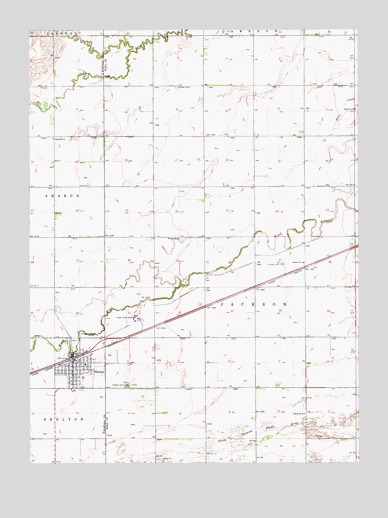
Shelton, NE USGS Topographic Map
Click on map above to begin viewing in our Map Viewer.

This topographic map contains these locations and features:
Feature Name Type Latitude Longitude GNIS ID View Map
Hall County Waterfowl Production AreaParkN40.7531°W98.6835°2765328View Map
Original Townsite of Wood River Historical MarkerParkN40.8047°W98.6545°1874270View Map
Sacred Heart Catholic ChurchChurchN40.7756°W98.7329°1875290View Map
Saint Pauls Lutheran ChurchChurchN40.7736°W98.7315°1875291View Map
SheltonPopulated PlaceN40.7792°W98.7309°833382View Map
SheltonLocaleN40.7800°W98.7354°1875287View Map
Shelton Medical ClinicHospitalN40.7778°W98.7340°1875288View Map
Shelton Police DepartmentBuildingN40.7782°W98.7338°2739890View Map
Shelton Post OfficePost OfficeN40.7788°W98.7337°1875286View Map
Shelton Public SchoolsSchoolN40.7714°W98.7337°1875294View Map
Shelton School (historical)SchoolN40.7786°W98.7292°1875080View Map
Shelton Township LibraryBuildingN40.7772°W98.7340°1875289View Map
Shelton Volunteer Fire and Rescue DepartmentBuildingN40.7783°W98.7343°1875293View Map
Township of JacksonCivilN40.7974°W98.6664°838071View Map
United Methodist ChurchChurchN40.7822°W98.7315°1875292View Map
Village of SheltonCivilN40.7788°W98.7306°2399798View Map

Note: Coordinates in the location and feature list above are referenced to NAD83 datum.


Copyright (C) 2008-2024 Ryan Niemi / Sunset Dynamics ... All Rights Reserved