TopoQuest Logo
Do you find TopoQuest useful?
Help keep TopoQuest running and adding new maps/features by donating!
Bitcoin:  19c7KJd3qBynnjoSw5npx9KScwjBe4ifkT
Litecoin:  LXs6TkuXGGXo1vDsWCkWVdjQX94eUKd6ui
Home View Maps Find Maps Find Places Resources & Links


Scaredman Creek, Oregon Topographic Map

USGS Map Title: Scaredman Creek, OR
USGS Map MRC: 43122D7
DRG (GeoTIFF) Download: o43122d7.tif


Neighboring USGS Topographic Map Quads:


  Burnt Mountain, OR  
43122E8
 

  Silica Mountain, OR  
43122E7
 

  Fairview Peak, OR  
43122E6
 

  Harrington Creek, OR  
43122D8
 

  Scaredman Creek, OR  
43122D7
 

  Chilcoot Mountain, OR  
43122D6
 

  Old Fairview, OR  
43122C8
 

  Mace Mountain, OR  
43122C7
 

  Steamboat, OR  
43122C6


Map MRC Location:

N44°
W123°
N44°
W122°
H8 H7 H6 H5 H4 H3 H2 H1
G8 G7 G6 G5 G4 G3 G2 G1
F8 F7 F6 F5 F4 F3 F2 F1
E8 E7 E6 E5 E4 E3 E2 E1
D8 D7 D6 D5 D4 D3 D2 D1
C8 C7 C6 C5 C4 C3 C2 C1
B8 B7 B6 B5 B4 B3 B2 B1
A8 A7 A6 A5 A4 A3 A2 A1
N43°
W123°
N43°
W122°

Scaredman Creek, OR USGS 1:24K Topographic Map Preview:
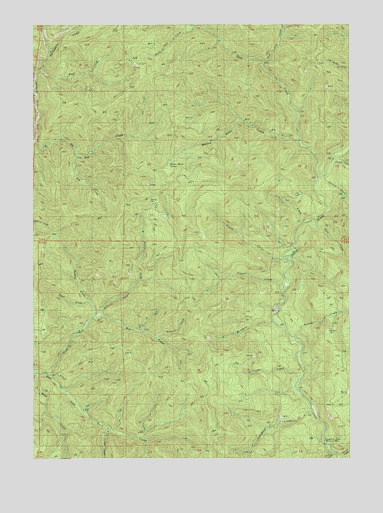
Scaredman Creek, OR USGS Topographic Map
Click on map above to begin viewing in our Map Viewer.

This topographic map contains these locations and features:
Feature Name Type Latitude Longitude GNIS ID View Map
Black Jack CreekStreamN43.4915°W122.8317°1162517View Map
Bluff CreekStreamN43.4873°W122.8720°1162518View Map
Brouse CreekStreamN43.4082°W122.7734°1162526View Map
Buck CreekStreamN43.4435°W122.7639°1138773View Map
Call CreekStreamN43.4721°W122.7928°1162516View Map
Camp CreekStreamN43.3971°W122.7712°1139206View Map
Canton ShelterLocaleN43.3779°W122.7595°1139315View Map
Chilcoot CreekStreamN43.4607°W122.7576°1139643View Map
Coon CreekStreamN43.3765°W122.7578°1140075View Map
Cougar CreekStreamN43.3832°W122.8456°1162504View Map
East Pass CreekStreamN43.4887°W122.7845°1141632View Map
Fracture CreekStreamN43.4096°W122.8262°1162508View Map
Grizzly CreekStreamN43.4321°W122.7764°1143099View Map
Hipower CreekStreamN43.3757°W122.7545°1143620View Map
Leach Camp TrailTrailN43.4898°W122.7687°1144902View Map
Mace CreekStreamN43.3998°W122.8748°1162505View Map
Mellow Moon CreekStreamN43.4665°W122.7706°1162515View Map
Mellow Moon SpringSpringN43.4592°W122.8222°1146085View Map
No Man ShelterLocaleN43.4615°W122.7570°1146852View Map
North Fork East Fork Rock CreekStreamN43.3987°W122.8689°1146900View Map
Pass CreekStreamN43.4565°W122.7631°1147479View Map
Pass Creek ShelterLocaleN43.4876°W122.7870°1147481View Map
Ravel CreekStreamN43.4193°W122.8539°1162512View Map
Ring Tail CreekStreamN43.4429°W122.7687°1148476View Map
Salmon CreekStreamN43.4546°W122.7637°1148976View Map
Scaredman CampLocaleN43.3765°W122.8084°1149116View Map
Scaredman CreekStreamN43.3882°W122.7651°1149117View Map
Scaredman Creek Recreation SiteParkN43.3790°W122.7623°1162506View Map
Surprise CreekStreamN43.4151°W122.8526°1162511View Map
Trapper CreekStreamN43.4246°W122.7745°1151391View Map
Trapper ShelterLocaleN43.4246°W122.7759°1151398View Map
Wapiti CreekStreamN43.4151°W122.8526°1162507View Map
West Pass Creek WayTrailN43.4851°W122.8037°1152138View Map
Wolverine CreekStreamN43.4140°W122.7803°1152613View Map
Zag CreekStreamN43.4623°W122.8581°1162513View Map
Zig Zag CreekStreamN43.4651°W122.8748°1162514View Map

Note: Coordinates in the location and feature list above are referenced to NAD83 datum.


Copyright (C) 2008-2024 Ryan Niemi / Sunset Dynamics ... All Rights Reserved