TopoQuest Logo
Do you find TopoQuest useful?
Help keep TopoQuest running and adding new maps/features by donating!
Bitcoin:  19c7KJd3qBynnjoSw5npx9KScwjBe4ifkT
Litecoin:  LXs6TkuXGGXo1vDsWCkWVdjQX94eUKd6ui
Home View Maps Find Maps Find Places Resources & Links


Rudement, Illinois Topographic Map

USGS Map Title: Rudement, IL
USGS Map MRC: 37088F4
DRG (GeoTIFF) Download: o37088f4.tif


Neighboring USGS Topographic Map Quads:


  Galatia, IL  
37088G5
 

  Eldorado, IL  
37088G4
 

  Ridgway, IL  
37088G3
 

  Harrisburg, IL  
37088F5
 

  Rudement, IL  
37088F4
 

  Equality, IL  
37088F3
 

  Eddyville, IL  
37088E5
 

  Herod, IL  
37088E4
 

  Karbers Ridge, IL  
37088E3


Map MRC Location:

N38°
W89°
N38°
W88°
H8 H7 H6 H5 H4 H3 H2 H1
G8 G7 G6 G5 G4 G3 G2 G1
F8 F7 F6 F5 F4 F3 F2 F1
E8 E7 E6 E5 E4 E3 E2 E1
D8 D7 D6 D5 D4 D3 D2 D1
C8 C7 C6 C5 C4 C3 C2 C1
B8 B7 B6 B5 B4 B3 B2 B1
A8 A7 A6 A5 A4 A3 A2 A1
N37°
W89°
N37°
W88°

Rudement, IL USGS 1:24K Topographic Map Preview:
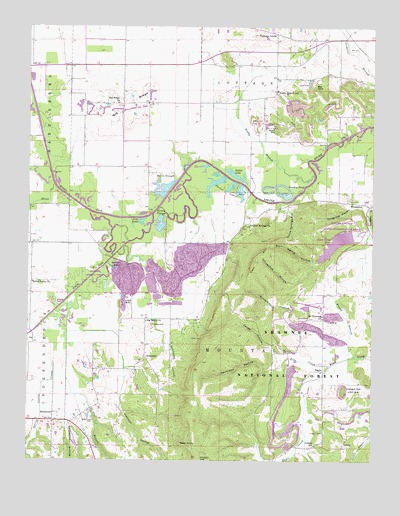
Rudement, IL USGS Topographic Map
Click on map above to begin viewing in our Map Viewer.

This topographic map contains these locations and features:
Feature Name Type Latitude Longitude GNIS ID View Map
Bald KnobSummitN37.6300°W88.4448°403849View Map
Beech HollowValleyN37.6274°W88.4996°424622View Map
Berkel LakeLakeN37.7074°W88.4249°404212View Map
Bethel ChurchChurchN37.6442°W88.3923°404284View Map
Big RidgeRidgeN37.7275°W88.4628°404430View Map
Big Ridge ChurchChurchN37.7281°W88.4684°404431View Map
Big Saline ChurchChurchN37.6656°W88.4570°404434View Map
Big Saline Church CemeteryCemeteryN37.6642°W88.4548°406323View Map
Blockhouse CemeteryCemeteryN37.6367°W88.4759°404565View Map
Blue Spring HollowValleyN37.6822°W88.3967°404608View Map
Brier CreekStreamN37.7039°W88.4906°404861View Map
Cave HillSummitN37.6823°W88.4178°405719View Map
Colbert Family CemeteryCemeteryN37.6337°W88.3925°406334View Map
Colbert HillSummitN37.6453°W88.3853°406336View Map
Colbert SchoolSchoolN37.6295°W88.3953°406337View Map
Cottage GrovePopulated PlaceN37.7481°W88.4106°422582View Map
Davis SloughGutN37.7050°W88.4489°406988View Map
De Neal BranchStreamN37.6617°W88.4859°424820View Map
Dennison HollowValleyN37.6513°W88.4117°407131View Map
DerbyPopulated PlaceN37.6289°W88.3856°422620View Map
EaglePopulated PlaceN37.6512°W88.3928°422648View Map
Eagle MountainsRangeN37.6673°W88.4312°1820958View Map
East Big Ridge School (historical)SchoolN37.7237°W88.4564°1820959View Map
Flatrock HollowValleyN37.6423°W88.4671°424892View Map
Forwe HollowValleyN37.6552°W88.4097°408559View Map
Gaskin LakeLakeN37.6805°W88.4661°408924View Map
Glen Jones LakeReservoirN37.6878°W88.3881°1820977View Map
Glen O Jones Lake DamDamN37.6900°W88.3817°1690905View Map
Grocery FordCrossingN37.6906°W88.4567°1820979View Map
Hargrave HollowValleyN37.6984°W88.3827°409780View Map
HorseshoePopulated PlaceN37.6989°W88.3789°422823View Map
Horseshoe HollowValleyN37.6825°W88.3952°410567View Map
Jones CemeteryCemeteryN37.6662°W88.3981°411202View Map
Jones School (historical)SchoolN37.6662°W88.3923°1820985View Map
Lockwood HollowValleyN37.6355°W88.4855°425141View Map
Lost LakeLakeN37.6935°W88.4595°412657View Map
Middle Fork Saline RiverStreamN37.6962°W88.4553°413499View Map
Mount Pleasant ChurchChurchN37.6662°W88.3928°414048View Map
Mud Springs HollowValleyN37.6362°W88.4952°1820991View Map
Parker LakesLakeN37.7041°W88.4266°415399View Map
Pruett BranchStreamN37.6550°W88.3817°416268View Map
Rocky BranchStreamN37.7075°W88.3964°416862View Map
Rocky Branch HollowValleyN37.6277°W88.3986°425405View Map
Rocky Branch SchoolSchoolN37.7314°W88.4103°416872View Map
Rose CreekStreamN37.6525°W88.3898°416937View Map
RudementPopulated PlaceN37.6364°W88.4903°417028View Map
Saline County State Conservation AreaParkN37.7023°W88.3767°1821010View Map
Saline Valley ChurchChurchN37.6764°W88.4987°417891View Map
Saline Valley School (historical)SchoolN37.6867°W88.4984°1821011View Map
Saline Valley Store (historical)Populated PlaceN37.6734°W88.4989°1821012View Map
Sandy BranchStreamN37.6906°W88.3764°417990View Map
Setten SloughGutN37.6948°W88.4517°418226View Map
Snockey PondLakeN37.7015°W88.4070°418682View Map
SomersetPopulated PlaceN37.6545°W88.4573°418702View Map
South Fork Saline RiverStreamN37.6962°W88.4550°418771View Map
Southeastern Illinois CollegeSchoolN37.7445°W88.4370°1821017View Map
Spring Valley CreekStreamN37.6737°W88.4820°425515View Map
Stillhouse HollowValleyN37.6649°W88.4532°419139View Map
Stone FaceCliffN37.6600°W88.4364°419164View Map
Sulphur Springs ChurchChurchN37.6925°W88.4203°419338View Map
Taylor School (historical)SchoolN37.6617°W88.4578°1821020View Map
Three Springs HollowValleyN37.6979°W88.4082°419697View Map
Township of CottageCivilN37.7376°W88.4341°428847View Map
Township of MountainCivilN37.6518°W88.4266°429400View Map
Vinyard MineMineN37.7209°W88.4112°420325View Map
West Big Ridge School (historical)SchoolN37.7281°W88.4798°1821024View Map
West Sulphur School (historical)SchoolN37.6845°W88.4195°1821026View Map
Whitesville (historical)Populated PlaceN37.6812°W88.4639°1821027View Map
Wiedeman HollowValleyN37.6694°W88.3948°421131View Map

Note: Coordinates in the location and feature list above are referenced to NAD83 datum.


Copyright (C) 2008-2024 Ryan Niemi / Sunset Dynamics ... All Rights Reserved