TopoQuest Logo
Do you find TopoQuest useful?
Help keep TopoQuest running and adding new maps/features by donating!
Bitcoin:  19c7KJd3qBynnjoSw5npx9KScwjBe4ifkT
Litecoin:  LXs6TkuXGGXo1vDsWCkWVdjQX94eUKd6ui
Home View Maps Find Maps Find Places Resources & Links


Canyon Hill, New Mexico Topographic Map

USGS Map Title: Canyon Hill, NM
USGS Map MRC: 33108A4
DRG (GeoTIFF) Download: o33108a4.tif


Neighboring USGS Topographic Map Quads:


  Shelley Peak, NM  
33108B5
 

  Diablo Range, NM  
33108B4
 

  Little Turkey Park, NM  
33108B3
 

  Canteen Canyon, NM  
33108A5
 

  Canyon Hill, NM  
33108A4
 

  Granny Mountain, NM  
33108A3
 

  Cliff, NM  
32108H5
 

  Dorsey Ranch, NM  
32108H4
 

  Reading Mountain, NM  
32108H3


Map MRC Location:

N34°
W109°
N34°
W108°
H8 H7 H6 H5 H4 H3 H2 H1
G8 G7 G6 G5 G4 G3 G2 G1
F8 F7 F6 F5 F4 F3 F2 F1
E8 E7 E6 E5 E4 E3 E2 E1
D8 D7 D6 D5 D4 D3 D2 D1
C8 C7 C6 C5 C4 C3 C2 C1
B8 B7 B6 B5 B4 B3 B2 B1
A8 A7 A6 A5 A4 A3 A2 A1
N33°
W109°
N33°
W108°

Canyon Hill, NM USGS 1:24K Topographic Map Preview:
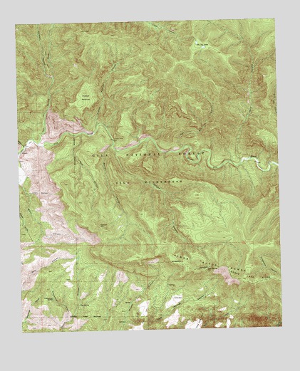
Canyon Hill, NM USGS Topographic Map
Click on map above to begin viewing in our Map Viewer.

This topographic map contains these locations and features:
Feature Name Type Latitude Longitude GNIS ID View Map
Blue Benny MineMineN33.0590°W108.4976°914867View Map
Brock Canyon ProspectMineN33.0584°W108.4970°914928View Map
Canyon HillSummitN33.0426°W108.4623°904738View Map
Cave CanyonValleyN33.0795°W108.4701°904845View Map
Cottonwood CanyonValleyN33.0045°W108.4789°905398View Map
Cottonwood SpringSpringN33.0135°W108.4855°905424View Map
Crow CanyonValleyN33.0562°W108.4970°905526View Map
Dog SpringSpringN33.0108°W108.4725°905801View Map
Hells CanyonValleyN33.0670°W108.3931°906913View Map
Hidden PastureFlatN33.0945°W108.4676°906952View Map
Hidden Pasture CanyonValleyN33.0842°W108.4623°906953View Map
Packsaddle CanyonValleyN33.0287°W108.3753°909428View Map
Rastus PlaceLocaleN33.0126°W108.4234°910016View Map
Seep Springs GapGapN33.0245°W108.4112°910928View Map
Shelley CanyonValleyN33.0731°W108.4534°910998View Map
Skeleton CanyonValleyN33.1026°W108.4828°911111View Map
Slick Rock MesaSummitN33.0053°W108.4131°911140View Map
Spring CanyonValleyN33.0756°W108.4548°911313View Map
The Clanton Hideout Historical MarkerParkN33.1026°W108.4828°932259View Map
The Dry LakesLakeN33.1141°W108.4103°911632View Map
TurkeyLocaleN33.1217°W108.4681°2038724View Map
Turkey CreekStreamN33.0759°W108.4909°920723View Map
Utah Bill CanyonValleyN33.0734°W108.4209°912012View Map
Watson CanyonValleyN33.0742°W108.4976°912190View Map
Watson Mountain DepositMineN33.0703°W108.4992°914895View Map
Wild Cow CanyonValleyN33.0862°W108.3756°912368View Map

Note: Coordinates in the location and feature list above are referenced to NAD83 datum.


Copyright (C) 2008-2024 Ryan Niemi / Sunset Dynamics ... All Rights Reserved