TopoQuest Logo
Do you find TopoQuest useful?
Help keep TopoQuest running and adding new maps/features by donating!
Bitcoin:  19c7KJd3qBynnjoSw5npx9KScwjBe4ifkT
Litecoin:  LXs6TkuXGGXo1vDsWCkWVdjQX94eUKd6ui
Home View Maps Find Maps Find Places Resources & Links


Redhead Branch, Louisiana Topographic Map

USGS Map Title: Redhead Branch, LA
USGS Map MRC: 30093F2
DRG (GeoTIFF) Download: o30093f2.tif


Neighboring USGS Topographic Map Quads:


  DeRidder, LA  
30093G3
 

  Boneset Creek, LA  
30093G2
 

  Sugartown, LA  
30093G1
 

  Mach Branch, LA  
30093F3
 

  Redhead Branch, LA  
30093F2
 

  Dry Creek, LA  
30093F1
 

  Kernan, LA  
30093E3
 

  Longville, LA  
30093E2
 

  Reeves, LA  
30093E1


Map MRC Location:

N31°
W94°
N31°
W93°
H8 H7 H6 H5 H4 H3 H2 H1
G8 G7 G6 G5 G4 G3 G2 G1
F8 F7 F6 F5 F4 F3 F2 F1
E8 E7 E6 E5 E4 E3 E2 E1
D8 D7 D6 D5 D4 D3 D2 D1
C8 C7 C6 C5 C4 C3 C2 C1
B8 B7 B6 B5 B4 B3 B2 B1
A8 A7 A6 A5 A4 A3 A2 A1
N30°
W94°
N30°
W93°

Redhead Branch, LA USGS 1:24K Topographic Map Preview:
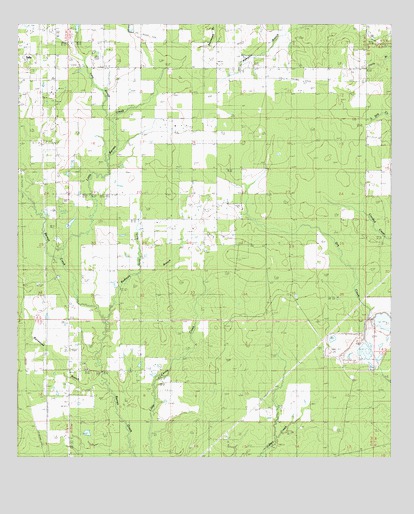
Redhead Branch, LA USGS Topographic Map
Click on map above to begin viewing in our Map Viewer.

This topographic map contains these locations and features:
Feature Name Type Latitude Longitude GNIS ID View Map
Bannister (historical)Populated PlaceN30.7074°W93.2493°544810View Map
Barentine CemeteryCemeteryN30.6519°W93.2279°544807View Map
Barrantine BranchStreamN30.6469°W93.2210°532319View Map
Beauregard Memorial Baptist ChurchChurchN30.6505°W93.2268°544792View Map
Beauregard Volunteer Fire Protection District 2 Broadlands StationBuildingN30.7196°W93.2383°2691853View Map
Broadlands Bible ChurchChurchN30.7306°W93.2370°2601414View Map
Camp Delta (historical)LocaleN30.6649°W93.2479°544806View Map
Caney Creek Oil FieldOilfieldN30.6269°W93.1835°544812View Map
East Caney Creek Oil and Gas FieldOilfieldN30.6269°W93.1418°544813View Map
East Tulla Gas FieldOilfieldN30.7294°W93.1724°544811View Map
Evergreen Mobile Home ParkPopulated PlaceN30.6991°W93.2359°2600848View Map
Insco (historical)Populated PlaceN30.6396°W93.2460°544805View Map
Ladniers BranchStreamN30.6960°W93.1343°544814View Map
Little Barnes CreekStreamN30.6808°W93.2343°536476View Map
Little Barnes Creek Gas FieldOilfieldN30.6771°W93.2363°544808View Map
Long BranchStreamN30.7221°W93.2179°536682View Map
Long GullyStreamN30.6777°W93.2102°536693View Map
Longville Lookout TowerTowerN30.6563°W93.2321°558797View Map
Memorial Baptist ChurchChurchN30.6505°W93.2283°2602252View Map
Parish Governing Authority District 4BCivilN30.6899°W93.2316°1930053View Map
Redhead BranchStreamN30.6644°W93.2213°538541View Map
Sweetville (historical)Populated PlaceN30.6749°W93.2482°544809View Map
Ward FourCivilN30.6327°W93.2315°544924View Map

Note: Coordinates in the location and feature list above are referenced to NAD83 datum.


Copyright (C) 2008-2024 Ryan Niemi / Sunset Dynamics ... All Rights Reserved