TopoQuest Logo
Do you find TopoQuest useful?
Help keep TopoQuest running and adding new maps/features by donating!
Bitcoin:  19c7KJd3qBynnjoSw5npx9KScwjBe4ifkT
Litecoin:  LXs6TkuXGGXo1vDsWCkWVdjQX94eUKd6ui
Home View Maps Find Maps Find Places Resources & Links


Red Top Mountain, Arizona Topographic Map

USGS Map Title: Red Top Mountain, AZ
USGS Map MRC: 34110B2
DRG (GeoTIFF) Download: o34110b2.tif


Neighboring USGS Topographic Map Quads:


  Clay Springs, AZ  
34110C3
 

  Pinedale, AZ  
34110C2
 

  Show Low North, AZ  
34110C1
 

  Limestone Canyon North, AZ  
34110B3
 

  Red Top Mountain, AZ  
34110B2
 

  Show Low South, AZ  
34110B1
 

  Limestone Canyon South, AZ  
34110A3
 

  Long Tom Canyon, AZ  
34110A2
 

  Faught Ridge, AZ  
34110A1


Map MRC Location:

N35°
W111°
N35°
W110°
H8 H7 H6 H5 H4 H3 H2 H1
G8 G7 G6 G5 G4 G3 G2 G1
F8 F7 F6 F5 F4 F3 F2 F1
E8 E7 E6 E5 E4 E3 E2 E1
D8 D7 D6 D5 D4 D3 D2 D1
C8 C7 C6 C5 C4 C3 C2 C1
B8 B7 B6 B5 B4 B3 B2 B1
A8 A7 A6 A5 A4 A3 A2 A1
N34°
W111°
N34°
W110°

Red Top Mountain, AZ USGS 1:24K Topographic Map Preview:
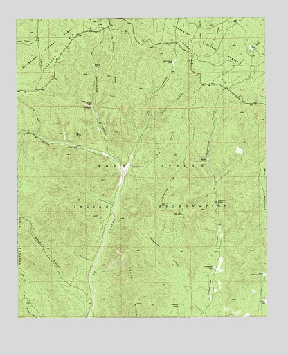
Red Top Mountain, AZ USGS Topographic Map
Click on map above to begin viewing in our Map Viewer.

This topographic map contains these locations and features:
Feature Name Type Latitude Longitude GNIS ID View Map
Box SpringSpringN34.2018°W110.2212°26685View Map
Charco TankReservoirN34.1309°W110.1264°27506View Map
Cottonwood RidgeRidgeN34.1828°W110.1262°28027View Map
Cottonwood SpringSpringN34.1733°W110.1503°28045View Map
Cottonwood TankReservoirN34.1456°W110.1524°28053View Map
Cub CanyonValleyN34.1875°W110.1937°28206View Map
Fence TankReservoirN34.2372°W110.1331°28970View Map
Hog Spring CanyonValleyN34.1931°W110.2057°30027View Map
Hop Canyon TankReservoirN34.2316°W110.1715°30103View Map
Hop Canyon Tank DamDamN34.2317°W110.1723°40196View Map
Hop MountainSummitN34.1684°W110.1704°30104View Map
Hop SpringSpringN34.2438°W110.1964°30105View Map
Joe TankReservoirN34.2480°W110.1394°30555View Map
Juniper TankReservoirN34.2141°W110.2160°30681View Map
Lower Cottonwood TankReservoirN34.1427°W110.1271°31351View Map
McCleve CanyonValleyN34.2406°W110.2415°31629View Map
Middle CanyonValleyN34.1314°W110.2143°31801View Map
Middle Cottonwood TankReservoirN34.1910°W110.1557°31803View Map
Red Top MountainSummitN34.1717°W110.1784°33531View Map
Sand TankReservoirN34.2275°W110.1733°34040View Map
Telephone CanyonValleyN34.1275°W110.1576°35179View Map
Telephone RidgeRidgeN34.1792°W110.1734°35183View Map
Telephone SpringSpringN34.1300°W110.1704°35186View Map
Turkey SpringSpringN34.1673°W110.2135°35571View Map
Walnut CanyonValleyN34.2070°W110.1834°35843View Map
Walnut TankReservoirN34.2306°W110.2117°35883View Map
Yellowjacket TankReservoirN34.2400°W110.2318°40300View Map
Yellowstone CanyonValleyN34.1837°W110.1984°36474View Map
Yellowstone TankReservoirN34.2134°W110.2131°36476View Map

Note: Coordinates in the location and feature list above are referenced to NAD83 datum.


Copyright (C) 2008-2024 Ryan Niemi / Sunset Dynamics ... All Rights Reserved